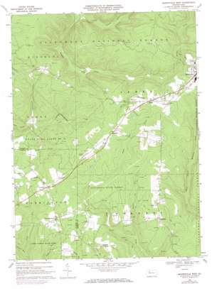
Marienville West Topo Map Pennsylvania
To zoom in, hover over the map of Marienville West
USGS Topo Quad 41079d2 - 1:24,000 scale
| Topo Map Name: | Marienville West |
| USGS Topo Quad ID: | 41079d2 |
| Print Size: | ca. 21 1/4" wide x 27" high |
| Southeast Coordinates: | 41.375° N latitude / 79.125° W longitude |
| Map Center Coordinates: | 41.4375° N latitude / 79.1875° W longitude |
| U.S. State: | PA |
| Filename: | o41079d2.jpg |
| Download Map JPG Image: | Marienville West topo map 1:24,000 scale |
| Map Type: | Topographic |
| Topo Series: | 7.5´ |
| Map Scale: | 1:24,000 |
| Source of Map Images: | United States Geological Survey (USGS) |
| Alternate Map Versions: |
Marienville West PA 1967, updated 1971 Download PDF Buy paper map Marienville West PA 1967, updated 1973 Download PDF Buy paper map Marienville West PA 1967, updated 1984 Download PDF Buy paper map Marienville West PA 2011 Download PDF Buy paper map Marienville West PA 2013 Download PDF Buy paper map Marienville West PA 2016 Download PDF Buy paper map |
| FStopo: | US Forest Service topo Marienville West is available: Download FStopo PDF Download FStopo TIF |
1:24,000 Topo Quads surrounding Marienville West
> Back to 41079a1 at 1:100,000 scale
> Back to 41078a1 at 1:250,000 scale
> Back to U.S. Topo Maps home
Marienville West topo map: Gazetteer
Marienville West: Airports
Shadowood Farm Airport elevation 507m 1663′Marienville West: Forests
Clear Creek State Forest Maple Creek Tract elevation 484m 1587′Marienville West: Populated Places
Gilfoyle elevation 507m 1663′Muzette elevation 501m 1643′
North Pine Grove elevation 495m 1624′
Redclyffe elevation 483m 1584′
Roses elevation 512m 1679′
Vowinckel elevation 498m 1633′
Williams elevation 511m 1676′
Marienville West: Streams
Bearpen Run elevation 424m 1391′Chapel Run elevation 430m 1410′
Ellsworth Run elevation 423m 1387′
Guiton Run elevation 386m 1266′
Little Salmon Creek elevation 383m 1256′
Marienville West digital topo map on disk
Buy this Marienville West topo map showing relief, roads, GPS coordinates and other geographical features, as a high-resolution digital map file on DVD:


