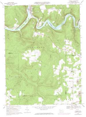
Tionesta Topo Map Pennsylvania
To zoom in, hover over the map of Tionesta
USGS Topo Quad 41079d4 - 1:24,000 scale
| Topo Map Name: | Tionesta |
| USGS Topo Quad ID: | 41079d4 |
| Print Size: | ca. 21 1/4" wide x 27" high |
| Southeast Coordinates: | 41.375° N latitude / 79.375° W longitude |
| Map Center Coordinates: | 41.4375° N latitude / 79.4375° W longitude |
| U.S. State: | PA |
| Filename: | o41079d4.jpg |
| Download Map JPG Image: | Tionesta topo map 1:24,000 scale |
| Map Type: | Topographic |
| Topo Series: | 7.5´ |
| Map Scale: | 1:24,000 |
| Source of Map Images: | United States Geological Survey (USGS) |
| Alternate Map Versions: |
Tionesta PA 1967, updated 1971 Download PDF Buy paper map Tionesta PA 1967, updated 1973 Download PDF Buy paper map Tionesta PA 2011 Download PDF Buy paper map Tionesta PA 2013 Download PDF Buy paper map Tionesta PA 2016 Download PDF Buy paper map |
| FStopo: | US Forest Service topo Tionesta is available: Download FStopo PDF Download FStopo TIF |
1:24,000 Topo Quads surrounding Tionesta
> Back to 41079a1 at 1:100,000 scale
> Back to 41078a1 at 1:250,000 scale
> Back to U.S. Topo Maps home
Tionesta topo map: Gazetteer
Tionesta: Dams
Tionesta Dam elevation 360m 1181′Tionesta: Lakes
Lake Lucy elevation 489m 1604′Tionesta: Populated Places
Hunter elevation 326m 1069′Nebraska elevation 339m 1112′
Tionesta elevation 331m 1085′
Wolfs Corners elevation 480m 1574′
Tionesta: Reservoirs
Tionesta Lake elevation 355m 1164′Tionesta: Springs
Red Spring elevation 402m 1318′Tionesta: Streams
Auge Run elevation 409m 1341′Bates Run elevation 316m 1036′
Chauncey Run elevation 376m 1233′
Coon Creek elevation 333m 1092′
East Branch Hemlock Creek elevation 387m 1269′
Glasner Run elevation 335m 1099′
Hunter Run elevation 311m 1020′
Indian Camp Run elevation 311m 1020′
Johns Run elevation 334m 1095′
Korb Run elevation 357m 1171′
Little Piney Run elevation 331m 1085′
Little Tionesta Creek elevation 317m 1040′
McCauley Run elevation 393m 1289′
North Branch Hemlock Creek elevation 387m 1269′
Peters Run elevation 328m 1076′
Piney Run elevation 331m 1085′
Sandrock Run elevation 379m 1243′
Sugar Run elevation 340m 1115′
Tionesta Creek elevation 317m 1040′
Tionesta digital topo map on disk
Buy this Tionesta topo map showing relief, roads, GPS coordinates and other geographical features, as a high-resolution digital map file on DVD:


