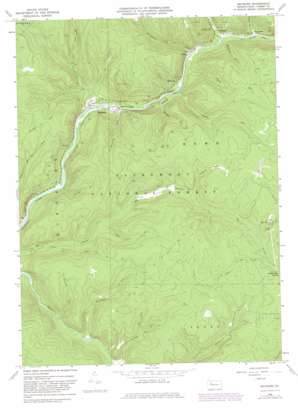
Mayburg Topo Map Pennsylvania
To zoom in, hover over the map of Mayburg
USGS Topo Quad 41079e2 - 1:24,000 scale
| Topo Map Name: | Mayburg |
| USGS Topo Quad ID: | 41079e2 |
| Print Size: | ca. 21 1/4" wide x 27" high |
| Southeast Coordinates: | 41.5° N latitude / 79.125° W longitude |
| Map Center Coordinates: | 41.5625° N latitude / 79.1875° W longitude |
| U.S. State: | PA |
| Filename: | o41079e2.jpg |
| Download Map JPG Image: | Mayburg topo map 1:24,000 scale |
| Map Type: | Topographic |
| Topo Series: | 7.5´ |
| Map Scale: | 1:24,000 |
| Source of Map Images: | United States Geological Survey (USGS) |
| Alternate Map Versions: |
Mayburg PA 1966, updated 1969 Download PDF Buy paper map Mayburg PA 1966, updated 1973 Download PDF Buy paper map Mayburg PA 1966, updated 1982 Download PDF Buy paper map Mayburg PA 2011 Download PDF Buy paper map Mayburg PA 2013 Download PDF Buy paper map Mayburg PA 2016 Download PDF Buy paper map |
| FStopo: | US Forest Service topo Mayburg is available: Download FStopo PDF Download FStopo TIF |
1:24,000 Topo Quads surrounding Mayburg
> Back to 41079e1 at 1:100,000 scale
> Back to 41078a1 at 1:250,000 scale
> Back to U.S. Topo Maps home
Mayburg topo map: Gazetteer
Mayburg: Parks
Minister Creek Recreation Area elevation 375m 1230′Mayburg: Populated Places
Balltown elevation 373m 1223′Blue Jay elevation 556m 1824′
Mayburg elevation 365m 1197′
Minister elevation 382m 1253′
Porkey elevation 366m 1200′
Truemans elevation 378m 1240′
Mayburg: Streams
Blood Run elevation 368m 1207′Bobbs Creek elevation 359m 1177′
Coalbed Run elevation 434m 1423′
Doe Run elevation 431m 1414′
Fools Creek elevation 371m 1217′
Fourmile Run elevation 376m 1233′
Kingsley Run elevation 359m 1177′
Little Minister Run elevation 354m 1161′
Logan Run elevation 382m 1253′
Minister Creek elevation 371m 1217′
Mud Lick Run elevation 398m 1305′
Panther Run elevation 363m 1190′
Phelps Run elevation 366m 1200′
Porcupine Run elevation 366m 1200′
Twomile Run elevation 367m 1204′
Wildcat Run elevation 373m 1223′
Mayburg digital topo map on disk
Buy this Mayburg topo map showing relief, roads, GPS coordinates and other geographical features, as a high-resolution digital map file on DVD:


