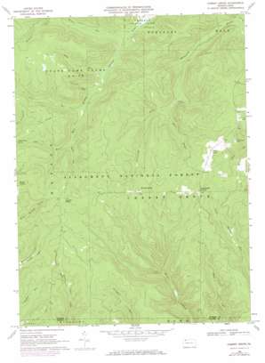
Cherry Grove Topo Map Pennsylvania
To zoom in, hover over the map of Cherry Grove
USGS Topo Quad 41079f2 - 1:24,000 scale
| Topo Map Name: | Cherry Grove |
| USGS Topo Quad ID: | 41079f2 |
| Print Size: | ca. 21 1/4" wide x 27" high |
| Southeast Coordinates: | 41.625° N latitude / 79.125° W longitude |
| Map Center Coordinates: | 41.6875° N latitude / 79.1875° W longitude |
| U.S. State: | PA |
| Filename: | o41079f2.jpg |
| Download Map JPG Image: | Cherry Grove topo map 1:24,000 scale |
| Map Type: | Topographic |
| Topo Series: | 7.5´ |
| Map Scale: | 1:24,000 |
| Source of Map Images: | United States Geological Survey (USGS) |
| Alternate Map Versions: |
Cherry Grove PA 1947, updated 1972 Download PDF Buy paper map Cherry Grove PA 1966, updated 1970 Download PDF Buy paper map Cherry Grove PA 1966, updated 1973 Download PDF Buy paper map Cherry Grove PA 1966, updated 1973 Download PDF Buy paper map Cherry Grove PA 1966, updated 1973 Download PDF Buy paper map Cherry Grove PA 2011 Download PDF Buy paper map Cherry Grove PA 2013 Download PDF Buy paper map Cherry Grove PA 2016 Download PDF Buy paper map |
| FStopo: | US Forest Service topo Cherry Grove is available: Download FStopo PDF Download FStopo TIF |
1:24,000 Topo Quads surrounding Cherry Grove
> Back to 41079e1 at 1:100,000 scale
> Back to 41078a1 at 1:250,000 scale
> Back to U.S. Topo Maps home
Cherry Grove topo map: Gazetteer
Cherry Grove: Populated Places
Cherry Grove elevation 593m 1945′Hearts Content elevation 547m 1794′
Hermit Spring elevation 567m 1860′
Cherry Grove: Springs
Rams Horn Spring elevation 545m 1788′Cherry Grove: Streams
Adams Run elevation 437m 1433′Conklin Run elevation 449m 1473′
Davis Run elevation 473m 1551′
Jones Run elevation 453m 1486′
Otter Branch elevation 474m 1555′
Shaw Run elevation 442m 1450′
Slater Run elevation 451m 1479′
Tom Run elevation 473m 1551′
Wildcat Run elevation 437m 1433′
Cherry Grove: Trails
Minister Valley Trail elevation 512m 1679′Cherry Grove digital topo map on disk
Buy this Cherry Grove topo map showing relief, roads, GPS coordinates and other geographical features, as a high-resolution digital map file on DVD:


