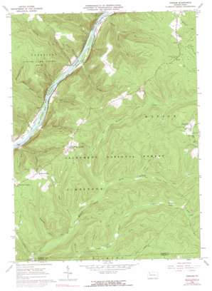
Cobham Topo Map Pennsylvania
To zoom in, hover over the map of Cobham
USGS Topo Quad 41079f3 - 1:24,000 scale
| Topo Map Name: | Cobham |
| USGS Topo Quad ID: | 41079f3 |
| Print Size: | ca. 21 1/4" wide x 27" high |
| Southeast Coordinates: | 41.625° N latitude / 79.25° W longitude |
| Map Center Coordinates: | 41.6875° N latitude / 79.3125° W longitude |
| U.S. State: | PA |
| Filename: | o41079f3.jpg |
| Download Map JPG Image: | Cobham topo map 1:24,000 scale |
| Map Type: | Topographic |
| Topo Series: | 7.5´ |
| Map Scale: | 1:24,000 |
| Source of Map Images: | United States Geological Survey (USGS) |
| Alternate Map Versions: |
Cobham PA 1966, updated 1967 Download PDF Buy paper map Cobham PA 1966, updated 1973 Download PDF Buy paper map Cobham PA 1966, updated 1977 Download PDF Buy paper map Cobham PA 2011 Download PDF Buy paper map Cobham PA 2013 Download PDF Buy paper map Cobham PA 2016 Download PDF Buy paper map |
| FStopo: | US Forest Service topo Cobham is available: Download FStopo PDF Download FStopo TIF |
1:24,000 Topo Quads surrounding Cobham
> Back to 41079e1 at 1:100,000 scale
> Back to 41078a1 at 1:250,000 scale
> Back to U.S. Topo Maps home
Cobham topo map: Gazetteer
Cobham: Bays
Althom Eddy elevation 341m 1118′Magee Eddy elevation 335m 1099′
Shanley Eddy elevation 339m 1112′
Cobham: Capes
Access Point elevation 341m 1118′Cobham: Islands
Fuellhart Island elevation 341m 1118′Millstone Island elevation 337m 1105′
Stewards Island elevation 341m 1118′
Cobham: Parks
Hearts Content Recreation Site elevation 580m 1902′State Game Lands Number 29 elevation 575m 1886′
State Game Lands Number 86 elevation 532m 1745′
Cobham: Populated Places
Cobham elevation 341m 1118′Magee elevation 351m 1151′
Queen elevation 367m 1204′
Cobham: Springs
Sandstone Springs elevation 551m 1807′Cobham: Streams
Alex Magee Run elevation 335m 1099′Baugher Run elevation 340m 1115′
Big Buckhorn Run elevation 386m 1266′
Bimber Run elevation 343m 1125′
Camp Run elevation 387m 1269′
Coalbed Run elevation 454m 1489′
Conklin Run elevation 335m 1099′
Connelly Run elevation 335m 1099′
Coon Run elevation 425m 1394′
Dutchmans Run elevation 368m 1207′
Hague Run elevation 335m 1099′
Jacks Run elevation 405m 1328′
Jaybuck Run elevation 376m 1233′
Little Run elevation 341m 1118′
Middle Hickory Creek elevation 402m 1318′
Perry Magee Run elevation 335m 1099′
Piney Run elevation 415m 1361′
Queen Creek elevation 366m 1200′
Slater Run elevation 344m 1128′
Snow Run elevation 335m 1099′
South Slater Run elevation 375m 1230′
Station Run elevation 335m 1099′
Waid Run elevation 341m 1118′
Cobham: Summits
Davy Hill elevation 481m 1578′Cobham: Trails
Hickory Creek Trail elevation 478m 1568′Jacks Trail elevation 556m 1824′
Magee Trail elevation 399m 1309′
Slater Run Trail elevation 480m 1574′
Tanbark Trail elevation 543m 1781′
Cobham: Valleys
Beers Hollow elevation 397m 1302′Bully Hollow elevation 358m 1174′
Dark Hollow elevation 401m 1315′
Cobham digital topo map on disk
Buy this Cobham topo map showing relief, roads, GPS coordinates and other geographical features, as a high-resolution digital map file on DVD:


