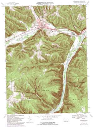
Youngsville Topo Map Pennsylvania
To zoom in, hover over the map of Youngsville
USGS Topo Quad 41079g3 - 1:24,000 scale
| Topo Map Name: | Youngsville |
| USGS Topo Quad ID: | 41079g3 |
| Print Size: | ca. 21 1/4" wide x 27" high |
| Southeast Coordinates: | 41.75° N latitude / 79.25° W longitude |
| Map Center Coordinates: | 41.8125° N latitude / 79.3125° W longitude |
| U.S. State: | PA |
| Filename: | o41079g3.jpg |
| Download Map JPG Image: | Youngsville topo map 1:24,000 scale |
| Map Type: | Topographic |
| Topo Series: | 7.5´ |
| Map Scale: | 1:24,000 |
| Source of Map Images: | United States Geological Survey (USGS) |
| Alternate Map Versions: |
Youngsville PA 1969, updated 1971 Download PDF Buy paper map Youngsville PA 1969, updated 1976 Download PDF Buy paper map Youngsville PA 1969, updated 1982 Download PDF Buy paper map Youngsville PA 1969, updated 1989 Download PDF Buy paper map Youngsville PA 2011 Download PDF Buy paper map Youngsville PA 2013 Download PDF Buy paper map Youngsville PA 2016 Download PDF Buy paper map |
| FStopo: | US Forest Service topo Youngsville is available: Download FStopo PDF Download FStopo TIF |
1:24,000 Topo Quads surrounding Youngsville
> Back to 41079e1 at 1:100,000 scale
> Back to 41078a1 at 1:250,000 scale
> Back to U.S. Topo Maps home
Youngsville topo map: Gazetteer
Youngsville: Airports
Brokenstraw Airport elevation 506m 1660′Youngsville: Islands
Crulls Island elevation 350m 1148′Thompsons Island elevation 345m 1131′
Youngsville: Parks
Buckaloons Recreation Area elevation 354m 1161′Wilder Field elevation 363m 1190′
Youngsville: Populated Places
Allegheny Springs elevation 435m 1427′Althom elevation 348m 1141′
Irvine elevation 356m 1167′
Youngsville elevation 366m 1200′
Youngsville: Streams
Anders Run elevation 529m 1735′Brokenstraw Creek elevation 351m 1151′
Browns Run elevation 387m 1269′
Browns Run elevation 389m 1276′
Charley Run elevation 349m 1145′
Clark Run elevation 344m 1128′
Double Run elevation 389m 1276′
Dry Run elevation 342m 1122′
Dunn Run elevation 344m 1128′
Hedgehog Run elevation 344m 1128′
Indian Camp Run elevation 359m 1177′
Irvine Run elevation 350m 1148′
Lenhart Run elevation 350m 1148′
Matthews Run elevation 360m 1181′
McKinney Run elevation 353m 1158′
Mead Run elevation 364m 1194′
Thompson Run elevation 344m 1128′
Youngsville: Summits
Crippen Hill elevation 570m 1870′Crippen Hill elevation 574m 1883′
York Mountain elevation 552m 1811′
Youngsville: Trails
Clark Trail elevation 508m 1666′Hedgehog Trail elevation 441m 1446′
Youngsville: Valleys
Pennsylvania Hollow elevation 348m 1141′Youngsville digital topo map on disk
Buy this Youngsville topo map showing relief, roads, GPS coordinates and other geographical features, as a high-resolution digital map file on DVD:


