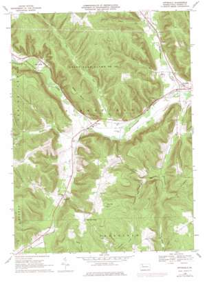
Pittsfield Topo Map Pennsylvania
To zoom in, hover over the map of Pittsfield
USGS Topo Quad 41079g4 - 1:24,000 scale
| Topo Map Name: | Pittsfield |
| USGS Topo Quad ID: | 41079g4 |
| Print Size: | ca. 21 1/4" wide x 27" high |
| Southeast Coordinates: | 41.75° N latitude / 79.375° W longitude |
| Map Center Coordinates: | 41.8125° N latitude / 79.4375° W longitude |
| U.S. State: | PA |
| Filename: | o41079g4.jpg |
| Download Map JPG Image: | Pittsfield topo map 1:24,000 scale |
| Map Type: | Topographic |
| Topo Series: | 7.5´ |
| Map Scale: | 1:24,000 |
| Source of Map Images: | United States Geological Survey (USGS) |
| Alternate Map Versions: |
Pittsfield PA 1968, updated 1971 Download PDF Buy paper map Pittsfield PA 1968, updated 1976 Download PDF Buy paper map Pittsfield PA 1968, updated 1976 Download PDF Buy paper map Pittsfield PA 2010 Download PDF Buy paper map Pittsfield PA 2013 Download PDF Buy paper map Pittsfield PA 2016 Download PDF Buy paper map |
1:24,000 Topo Quads surrounding Pittsfield
> Back to 41079e1 at 1:100,000 scale
> Back to 41078a1 at 1:250,000 scale
> Back to U.S. Topo Maps home
Pittsfield topo map: Gazetteer
Pittsfield: Parks
State Game Lands Number 143 elevation 485m 1591′Pittsfield: Populated Places
Garland elevation 394m 1292′Horn Siding elevation 412m 1351′
Pittsfield elevation 380m 1246′
Torpedo elevation 424m 1391′
Pittsfield: Streams
Andrews Run elevation 376m 1233′Barton Run elevation 384m 1259′
Birch Springs Run elevation 411m 1348′
Blue Eye Run elevation 387m 1269′
Bull Run elevation 407m 1335′
Gar Run elevation 393m 1289′
Hosmer Run elevation 399m 1309′
Little Brokenstraw Creek elevation 378m 1240′
Rattlesnake Run elevation 411m 1348′
Taylor Run elevation 396m 1299′
Wade Run elevation 426m 1397′
Pittsfield: Summits
Baker Rocks elevation 550m 1804′Cole Hill elevation 584m 1916′
Pittsfield: Valleys
Page Hollow elevation 398m 1305′Pittsfield digital topo map on disk
Buy this Pittsfield topo map showing relief, roads, GPS coordinates and other geographical features, as a high-resolution digital map file on DVD:


