Lake Canadohta Topo Map Pennsylvania
To zoom in, hover over the map of Lake Canadohta
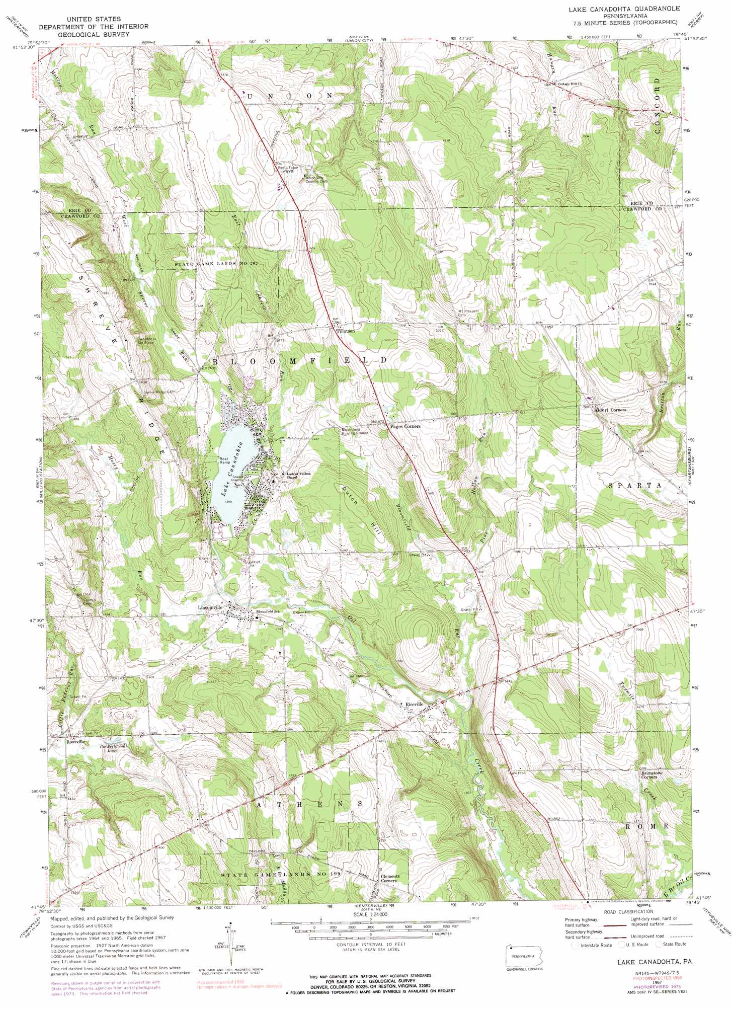
USGS Topo Quad 41079g7 - 1:24,000 scale
| Topo Map Name: | Lake Canadohta |
| USGS Topo Quad ID: | 41079g7 |
| Print Size: | ca. 21 1/4" wide x 27" high |
| Southeast Coordinates: | 41.75° N latitude / 79.75° W longitude |
| Map Center Coordinates: | 41.8125° N latitude / 79.8125° W longitude |
| U.S. State: | PA |
| Filename: | o41079g7.jpg |
| Download Map JPG Image: | Lake Canadohta topo map 1:24,000 scale |
| Map Type: | Topographic |
| Topo Series: | 7.5´ |
| Map Scale: | 1:24,000 |
| Source of Map Images: | United States Geological Survey (USGS) |
| Alternate Map Versions: |
Lake Canadohta PA 1967, updated 1972 Download PDF Buy paper map Lake Canadohta PA 1967, updated 1974 Download PDF Buy paper map Lake Canadohta PA 1967, updated 1991 Download PDF Buy paper map Lake Canadohta PA 2010 Download PDF Buy paper map Lake Canadohta PA 2013 Download PDF Buy paper map Lake Canadohta PA 2016 Download PDF Buy paper map |
1:24,000 Topo Quads surrounding Lake Canadohta
Erie South |
Hammett |
Wattsburg |
Clymer |
North Clymer |
Cambridge Springs Ne |
Waterford |
Union City |
Corry |
Columbus |
Cambridge Springs |
Millers Station |
Lake Canadohta |
Spartansburg |
Spring Creek |
Blooming Valley |
Townville |
Centerville |
Titusville North |
Grand Valley |
Cochranton |
Sugar Lake |
Dempseytown |
Titusville South |
Pleasantville |
> Back to 41079e1 at 1:100,000 scale
> Back to 41078a1 at 1:250,000 scale
> Back to U.S. Topo Maps home
Lake Canadohta topo map: Gazetteer
Lake Canadohta: Lakes
Lake Canadohta elevation 423m 1387′Puckerbrush Lake elevation 409m 1341′
Lake Canadohta: Parks
State Game Lands Number 202 elevation 483m 1584′Lake Canadohta: Populated Places
Canadohta Lake elevation 424m 1391′Lakeville elevation 439m 1440′
Lincolnville elevation 418m 1371′
Riceville elevation 414m 1358′
Rootville elevation 408m 1338′
Tillotson elevation 477m 1564′
Lake Canadohta: Post Offices
Lake Canadohta Post Office (historical) elevation 424m 1391′Lake Canadohta: Ridges
Shreve Ridge elevation 512m 1679′Lake Canadohta: Streams
Bloomfield Run elevation 399m 1309′East Shreve Run elevation 424m 1391′
Mosey Run elevation 417m 1368′
Pine Hollow Run elevation 405m 1328′
West Shreve Run elevation 424m 1391′
Lake Canadohta: Summits
Dutch Hill elevation 476m 1561′Lake Canadohta digital topo map on disk
Buy this Lake Canadohta topo map showing relief, roads, GPS coordinates and other geographical features, as a high-resolution digital map file on DVD:
 map DVD")