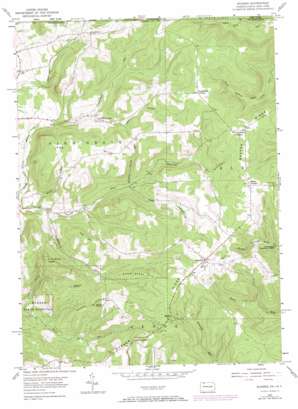
Scandia Topo Map Pennsylvania
To zoom in, hover over the map of Scandia
USGS Topo Quad 41079h1 - 1:24,000 scale
| Topo Map Name: | Scandia |
| USGS Topo Quad ID: | 41079h1 |
| Print Size: | ca. 21 1/4" wide x 27" high |
| Southeast Coordinates: | 41.875° N latitude / 79° W longitude |
| Map Center Coordinates: | 41.9375° N latitude / 79.0625° W longitude |
| U.S. States: | PA, NY |
| Filename: | o41079h1.jpg |
| Download Map JPG Image: | Scandia topo map 1:24,000 scale |
| Map Type: | Topographic |
| Topo Series: | 7.5´ |
| Map Scale: | 1:24,000 |
| Source of Map Images: | United States Geological Survey (USGS) |
| Alternate Map Versions: |
Scandia PA 1954, updated 1956 Download PDF Buy paper map Scandia PA 1954, updated 1967 Download PDF Buy paper map Scandia PA 1954, updated 1972 Download PDF Buy paper map Scandia PA 2011 Download PDF Buy paper map Scandia PA 2013 Download PDF Buy paper map Scandia PA 2016 Download PDF Buy paper map |
| FStopo: | US Forest Service topo Scandia is available: Download FStopo PDF Download FStopo TIF |
1:24,000 Topo Quads surrounding Scandia
> Back to 41079e1 at 1:100,000 scale
> Back to 41078a1 at 1:250,000 scale
> Back to U.S. Topo Maps home
Scandia topo map: Gazetteer
Scandia: Airports
Scandia Air Park elevation 632m 2073′Scandia: Flats
Pine Grove Glade elevation 534m 1751′Scandia: Pillars
South Rocks elevation 626m 2053′Scandia: Populated Places
Cable Hollow elevation 468m 1535′Gouldtown elevation 512m 1679′
Scandia elevation 638m 2093′
Scandia: Ridges
Quaker Ridge elevation 615m 2017′Scandia: Streams
Reynolds Run elevation 449m 1473′Sulphur Spring Run elevation 458m 1502′
Vanarsdale Run elevation 452m 1482′
Widdlefield Run elevation 397m 1302′
Wolcott Run elevation 394m 1292′
Scandia: Summits
Bone Steel Hill elevation 569m 1866′Cole Hill elevation 588m 1929′
Fox Hill elevation 601m 1971′
Gardners Rocks elevation 612m 2007′
Goose Heaven Hill elevation 626m 2053′
Warren Rocks elevation 612m 2007′
Scandia: Valleys
Cable Hollow elevation 462m 1515′Priest Hollow elevation 464m 1522′
Scandia digital topo map on disk
Buy this Scandia topo map showing relief, roads, GPS coordinates and other geographical features, as a high-resolution digital map file on DVD:


