Harlansburg Topo Map Pennsylvania
To zoom in, hover over the map of Harlansburg
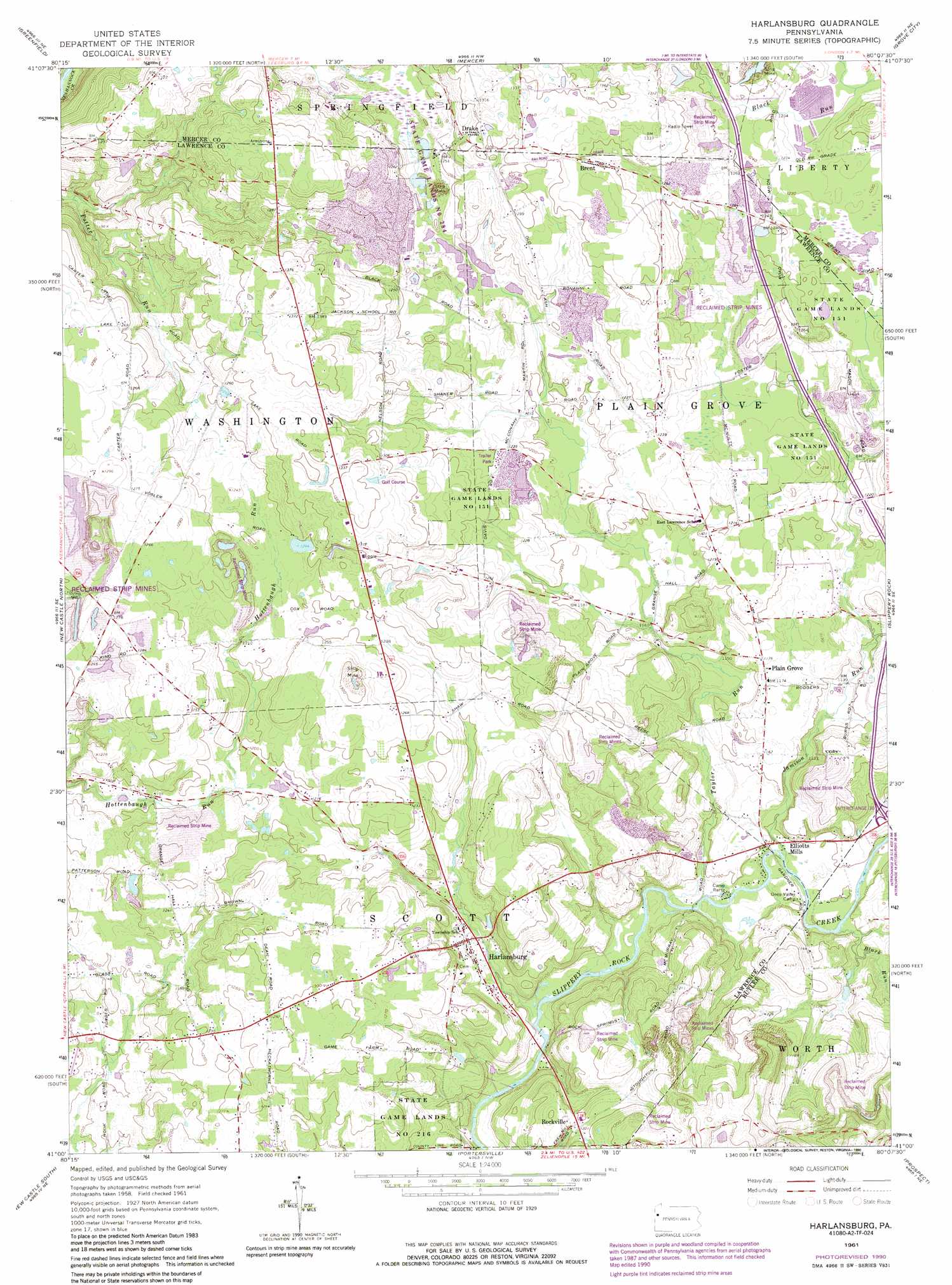
USGS Topo Quad 41080a2 - 1:24,000 scale
| Topo Map Name: | Harlansburg |
| USGS Topo Quad ID: | 41080a2 |
| Print Size: | ca. 21 1/4" wide x 27" high |
| Southeast Coordinates: | 41° N latitude / 80.125° W longitude |
| Map Center Coordinates: | 41.0625° N latitude / 80.1875° W longitude |
| U.S. State: | PA |
| Filename: | o41080a2.jpg |
| Download Map JPG Image: | Harlansburg topo map 1:24,000 scale |
| Map Type: | Topographic |
| Topo Series: | 7.5´ |
| Map Scale: | 1:24,000 |
| Source of Map Images: | United States Geological Survey (USGS) |
| Alternate Map Versions: |
Harlansburg PA 1961, updated 1964 Download PDF Buy paper map Harlansburg PA 1961, updated 1972 Download PDF Buy paper map Harlansburg PA 1961, updated 1990 Download PDF Buy paper map Harlansburg PA 2010 Download PDF Buy paper map Harlansburg PA 2013 Download PDF Buy paper map Harlansburg PA 2016 Download PDF Buy paper map |
1:24,000 Topo Quads surrounding Harlansburg
Sharpsville |
Fredonia |
Jackson Center |
Sandy Lake |
Polk |
Sharon East |
Greenfield |
Mercer |
Grove City |
Barkeyville |
Edinburg |
New Castle North |
Harlansburg |
Slippery Rock |
West Sunbury |
Bessemer |
New Castle South |
Portersville |
Prospect |
Mount Chestnut |
New Galilee |
Beaver Falls |
Zelienople |
Evans City |
Butler |
> Back to 41080a1 at 1:100,000 scale
> Back to 41080a1 at 1:250,000 scale
> Back to U.S. Topo Maps home
Harlansburg topo map: Gazetteer
Harlansburg: Airports
Meadowlark Farm Airport elevation 359m 1177′Shaw Dairy Farm Airport elevation 420m 1377′
Harlansburg: Parks
State Game Lands Number 151 elevation 401m 1315′State Game Lands Number 216 elevation 372m 1220′
State Game Lands Number 284 elevation 415m 1361′
Harlansburg: Populated Places
Brent elevation 399m 1309′Drake elevation 390m 1279′
Elliotts Mills elevation 340m 1115′
Harlansburg elevation 343m 1125′
Plain Grove elevation 355m 1164′
Rockville elevation 372m 1220′
Harlansburg: Reservoirs
Chambers Reservoir elevation 390m 1279′Harlansburg: Streams
Black Run elevation 337m 1105′Jamison Run elevation 344m 1128′
Taylor Run elevation 343m 1125′
Harlansburg digital topo map on disk
Buy this Harlansburg topo map showing relief, roads, GPS coordinates and other geographical features, as a high-resolution digital map file on DVD:
 map DVD")