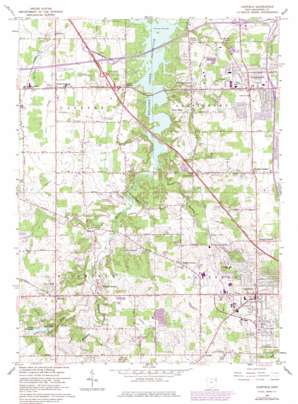
Canfield Topo Map Ohio
To zoom in, hover over the map of Canfield
USGS Topo Quad 41080a7 - 1:24,000 scale
| Topo Map Name: | Canfield |
| USGS Topo Quad ID: | 41080a7 |
| Print Size: | ca. 21 1/4" wide x 27" high |
| Southeast Coordinates: | 41° N latitude / 80.75° W longitude |
| Map Center Coordinates: | 41.0625° N latitude / 80.8125° W longitude |
| U.S. State: | OH |
| Filename: | o41080a7.jpg |
| Download Map JPG Image: | Canfield topo map 1:24,000 scale |
| Map Type: | Topographic |
| Topo Series: | 7.5´ |
| Map Scale: | 1:24,000 |
| Source of Map Images: | United States Geological Survey (USGS) |
| Alternate Map Versions: |
Canfield OH 1952, updated 1953 Download PDF Buy paper map Canfield OH 1963, updated 1964 Download PDF Buy paper map Canfield OH 1963, updated 1971 Download PDF Buy paper map Canfield OH 1963, updated 1979 Download PDF Buy paper map Canfield OH 1963, updated 1979 Download PDF Buy paper map Canfield OH 2010 Download PDF Buy paper map Canfield OH 2013 Download PDF Buy paper map Canfield OH 2016 Download PDF Buy paper map |
1:24,000 Topo Quads surrounding Canfield
> Back to 41080a1 at 1:100,000 scale
> Back to 41080a1 at 1:250,000 scale
> Back to U.S. Topo Maps home
Canfield topo map: Gazetteer
Canfield: Airports
Briel Airport elevation 357m 1171′Brocker Field elevation 354m 1161′
Mahoning County Joint Vocational School Airport elevation 343m 1125′
Wetzl Airport elevation 293m 961′
Youngstown Executive Airport (historical) elevation 299m 980′
Canfield: Canals
North Jackson Ditch elevation 310m 1017′Canfield: Crossings
Interchange 15 elevation 304m 997′Interchange 223 elevation 316m 1036′
Canfield: Dams
Diehl Lake Dam elevation 330m 1082′Canfield: Lakes
Lower Diehl Lake elevation 314m 1030′Upper Diehl Lake elevation 324m 1062′
Canfield: Populated Places
Austintown elevation 344m 1128′Camp Park elevation 306m 1003′
Canfield elevation 349m 1145′
Dublin elevation 363m 1190′
Ellsworth elevation 320m 1049′
Geeburg elevation 295m 967′
Herbert Corners elevation 358m 1174′
Misner Corners elevation 345m 1131′
North Jackson elevation 311m 1020′
Ohlton (historical) elevation 311m 1020′
Shepard's Mobile Home Park elevation 310m 1017′
Shively Corners elevation 321m 1053′
Smith Corners elevation 350m 1148′
Stony Ridge elevation 286m 938′
Taylor Corners elevation 293m 961′
West Austintown elevation 306m 1003′
Westhill Heights elevation 310m 1017′
Canfield: Post Offices
Austintown Post Office (historical) elevation 343m 1125′Canfield Post Office elevation 353m 1158′
Ellsworth Post Office (historical) elevation 320m 1049′
North Jackson Post Office elevation 311m 1020′
West Austintown Post Office (historical) elevation 308m 1010′
Canfield: Reservoirs
Diehl Lake elevation 330m 1082′Palmyra Lake elevation 298m 977′
Canfield: Streams
Sawmill Creek elevation 293m 961′West Branch Meander Creek elevation 292m 958′
Canfield digital topo map on disk
Buy this Canfield topo map showing relief, roads, GPS coordinates and other geographical features, as a high-resolution digital map file on DVD:


