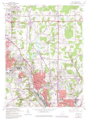
Girard Topo Map Ohio
To zoom in, hover over the map of Girard
USGS Topo Quad 41080b6 - 1:24,000 scale
| Topo Map Name: | Girard |
| USGS Topo Quad ID: | 41080b6 |
| Print Size: | ca. 21 1/4" wide x 27" high |
| Southeast Coordinates: | 41.125° N latitude / 80.625° W longitude |
| Map Center Coordinates: | 41.1875° N latitude / 80.6875° W longitude |
| U.S. State: | OH |
| Filename: | o41080b6.jpg |
| Download Map JPG Image: | Girard topo map 1:24,000 scale |
| Map Type: | Topographic |
| Topo Series: | 7.5´ |
| Map Scale: | 1:24,000 |
| Source of Map Images: | United States Geological Survey (USGS) |
| Alternate Map Versions: |
Girard OH 1954, updated 1956 Download PDF Buy paper map Girard OH 1962, updated 1964 Download PDF Buy paper map Girard OH 1962, updated 1971 Download PDF Buy paper map Girard OH 1962, updated 1980 Download PDF Buy paper map Girard OH 1962, updated 1980 Download PDF Buy paper map Girard OH 1994, updated 1997 Download PDF Buy paper map Girard OH 2010 Download PDF Buy paper map Girard OH 2013 Download PDF Buy paper map Girard OH 2016 Download PDF Buy paper map |
1:24,000 Topo Quads surrounding Girard
> Back to 41080a1 at 1:100,000 scale
> Back to 41080a1 at 1:250,000 scale
> Back to U.S. Topo Maps home
Girard topo map: Gazetteer
Girard: Airports
Price Field elevation 331m 1085′Youngstown Development Center Heliport elevation 310m 1017′
Girard: Canals
Guthiel Ditch elevation 322m 1056′Girard: Crossings
Interchange 1 elevation 317m 1040′Interchange 227 elevation 276m 905′
Interchange 228 elevation 306m 1003′
Interchange 229 elevation 328m 1076′
Girard: Dams
Lake Girard Dam elevation 305m 1000′Liberty Lake Dam elevation 297m 974′
Squaw Valley Park Lake Dam elevation 326m 1069′
Girard: Parks
Churchill Park elevation 304m 997′Crandal Park-Fifth Avenue Historic District elevation 328m 1076′
David Tod Memorial Park elevation 278m 912′
Price Field elevation 332m 1089′
Stevens Park elevation 313m 1026′
Tod Field elevation 295m 967′
Woodland Park elevation 286m 938′
Girard: Populated Places
Bel Air Mobile Home Park elevation 336m 1102′Belmont Park elevation 338m 1108′
Cedar Corners elevation 311m 1020′
Cedar Park elevation 332m 1089′
Churchill elevation 325m 1066′
Ekerts Corners elevation 288m 944′
Girard elevation 276m 905′
Grimms Mobile Home Park elevation 332m 1089′
Hakes Corners elevation 321m 1053′
Halls Corners elevation 296m 971′
Hillcrest Trailer Court elevation 334m 1095′
Hilltop elevation 298m 977′
Howland Corners elevation 287m 941′
Howland Mobile Home Park elevation 326m 1069′
Klines Corner elevation 332m 1089′
Loys Corners elevation 320m 1049′
Madden Corners elevation 286m 938′
McDonald elevation 294m 964′
McKinley Heights elevation 302m 990′
Midway Mobile Home Park elevation 352m 1154′
Paul's Trailer Park elevation 325m 1066′
Sodom elevation 337m 1105′
Suburban Mobile Home Park elevation 308m 1010′
Summit elevation 305m 1000′
Tibbetts Corners elevation 297m 974′
Vienna elevation 350m 1148′
Girard: Post Offices
Churchill Post Office (historical) elevation 323m 1059′Girard Post Office elevation 275m 902′
Girard Post Office elevation 277m 908′
McDonald Post Office elevation 296m 971′
Sodom Post Office (historical) elevation 338m 1108′
Vienna Post Office elevation 351m 1151′
Girard: Reservoirs
Lower Girard Lake elevation 297m 974′Squaw Valley Park Lake elevation 326m 1069′
Upper Girard Lake elevation 305m 1000′
Girard: Streams
Fourmile Run elevation 256m 839′Little Squaw Creek elevation 258m 846′
Squaw Creek elevation 258m 846′
Girard digital topo map on disk
Buy this Girard topo map showing relief, roads, GPS coordinates and other geographical features, as a high-resolution digital map file on DVD:


