Sandy Lake Topo Map Pennsylvania
To zoom in, hover over the map of Sandy Lake
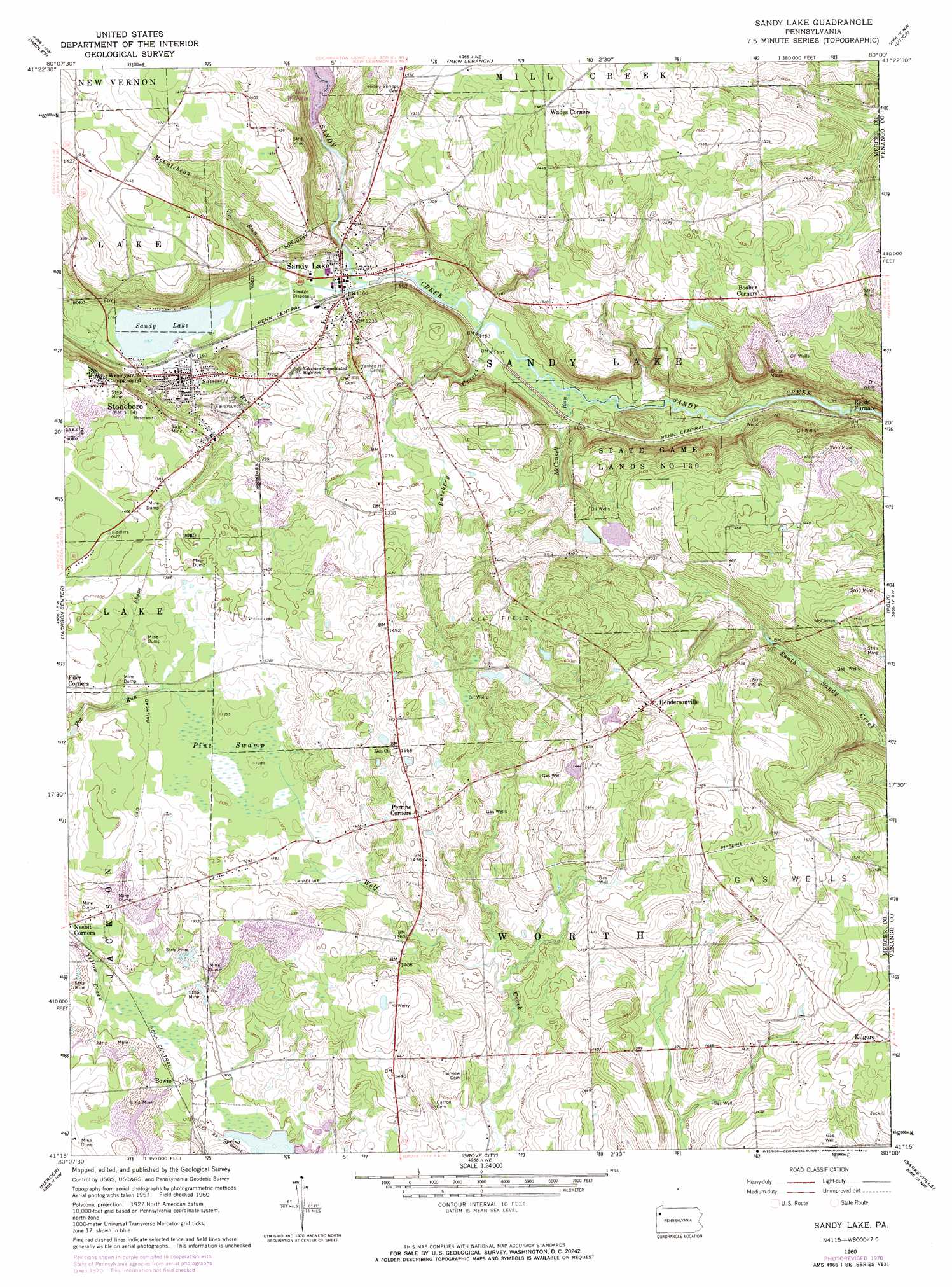
USGS Topo Quad 41080c1 - 1:24,000 scale
| Topo Map Name: | Sandy Lake |
| USGS Topo Quad ID: | 41080c1 |
| Print Size: | ca. 21 1/4" wide x 27" high |
| Southeast Coordinates: | 41.25° N latitude / 80° W longitude |
| Map Center Coordinates: | 41.3125° N latitude / 80.0625° W longitude |
| U.S. State: | PA |
| Filename: | o41080c1.jpg |
| Download Map JPG Image: | Sandy Lake topo map 1:24,000 scale |
| Map Type: | Topographic |
| Topo Series: | 7.5´ |
| Map Scale: | 1:24,000 |
| Source of Map Images: | United States Geological Survey (USGS) |
| Alternate Map Versions: |
Sandy Lake PA 1960, updated 1962 Download PDF Buy paper map Sandy Lake PA 1960, updated 1972 Download PDF Buy paper map Sandy Lake PA 1960, updated 1972 Download PDF Buy paper map Sandy Lake PA 2010 Download PDF Buy paper map Sandy Lake PA 2013 Download PDF Buy paper map Sandy Lake PA 2016 Download PDF Buy paper map |
1:24,000 Topo Quads surrounding Sandy Lake
Conneaut Lake |
Geneva |
Cochranton |
Sugar Lake |
Dempseytown |
Greenville East |
Hadley |
New Lebanon |
Utica |
Franklin |
Fredonia |
Jackson Center |
Sandy Lake |
Polk |
Kennerdell |
Greenfield |
Mercer |
Grove City |
Barkeyville |
Eau Claire |
New Castle North |
Harlansburg |
Slippery Rock |
West Sunbury |
Hilliards |
> Back to 41080a1 at 1:100,000 scale
> Back to 41080a1 at 1:250,000 scale
> Back to U.S. Topo Maps home
Sandy Lake topo map: Gazetteer
Sandy Lake: Dams
Lake Wilhelm Dam elevation 363m 1190′Pa-474 Dam elevation 376m 1233′
Sandy Lake: Lakes
Sandy Lake elevation 353m 1158′Sandy Lake: Parks
State Game Lands Number 130 elevation 433m 1420′Sandy Lake: Populated Places
Booher Corners elevation 463m 1519′Bowie elevation 396m 1299′
Hendersonville elevation 455m 1492′
Kilgore elevation 468m 1535′
Perrine Corners elevation 454m 1489′
Reeds Furnace elevation 347m 1138′
Sandy Lake elevation 353m 1158′
Stoneboro elevation 359m 1177′
Sandy Lake: Reservoirs
Lake Wilheim elevation 363m 1190′Pa-474 Reservoir elevation 376m 1233′
Sandy Lake: Streams
Butchery Creek elevation 349m 1145′McConnell Run elevation 349m 1145′
McCutcheon Run elevation 352m 1154′
Sawmill Run elevation 352m 1154′
Sandy Lake: Swamps
Pine Swamp elevation 417m 1368′Sandy Lake digital topo map on disk
Buy this Sandy Lake topo map showing relief, roads, GPS coordinates and other geographical features, as a high-resolution digital map file on DVD:
 map DVD")