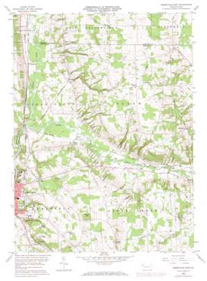
Greenville East Topo Map Pennsylvania
To zoom in, hover over the map of Greenville East
USGS Topo Quad 41080d3 - 1:24,000 scale
| Topo Map Name: | Greenville East |
| USGS Topo Quad ID: | 41080d3 |
| Print Size: | ca. 21 1/4" wide x 27" high |
| Southeast Coordinates: | 41.375° N latitude / 80.25° W longitude |
| Map Center Coordinates: | 41.4375° N latitude / 80.3125° W longitude |
| U.S. State: | PA |
| Filename: | o41080d3.jpg |
| Download Map JPG Image: | Greenville East topo map 1:24,000 scale |
| Map Type: | Topographic |
| Topo Series: | 7.5´ |
| Map Scale: | 1:24,000 |
| Source of Map Images: | United States Geological Survey (USGS) |
| Alternate Map Versions: |
Greensville East PA 1958, updated 1960 Download PDF Buy paper map Greensville East PA 1958, updated 1972 Download PDF Buy paper map Greensville East PA 1958, updated 1972 Download PDF Buy paper map Greenville East PA 2010 Download PDF Buy paper map Greenville East PA 2013 Download PDF Buy paper map Greenville East PA 2016 Download PDF Buy paper map |
1:24,000 Topo Quads surrounding Greenville East
> Back to 41080a1 at 1:100,000 scale
> Back to 41080a1 at 1:250,000 scale
> Back to U.S. Topo Maps home
Greenville East topo map: Gazetteer
Greenville East: Airports
Jim Lee Airport elevation 388m 1272′Greenville East: Dams
Greenville Dam Number Three elevation 354m 1161′Hadley Dam elevation 348m 1141′
Mathay Dam elevation 361m 1184′
Saul Run Dam elevation 328m 1076′
Greenville East: Populated Places
Henlein elevation 344m 1128′K O Junction elevation 302m 990′
Kashner elevation 391m 1282′
Kennard elevation 316m 1036′
Leechs Corners elevation 315m 1033′
Minnis Corner elevation 336m 1102′
Osborn elevation 412m 1351′
Osgood elevation 302m 990′
Petersburg elevation 365m 1197′
Salem elevation 302m 990′
Greenville East: Reservoirs
Greenville Reservoir elevation 354m 1161′Hadley Dam Reservoir elevation 348m 1141′
Mathay Run Pond elevation 361m 1184′
Saul Run Dam Reservoir elevation 328m 1076′
Greenville East: Streams
Bluff Run elevation 296m 971′Crooked Creek elevation 296m 971′
Minis Hollow Run elevation 297m 974′
Morrison Run elevation 317m 1040′
Greenville East: Summits
Quarry Hill elevation 376m 1233′Snyder Hill elevation 384m 1259′
Wheeler Hill elevation 418m 1371′
Greenville East digital topo map on disk
Buy this Greenville East topo map showing relief, roads, GPS coordinates and other geographical features, as a high-resolution digital map file on DVD:


