East Trumbull Topo Map Ohio
To zoom in, hover over the map of East Trumbull
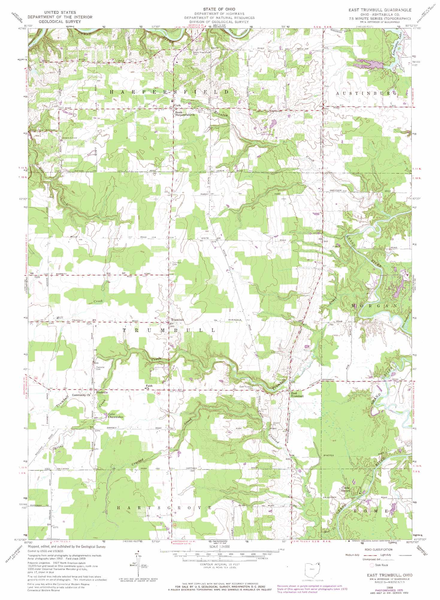
USGS Topo Quad 41080f8 - 1:24,000 scale
| Topo Map Name: | East Trumbull |
| USGS Topo Quad ID: | 41080f8 |
| Print Size: | ca. 21 1/4" wide x 27" high |
| Southeast Coordinates: | 41.625° N latitude / 80.875° W longitude |
| Map Center Coordinates: | 41.6875° N latitude / 80.9375° W longitude |
| U.S. State: | OH |
| Filename: | o41080f8.jpg |
| Download Map JPG Image: | East Trumbull topo map 1:24,000 scale |
| Map Type: | Topographic |
| Topo Series: | 7.5´ |
| Map Scale: | 1:24,000 |
| Source of Map Images: | United States Geological Survey (USGS) |
| Alternate Map Versions: |
East Trumbull OH 1959, updated 1961 Download PDF Buy paper map East Trumbull OH 1959, updated 1966 Download PDF Buy paper map East Trumbull OH 1959, updated 1971 Download PDF Buy paper map East Trumbull OH 1994, updated 1997 Download PDF Buy paper map East Trumbull OH 2010 Download PDF Buy paper map East Trumbull OH 2013 Download PDF Buy paper map East Trumbull OH 2016 Download PDF Buy paper map |
1:24,000 Topo Quads surrounding East Trumbull
Ashtabula North |
North Kingsville |
|||
Perry |
Madison |
Geneva |
Ashtabula South |
Gageville |
Painesville |
Thompson |
East Trumbull |
Jefferson |
Dorset |
Chardon |
East Claridon |
Windsor |
Orwell |
Cherry Valley |
Burton |
Middlefield |
West Farmington |
Bristolville |
Gustavus |
> Back to 41080e1 at 1:100,000 scale
> Back to 41080a1 at 1:250,000 scale
> Back to U.S. Topo Maps home
East Trumbull topo map: Gazetteer
East Trumbull: Airports
Armington Airport elevation 251m 823′Echerd Airfield elevation 295m 967′
Trumbull Airport elevation 313m 1026′
East Trumbull: Dams
Bruno Pond Dam elevation 263m 862′Lake Beaumont Dam elevation 239m 784′
Lake George Dam elevation 247m 810′
East Trumbull: Lakes
Lake Chawaukee elevation 313m 1026′East Trumbull: Populated Places
Barnes Corners (historical) elevation 257m 843′Cork elevation 296m 971′
East Trumbull elevation 251m 823′
Footville elevation 317m 1040′
Trumbull elevation 301m 987′
East Trumbull: Post Offices
Trumbull Post Office (historical) elevation 302m 990′East Trumbull: Reservoirs
Bruno Pond elevation 263m 862′Lake Beaumont elevation 239m 784′
Lake George elevation 247m 810′
East Trumbull: Streams
Bronson Creek elevation 234m 767′Mud Creek elevation 234m 767′
Spring Creek elevation 278m 912′
Three Brothers Creek elevation 234m 767′
Trumbull Creek elevation 231m 757′
East Trumbull digital topo map on disk
Buy this East Trumbull topo map showing relief, roads, GPS coordinates and other geographical features, as a high-resolution digital map file on DVD:
 map DVD")