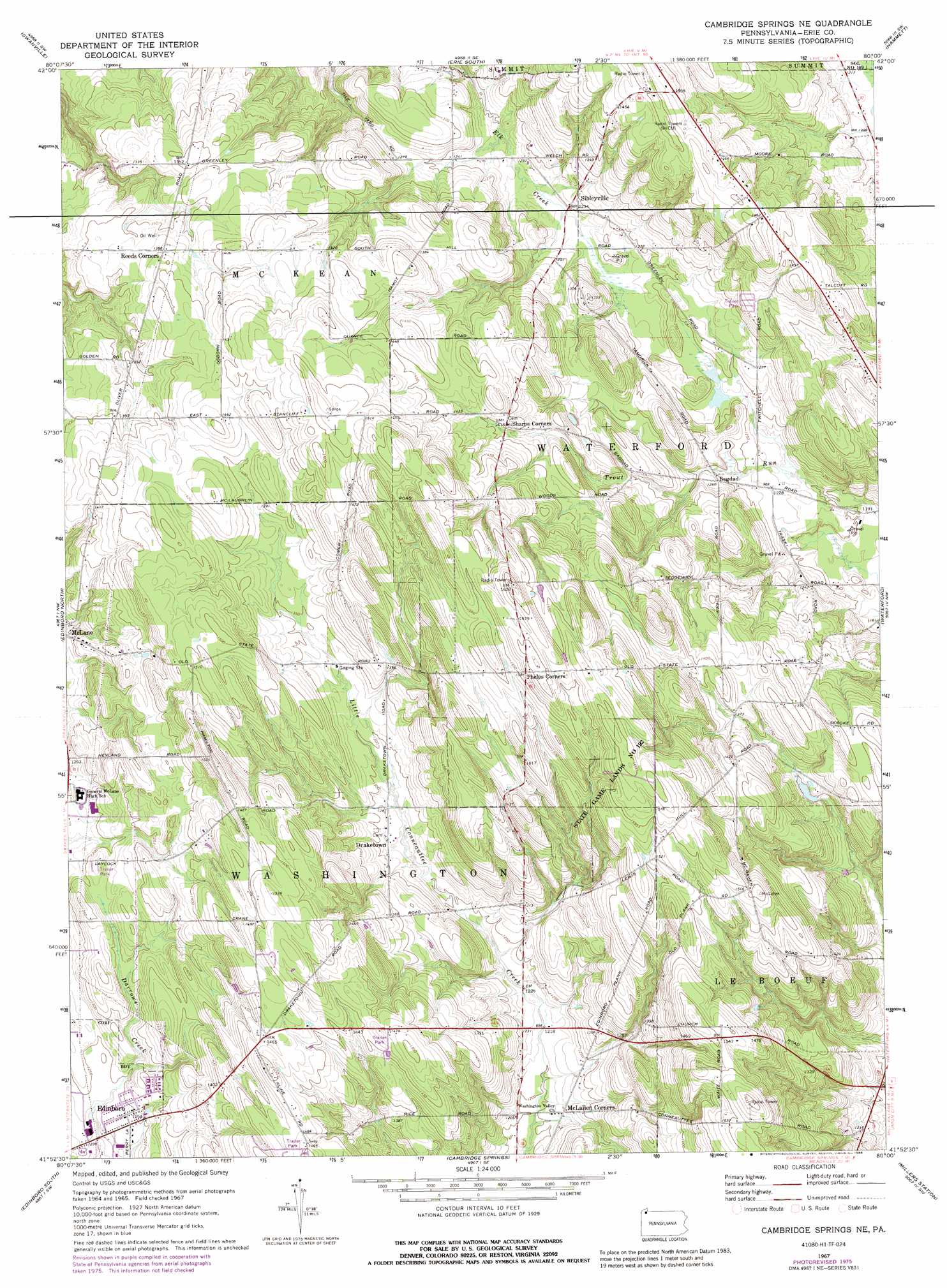
Cambridge Springs Ne Topo Map Pennsylvania
To zoom in, hover over the map of Cambridge Springs Ne
USGS Topo Quad 41080h1 - 1:24,000 scale
| Topo Map Name: | Cambridge Springs Ne |
| USGS Topo Quad ID: | 41080h1 |
| Print Size: | ca. 21 1/4" wide x 27" high |
| Southeast Coordinates: | 41.875° N latitude / 80° W longitude |
| Map Center Coordinates: | 41.9375° N latitude / 80.0625° W longitude |
| U.S. State: | PA |
| Filename: | o41080h1.jpg |
| Download Map JPG Image: | Cambridge Springs Ne topo map 1:24,000 scale |
| Map Type: | Topographic |
| Topo Series: | 7.5´ |
| Map Scale: | 1:24,000 |
| Source of Map Images: | United States Geological Survey (USGS) |
| Alternate Map Versions: |
Cambridge Springs NE PA 1967, updated 1972 Download PDF Buy paper map Cambridge Springs NE PA 1967, updated 1976 Download PDF Buy paper map Cambridge Springs NE PA 1967, updated 1988 Download PDF Buy paper map Cambridge Springs NE PA 2010 Download PDF Buy paper map Cambridge Springs NE PA 2013 Download PDF Buy paper map Cambridge Springs NE PA 2016 Download PDF Buy paper map |
1:24,000 Topo Quads surrounding Cambridge Springs Ne
Erie North |
Harborcreek |
North East |
||
Fairview |
Swanville |
Erie South |
Hammett |
Wattsburg |
Albion |
Edinboro North |
Cambridge Springs Ne |
Waterford |
Union City |
Conneautville |
Edinboro South |
Cambridge Springs |
Millers Station |
Lake Canadohta |
Harmonsburg |
Meadville |
Blooming Valley |
Townville |
Centerville |
> Back to 41080e1 at 1:100,000 scale
> Back to 41080a1 at 1:250,000 scale
> Back to U.S. Topo Maps home
Cambridge Springs Ne topo map: Gazetteer
Cambridge Springs Ne: Airports
Carlson Airport elevation 442m 1450′Cambridge Springs Ne: Parks
State Game Lands Number 192 elevation 481m 1578′Cambridge Springs Ne: Populated Places
Bagdad elevation 384m 1259′Draketown elevation 392m 1286′
McLallen Corners elevation 371m 1217′
Reeds Corners elevation 421m 1381′
Sibleyville elevation 375m 1230′
Cambridge Springs Ne: Post Offices
McLallen Post Office elevation 371m 1217′Cambridge Springs Ne digital topo map on disk
Buy this Cambridge Springs Ne topo map showing relief, roads, GPS coordinates and other geographical features, as a high-resolution digital map file on DVD:
 map DVD")