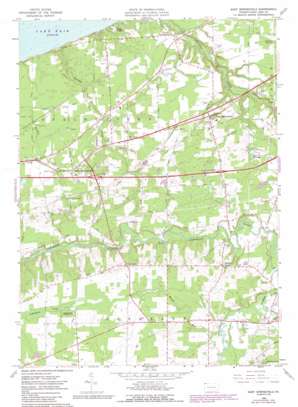
East Springfield Topo Map Pennsylvania
To zoom in, hover over the map of East Springfield
USGS Topo Quad 41080h4 - 1:24,000 scale
| Topo Map Name: | East Springfield |
| USGS Topo Quad ID: | 41080h4 |
| Print Size: | ca. 21 1/4" wide x 27" high |
| Southeast Coordinates: | 41.875° N latitude / 80.375° W longitude |
| Map Center Coordinates: | 41.9375° N latitude / 80.4375° W longitude |
| U.S. State: | PA |
| Filename: | o41080h4.jpg |
| Download Map JPG Image: | East Springfield topo map 1:24,000 scale |
| Map Type: | Topographic |
| Topo Series: | 7.5´ |
| Map Scale: | 1:24,000 |
| Source of Map Images: | United States Geological Survey (USGS) |
| Alternate Map Versions: |
East Springfield PA 1959, updated 1960 Download PDF Buy paper map East Springfield PA 1959, updated 1970 Download PDF Buy paper map East Springfield PA 1959, updated 1983 Download PDF Buy paper map East Springfield PA 1959, updated 1990 Download PDF Buy paper map East Springfield PA 2010 Download PDF Buy paper map East Springfield PA 2013 Download PDF Buy paper map East Springfield PA 2016 Download PDF Buy paper map |
1:24,000 Topo Quads surrounding East Springfield
> Back to 41080e1 at 1:100,000 scale
> Back to 41080a1 at 1:250,000 scale
> Back to U.S. Topo Maps home
East Springfield topo map: Gazetteer
East Springfield: Airports
Port Albion Airport elevation 300m 984′East Springfield: Populated Places
Akerly elevation 277m 908′Center Corner elevation 218m 715′
Cherry Hill elevation 276m 905′
Cross elevation 235m 770′
East Springfield elevation 228m 748′
Kidders Corner elevation 275m 902′
Lexington (historical) elevation 264m 866′
North Springfield elevation 201m 659′
Thornton Junction elevation 222m 728′
West Springfield elevation 217m 711′
East Springfield: Reservoirs
Lake Annata elevation 245m 803′East Springfield: Streams
East Branch Conneaut Creek elevation 255m 836′Marsh Run elevation 256m 839′
Raccoon Creek elevation 174m 570′
East Springfield digital topo map on disk
Buy this East Springfield topo map showing relief, roads, GPS coordinates and other geographical features, as a high-resolution digital map file on DVD:


