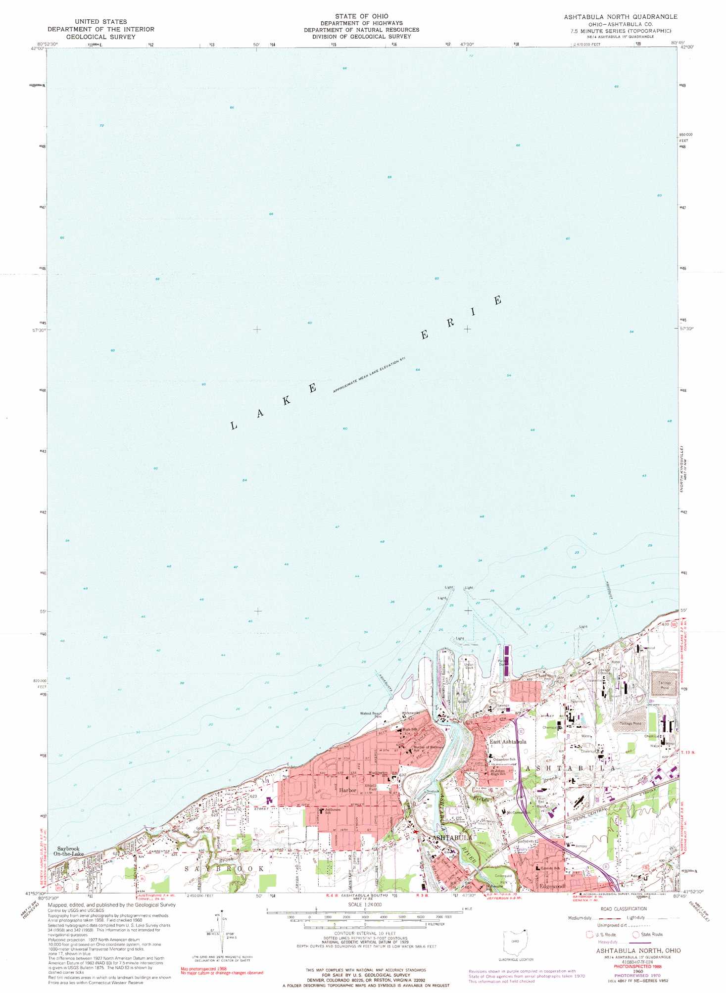
Ashtabula North Topo Map Ohio
To zoom in, hover over the map of Ashtabula North
USGS Topo Quad 41080h7 - 1:24,000 scale
| Topo Map Name: | Ashtabula North |
| USGS Topo Quad ID: | 41080h7 |
| Print Size: | ca. 21 1/4" wide x 27" high |
| Southeast Coordinates: | 41.875° N latitude / 80.75° W longitude |
| Map Center Coordinates: | 41.9375° N latitude / 80.8125° W longitude |
| U.S. State: | OH |
| Filename: | o41080h7.jpg |
| Download Map JPG Image: | Ashtabula North topo map 1:24,000 scale |
| Map Type: | Topographic |
| Topo Series: | 7.5´ |
| Map Scale: | 1:24,000 |
| Source of Map Images: | United States Geological Survey (USGS) |
| Alternate Map Versions: |
Ashtabula North OH 1960, updated 1961 Download PDF Buy paper map Ashtabula North OH 1960, updated 1970 Download PDF Buy paper map Ashtabula North OH 1960, updated 1983 Download PDF Buy paper map Ashtabula North OH 1960, updated 1991 Download PDF Buy paper map Ashtabula North OH 2010 Download PDF Buy paper map Ashtabula North OH 2013 Download PDF Buy paper map Ashtabula North OH 2016 Download PDF Buy paper map |
1:24,000 Topo Quads surrounding Ashtabula North
Ashtabula North |
North Kingsville |
Conneaut |
||
Madison |
Geneva |
Ashtabula South |
Gageville |
Pierpont |
Thompson |
East Trumbull |
Jefferson |
Dorset |
Leon |
> Back to 41080e1 at 1:100,000 scale
> Back to 41080a1 at 1:250,000 scale
> Back to U.S. Topo Maps home
Ashtabula North topo map: Gazetteer
Ashtabula North: Bridges
West Fifth Street Bridge elevation 176m 577′Ashtabula North: Parks
Ashtabula Harbour Commercial Historic District elevation 179m 587′Brooker Field elevation 194m 636′
Cederquist Park elevation 179m 587′
Lake Shore Park elevation 192m 629′
Massucci Field elevation 192m 629′
Smith Park elevation 193m 633′
Walnut Beach Park elevation 174m 570′
Wenner Field elevation 192m 629′
Ashtabula North: Populated Places
East Ashtabula elevation 191m 626′Edgewood Trailer Park elevation 203m 666′
Erieview elevation 190m 623′
Harbor elevation 194m 636′
Keyes Trailer Park elevation 202m 662′
Oakwood Mobile Home Park elevation 197m 646′
State Road Mobile Home Park elevation 197m 646′
Willow Arms elevation 194m 636′
Ashtabula North: Post Offices
Harbor Post Office (historical) elevation 194m 636′Harbor Station Ashtabula Post Office elevation 191m 626′
Ashtabula North: Streams
Ashtabula River elevation 174m 570′Fields Brook elevation 176m 577′
Red Brook elevation 176m 577′
Strong Creek elevation 177m 580′
Ashtabula North digital topo map on disk
Buy this Ashtabula North topo map showing relief, roads, GPS coordinates and other geographical features, as a high-resolution digital map file on DVD:
 map DVD")