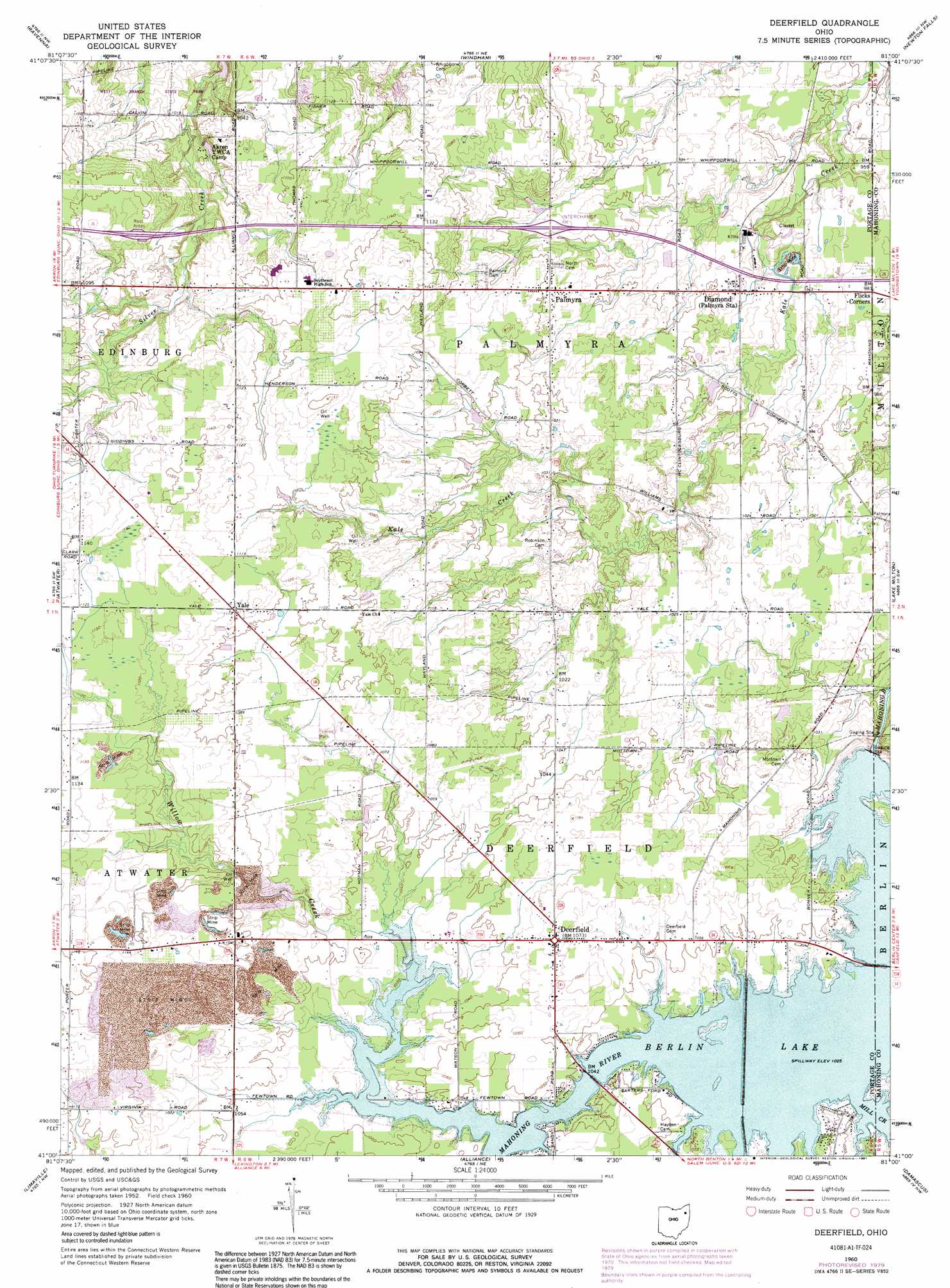
Deerfield Topo Map Ohio
To zoom in, hover over the map of Deerfield
USGS Topo Quad 41081a1 - 1:24,000 scale
| Topo Map Name: | Deerfield |
| USGS Topo Quad ID: | 41081a1 |
| Print Size: | ca. 21 1/4" wide x 27" high |
| Southeast Coordinates: | 41° N latitude / 81° W longitude |
| Map Center Coordinates: | 41.0625° N latitude / 81.0625° W longitude |
| U.S. State: | OH |
| Filename: | o41081a1.jpg |
| Download Map JPG Image: | Deerfield topo map 1:24,000 scale |
| Map Type: | Topographic |
| Topo Series: | 7.5´ |
| Map Scale: | 1:24,000 |
| Source of Map Images: | United States Geological Survey (USGS) |
| Alternate Map Versions: |
Deerfield OH 1960, updated 1961 Download PDF Buy paper map Deerfield OH 1960, updated 1971 Download PDF Buy paper map Deerfield OH 1960, updated 1979 Download PDF Buy paper map Deerfield OH 1960, updated 1991 Download PDF Buy paper map Deerfield OH 1994, updated 1997 Download PDF Buy paper map Deerfield OH 2010 Download PDF Buy paper map Deerfield OH 2013 Download PDF Buy paper map Deerfield OH 2016 Download PDF Buy paper map |
1:24,000 Topo Quads surrounding Deerfield
Aurora |
Mantua |
Garrettsville |
Southington |
Champion |
Kent |
Ravenna |
Windham |
Newton Falls |
Warren |
Suffield |
Atwater |
Deerfield |
Lake Milton |
Canfield |
Hartville |
Limaville |
Alliance |
Damascus |
Salem |
Canton East |
Robertsville |
Homeworth |
Hanoverton |
Lisbon |
> Back to 41081a1 at 1:100,000 scale
> Back to 41080a1 at 1:250,000 scale
> Back to U.S. Topo Maps home
Deerfield topo map: Gazetteer
Deerfield: Crossings
Interchange 48 elevation 311m 1020′Deerfield: Dams
Berlin Dam elevation 295m 967′Deerfield: Populated Places
All Seasons Lake Park elevation 328m 1076′Bloody Corners elevation 335m 1099′
Davis elevation 301m 987′
Deerfield elevation 328m 1076′
Diamond elevation 302m 990′
Flicks Corners elevation 300m 984′
Hutson (historical) elevation 317m 1040′
Keans (historical) elevation 311m 1020′
Lloyd elevation 312m 1023′
Palmyra elevation 317m 1040′
Yale elevation 338m 1108′
Deerfield: Post Offices
Deerfield Post Office elevation 328m 1076′Diamond Post Office elevation 302m 990′
Lloyd Post Office (historical) elevation 312m 1023′
Palmyra Post Office (historical) elevation 316m 1036′
Yale Post Office (historical) elevation 338m 1108′
Deerfield: Reservoirs
Berlin Lake elevation 295m 967′Deerfield: Streams
Mill Creek elevation 313m 1026′Silver Creek elevation 305m 1000′
Willow Creek elevation 314m 1030′
Deerfield digital topo map on disk
Buy this Deerfield topo map showing relief, roads, GPS coordinates and other geographical features, as a high-resolution digital map file on DVD:
 map DVD")