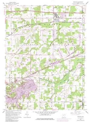
Windham Topo Map Ohio
To zoom in, hover over the map of Windham
USGS Topo Quad 41081b1 - 1:24,000 scale
| Topo Map Name: | Windham |
| USGS Topo Quad ID: | 41081b1 |
| Print Size: | ca. 21 1/4" wide x 27" high |
| Southeast Coordinates: | 41.125° N latitude / 81° W longitude |
| Map Center Coordinates: | 41.1875° N latitude / 81.0625° W longitude |
| U.S. State: | OH |
| Filename: | o41081b1.jpg |
| Download Map JPG Image: | Windham topo map 1:24,000 scale |
| Map Type: | Topographic |
| Topo Series: | 7.5´ |
| Map Scale: | 1:24,000 |
| Source of Map Images: | United States Geological Survey (USGS) |
| Alternate Map Versions: |
Windham OH 1959, updated 1961 Download PDF Buy paper map Windham OH 1959, updated 1971 Download PDF Buy paper map Windham OH 1959, updated 1980 Download PDF Buy paper map Windham OH 1994, updated 1997 Download PDF Buy paper map Windham OH 2010 Download PDF Buy paper map Windham OH 2013 Download PDF Buy paper map Windham OH 2016 Download PDF Buy paper map |
1:24,000 Topo Quads surrounding Windham
> Back to 41081a1 at 1:100,000 scale
> Back to 41080a1 at 1:250,000 scale
> Back to U.S. Topo Maps home
Windham topo map: Gazetteer
Windham: Airports
Bossow Airport elevation 330m 1082′Dunn Field elevation 291m 954′
Windham: Bays
Silver Creek Bay elevation 296m 971′Windham: Dams
Michael J Kirwan Dam elevation 291m 954′Windham: Islands
Hickory Island elevation 300m 984′Windham: Lakes
Marys Lake elevation 292m 958′Windham: Parks
West Branch State Park elevation 299m 980′Windham: Populated Places
East Davis (historical) elevation 293m 961′Greenleafs Corners (historical) elevation 327m 1072′
Harrisport (historical) elevation 281m 921′
McClintocksburg elevation 286m 938′
Paris elevation 298m 977′
Pritchard elevation 289m 948′
Purdys Trailer Park elevation 295m 967′
Wayland elevation 289m 948′
Windham elevation 296m 971′
Windham: Post Offices
Pritchard Post Office (historical) elevation 289m 948′Wayland Post Office elevation 289m 948′
Windham: Reservoirs
Michael J Kirwan Reservoir elevation 291m 954′Windham: Streams
Sand Creek elevation 283m 928′Windham digital topo map on disk
Buy this Windham topo map showing relief, roads, GPS coordinates and other geographical features, as a high-resolution digital map file on DVD:


