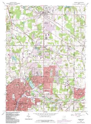
Hudson Topo Map Ohio
To zoom in, hover over the map of Hudson
USGS Topo Quad 41081b4 - 1:24,000 scale
| Topo Map Name: | Hudson |
| USGS Topo Quad ID: | 41081b4 |
| Print Size: | ca. 21 1/4" wide x 27" high |
| Southeast Coordinates: | 41.125° N latitude / 81.375° W longitude |
| Map Center Coordinates: | 41.1875° N latitude / 81.4375° W longitude |
| U.S. State: | OH |
| Filename: | o41081b4.jpg |
| Download Map JPG Image: | Hudson topo map 1:24,000 scale |
| Map Type: | Topographic |
| Topo Series: | 7.5´ |
| Map Scale: | 1:24,000 |
| Source of Map Images: | United States Geological Survey (USGS) |
| Alternate Map Versions: |
Hudson OH 1953, updated 1955 Download PDF Buy paper map Hudson OH 1963, updated 1964 Download PDF Buy paper map Hudson OH 1963, updated 1971 Download PDF Buy paper map Hudson OH 1963, updated 1980 Download PDF Buy paper map Hudson OH 1963, updated 1985 Download PDF Buy paper map Hudson OH 1994, updated 2000 Download PDF Buy paper map Hudson OH 2010 Download PDF Buy paper map Hudson OH 2013 Download PDF Buy paper map Hudson OH 2016 Download PDF Buy paper map |
1:24,000 Topo Quads surrounding Hudson
> Back to 41081a1 at 1:100,000 scale
> Back to 41080a1 at 1:250,000 scale
> Back to U.S. Topo Maps home
Hudson topo map: Gazetteer
Hudson: Airports
Blades Landing Heliport elevation 337m 1105′Kent State University Airport elevation 340m 1115′
ODOT District 4 Summit Co Heliport elevation 315m 1033′
Hudson: Dams
Cuyahoga Falls Low Head Dam elevation 307m 1007′Meadowbrook Lake Dam elevation 307m 1007′
Pine Lake Dam elevation 311m 1020′
The Meadows Retention Dam elevation 310m 1017′
Hudson: Lakes
Crystal Lake elevation 302m 990′Lake Forest elevation 303m 994′
Mud Lake elevation 302m 990′
Park Lake elevation 318m 1043′
Silver Lake elevation 301m 987′
Silver Springs Lake elevation 320m 1049′
Sobczak Lake elevation 310m 1017′
Wyoga Lake elevation 297m 974′
Hudson: Parks
Adell Durbin Park elevation 332m 1089′Cascade Park elevation 329m 1079′
Crestdale Park elevation 334m 1095′
Crystal Lake Park elevation 311m 1020′
Damon Park elevation 304m 997′
Galt Park elevation 314m 1030′
Guise Park elevation 316m 1036′
Harrington Field elevation 321m 1053′
Heather Hills Park elevation 336m 1102′
Hudson Historic District elevation 326m 1069′
Indian Mount Park elevation 343m 1125′
Kennedy Park elevation 308m 1010′
Lavelli Field elevation 336m 1102′
Lease Park elevation 317m 1040′
Linden Park elevation 308m 1010′
Lions Park elevation 315m 1033′
Meadowbrook Lake Park elevation 311m 1020′
Monroe Falls Metropolitan Park elevation 327m 1072′
Northport Park elevation 344m 1128′
Oak Park elevation 314m 1030′
Oregon Trail Park elevation 332m 1089′
Partridge Park elevation 341m 1118′
Riverside Park elevation 309m 1013′
Ross Park elevation 311m 1020′
Sherwood Acres Park elevation 347m 1138′
Silver Springs Park elevation 328m 1076′
Trails End Park elevation 331m 1085′
Waterworks Park elevation 304m 997′
Wetmore Park elevation 321m 1053′
Yocavona Park elevation 313m 1026′
Hudson: Populated Places
Chittendens Corners elevation 305m 1000′Cuyahoga Falls elevation 312m 1023′
Darrowville elevation 326m 1069′
Fish Creek elevation 323m 1059′
Hudson elevation 325m 1066′
Metz elevation 319m 1046′
Midway Trailer Court elevation 313m 1026′
Munroe Falls elevation 314m 1030′
Oregon Corners elevation 324m 1062′
Silver Lake elevation 321m 1053′
Stow elevation 333m 1092′
Stow Mobile Home Village elevation 338m 1108′
Hudson: Post Offices
Cuyahoga Falls Post Office elevation 312m 1023′Cuyahoga Falls Post Office elevation 316m 1036′
Darrowville Post Office (historical) elevation 326m 1069′
Hudson Post Office elevation 326m 1069′
Hudson Post Office elevation 325m 1066′
Metz Post Office (historical) elevation 318m 1043′
Munroe Falls Post Office elevation 312m 1023′
Munroe Falls Post Office elevation 321m 1053′
Stow Post Office (historical) elevation 332m 1089′
Stowe Post Office elevation 347m 1138′
Hudson: Reservoirs
Cuyahoga Falls Low Head Reservoir elevation 307m 1007′Darrow Lake elevation 320m 1049′
Heritage Lake elevation 331m 1085′
Meadowbrook Lake elevation 307m 1007′
Pine Lake elevation 311m 1020′
The Meadows Retention Pond elevation 310m 1017′
Hudson: Streams
Fish Creek elevation 306m 1003′Kelsey Brook elevation 303m 994′
Powers Brook elevation 301m 987′
Stefans Run elevation 301m 987′
Walnut Creek elevation 304m 997′
Hudson: Swamps
Pine Swamp (historical) elevation 303m 994′Hudson digital topo map on disk
Buy this Hudson topo map showing relief, roads, GPS coordinates and other geographical features, as a high-resolution digital map file on DVD:


