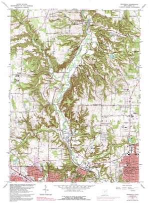
Peninsula Topo Map Ohio
To zoom in, hover over the map of Peninsula
USGS Topo Quad 41081b5 - 1:24,000 scale
| Topo Map Name: | Peninsula |
| USGS Topo Quad ID: | 41081b5 |
| Print Size: | ca. 21 1/4" wide x 27" high |
| Southeast Coordinates: | 41.125° N latitude / 81.5° W longitude |
| Map Center Coordinates: | 41.1875° N latitude / 81.5625° W longitude |
| U.S. State: | OH |
| Filename: | o41081b5.jpg |
| Download Map JPG Image: | Peninsula topo map 1:24,000 scale |
| Map Type: | Topographic |
| Topo Series: | 7.5´ |
| Map Scale: | 1:24,000 |
| Source of Map Images: | United States Geological Survey (USGS) |
| Alternate Map Versions: |
Peninsula OH 1953, updated 1955 Download PDF Buy paper map Peninsula OH 1963, updated 1965 Download PDF Buy paper map Peninsula OH 1963, updated 1967 Download PDF Buy paper map Peninsula OH 1963, updated 1979 Download PDF Buy paper map Peninsula OH 1963, updated 1992 Download PDF Buy paper map Peninsula OH 1963, updated 1992 Download PDF Buy paper map Peninsula OH 1994, updated 1997 Download PDF Buy paper map Peninsula OH 2010 Download PDF Buy paper map Peninsula OH 2013 Download PDF Buy paper map Peninsula OH 2016 Download PDF Buy paper map |
1:24,000 Topo Quads surrounding Peninsula
> Back to 41081a1 at 1:100,000 scale
> Back to 41080a1 at 1:250,000 scale
> Back to U.S. Topo Maps home
Peninsula topo map: Gazetteer
Peninsula: Airports
Old Portage Heliport elevation 229m 751′Peninsula: Benches
Boston Ledges elevation 267m 875′Ritchie Ledges elevation 277m 908′
Peninsula: Bridges
Everett Road Bridge elevation 225m 738′Furnace Run Aqueduct elevation 219m 718′
Peninsula: Crossings
Interchange 12 elevation 334m 1095′Peninsula: Dams
Bell Lake Dam elevation 283m 928′Camp Butler Lake Dam elevation 255m 836′
Deep Lock (historical) elevation 266m 872′
Lake Litchfield Dam elevation 248m 813′
Pancake Lock (historical) elevation 219m 718′
Saalfield Pond Dam Number One elevation 274m 898′
Virginia Kendall Park Lake Dam elevation 246m 807′
Peninsula: Lakes
Indigo Lake elevation 236m 774′Kool Lake elevation 279m 915′
Peninsula: Parks
Ascot Park elevation 305m 1000′Babb Run Park elevation 267m 875′
Croghan Park elevation 296m 971′
Cuyahoga Valley National Park elevation 210m 688′
Newberry Park elevation 306m 1003′
Peninsula Village Historic District elevation 236m 774′
Sand Run Metropolitan Park elevation 245m 803′
Tamsin Park elevation 295m 967′
Valley Vista Park elevation 306m 1003′
Virginia Kendall Park elevation 320m 1049′
Wood Park elevation 294m 964′
Peninsula: Populated Places
Botzum elevation 230m 754′Cranmer elevation 234m 767′
East Steels Corners elevation 326m 1069′
Everett elevation 222m 728′
Fairlawn elevation 308m 1010′
Indian Springs Mobile Home Park elevation 221m 725′
Ira elevation 225m 738′
Iron Bridge (historical) elevation 299m 980′
Northampton Center elevation 304m 997′
Oak Leaf Mobile Home Park elevation 323m 1059′
Peninsula elevation 230m 754′
West Steels Corners elevation 304m 997′
Peninsula: Post Offices
Botzum Post Office (historical) elevation 227m 744′Cranmer Post Office (historical) elevation 233m 764′
Everett Post Office (historical) elevation 221m 725′
Fairlawn Post Office (historical) elevation 306m 1003′
Ira Post Office (historical) elevation 226m 741′
Peninsula Post Office elevation 229m 751′
Peninsula: Reservoirs
Bell Lake elevation 283m 928′Camp Butler Lake elevation 255m 836′
Kendall Lake elevation 245m 803′
Lake Litchfield elevation 248m 813′
Old Mill Pond elevation 293m 961′
Saalfield Pond Number One elevation 274m 898′
Vesper Lake elevation 298m 977′
Virginia Kendall Park Lake elevation 246m 807′
Peninsula: Streams
Boston Run elevation 206m 675′Dickerson Run elevation 213m 698′
Furnace Run elevation 216m 708′
Haskell Run elevation 210m 688′
Joeys Run elevation 289m 948′
Langes Run elevation 213m 698′
Mud Brook elevation 225m 738′
Riding Run elevation 237m 777′
Ritchie Run elevation 213m 698′
Robinson Run elevation 216m 708′
Salt Run elevation 211m 692′
Sand Run elevation 225m 738′
Slipper Run elevation 210m 688′
Woodward Creek elevation 222m 728′
Yellow Creek elevation 222m 728′
Peninsula digital topo map on disk
Buy this Peninsula topo map showing relief, roads, GPS coordinates and other geographical features, as a high-resolution digital map file on DVD:


