Middlefield Topo Map Ohio
To zoom in, hover over the map of Middlefield
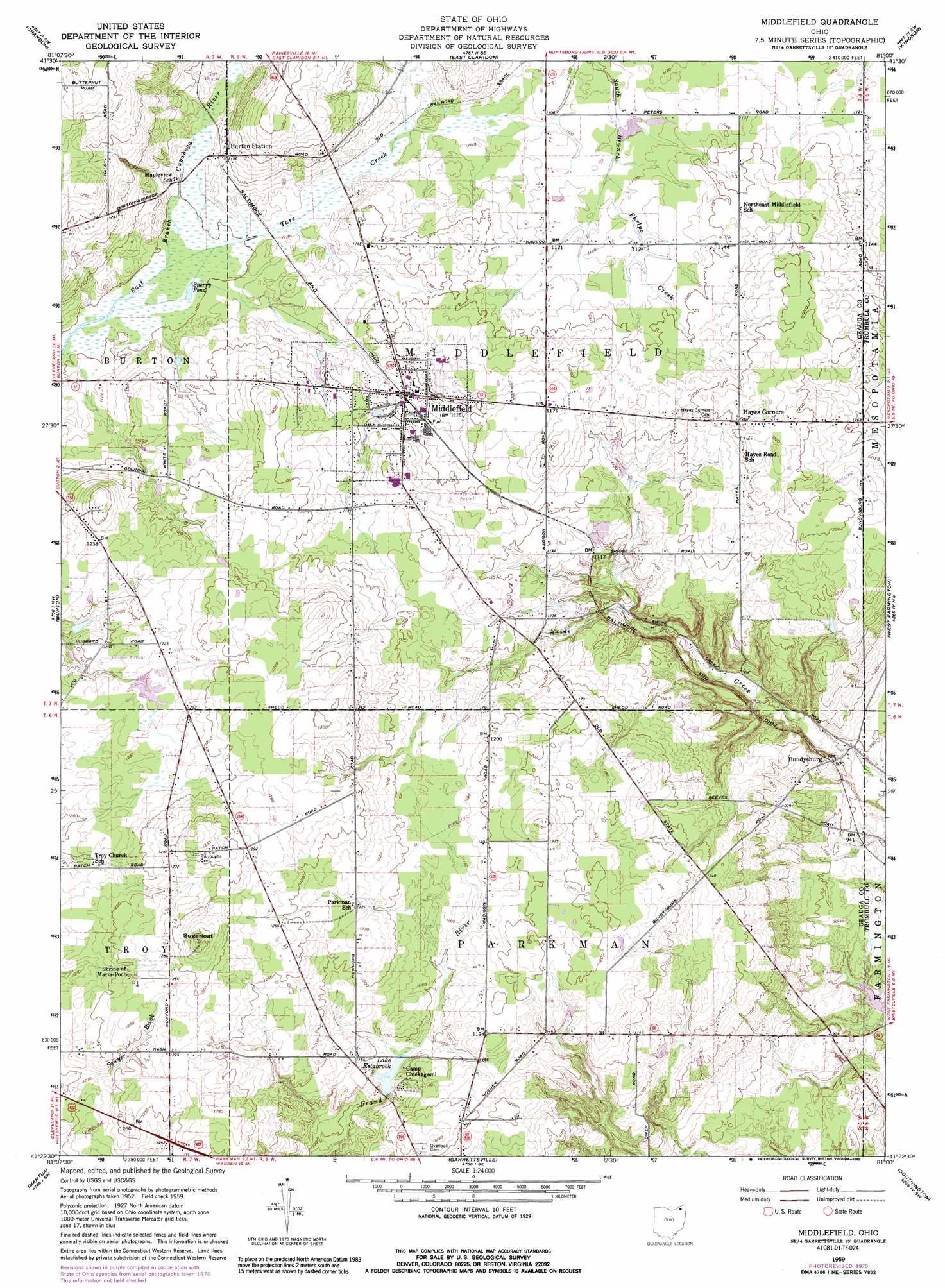
USGS Topo Quad 41081d1 - 1:24,000 scale
| Topo Map Name: | Middlefield |
| USGS Topo Quad ID: | 41081d1 |
| Print Size: | ca. 21 1/4" wide x 27" high |
| Southeast Coordinates: | 41.375° N latitude / 81° W longitude |
| Map Center Coordinates: | 41.4375° N latitude / 81.0625° W longitude |
| U.S. State: | OH |
| Filename: | o41081d1.jpg |
| Download Map JPG Image: | Middlefield topo map 1:24,000 scale |
| Map Type: | Topographic |
| Topo Series: | 7.5´ |
| Map Scale: | 1:24,000 |
| Source of Map Images: | United States Geological Survey (USGS) |
| Alternate Map Versions: |
Middlefield OH 1959, updated 1961 Download PDF Buy paper map Middlefield OH 1959, updated 1971 Download PDF Buy paper map Middlefield OH 1959, updated 1989 Download PDF Buy paper map Middlefield OH 1994, updated 1997 Download PDF Buy paper map Middlefield OH 2010 Download PDF Buy paper map Middlefield OH 2013 Download PDF Buy paper map Middlefield OH 2016 Download PDF Buy paper map |
1:24,000 Topo Quads surrounding Middlefield
Mentor |
Painesville |
Thompson |
East Trumbull |
Jefferson |
Chesterland |
Chardon |
East Claridon |
Windsor |
Orwell |
South Russell |
Burton |
Middlefield |
West Farmington |
Bristolville |
Aurora |
Mantua |
Garrettsville |
Southington |
Champion |
Kent |
Ravenna |
Windham |
Newton Falls |
Warren |
> Back to 41081a1 at 1:100,000 scale
> Back to 41080a1 at 1:250,000 scale
> Back to U.S. Topo Maps home
Middlefield topo map: Gazetteer
Middlefield: Airports
Airwolf Heliport elevation 352m 1154′Geauga County Airport elevation 352m 1154′
Harrington Square Heliport elevation 351m 1151′
Hosmer Airfield elevation 372m 1220′
Pauls Airport elevation 359m 1177′
Middlefield: Dams
Larry Peairs Memorial Lake Dam elevation 345m 1131′Middlefield: Lakes
Lake Estabrook elevation 342m 1122′Sperry Pond elevation 333m 1092′
Middlefield: Populated Places
Bundysburg elevation 298m 977′Burton Station elevation 346m 1135′
Hayes Corners elevation 365m 1197′
Maple Grove elevation 395m 1295′
Middlefield elevation 343m 1125′
Middlefield: Post Offices
Bundysburg Post Office (historical) elevation 298m 977′Burton Station Post Office (historical) elevation 348m 1141′
Middlefield Post Office elevation 359m 1177′
Middlfield Post Office elevation 343m 1125′
Welshfield Post Office (historical) elevation 360m 1181′
Middlefield: Reservoirs
Larry Peairs Memorial Lake elevation 345m 1131′Middlefield: Streams
Tare Creek elevation 332m 1089′Middlefield: Summits
Sugarloaf elevation 423m 1387′Middlefield digital topo map on disk
Buy this Middlefield topo map showing relief, roads, GPS coordinates and other geographical features, as a high-resolution digital map file on DVD:
 map DVD")