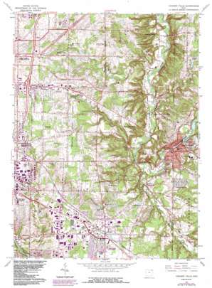
Chagrin Falls Topo Map Ohio
To zoom in, hover over the map of Chagrin Falls
USGS Topo Quad 41081d4 - 1:24,000 scale
| Topo Map Name: | Chagrin Falls |
| USGS Topo Quad ID: | 41081d4 |
| Print Size: | ca. 21 1/4" wide x 27" high |
| Southeast Coordinates: | 41.375° N latitude / 81.375° W longitude |
| Map Center Coordinates: | 41.4375° N latitude / 81.4375° W longitude |
| U.S. State: | OH |
| Filename: | o41081d4.jpg |
| Download Map JPG Image: | Chagrin Falls topo map 1:24,000 scale |
| Map Type: | Topographic |
| Topo Series: | 7.5´ |
| Map Scale: | 1:24,000 |
| Source of Map Images: | United States Geological Survey (USGS) |
| Alternate Map Versions: |
Chagrin Falls OH 1953, updated 1955 Download PDF Buy paper map Chagrin Falls OH 1963, updated 1964 Download PDF Buy paper map Chagrin Falls OH 1963, updated 1971 Download PDF Buy paper map Chagrin Falls OH 1963, updated 1980 Download PDF Buy paper map Chagrin Falls OH 1963, updated 1980 Download PDF Buy paper map Chagrin Falls OH 1963, updated 1984 Download PDF Buy paper map Chagrin Falls OH 1963, updated 1984 Download PDF Buy paper map Chagrin Falls OH 1994, updated 2000 Download PDF Buy paper map Chagrin Falls OH 2010 Download PDF Buy paper map Chagrin Falls OH 2013 Download PDF Buy paper map Chagrin Falls OH 2016 Download PDF Buy paper map |
1:24,000 Topo Quads surrounding Chagrin Falls
> Back to 41081a1 at 1:100,000 scale
> Back to 41080a1 at 1:250,000 scale
> Back to U.S. Topo Maps home
Chagrin Falls topo map: Gazetteer
Chagrin Falls: Airports
Golf Course Heliport elevation 352m 1154′Harper Ridge Airport elevation 367m 1204′
Ingalls Airport elevation 230m 754′
Jackson Road Heliport elevation 327m 1072′
Joy Plant Heliport elevation 326m 1069′
Som Jackson Heliport elevation 325m 1066′
V J S Heliport elevation 324m 1062′
Chagrin Falls: Crossings
Interchange 28 elevation 349m 1145′Interchange 29 elevation 365m 1197′
Chagrin Falls: Dams
Chase Bag Company Lower Lake Dam elevation 285m 935′Chase Bag Company Upper Lake Dam elevation 293m 961′
Ohnoname 16 Dam elevation 289m 948′
Chagrin Falls: Falls
Chagrin Falls elevation 274m 898′Chagrin Falls: Flats
Jackson Field elevation 247m 810′Chagrin Falls: Lakes
Meadow Lake elevation 321m 1053′Millpond elevation 287m 941′
Neptune Lake elevation 354m 1161′
Chagrin Falls: Parks
Bedford Chagrin Parkway elevation 368m 1207′Chagrin Falls Triangle Park Commercial Historic District elevation 280m 918′
Chagrin Falls West Side Historic District elevation 277m 908′
Chagrin State Scenic River elevation 234m 767′
Chagrin Valley Parkway elevation 244m 800′
Mother of Perpetual Help Shrine elevation 374m 1227′
Riverside Park elevation 283m 928′
Solon Community Park elevation 314m 1030′
South Chagrin Reservation elevation 305m 1000′
Chagrin Falls: Populated Places
Bentleyville elevation 285m 935′Chagrin Falls elevation 306m 1003′
Chagrin Falls Park elevation 297m 974′
Cowans (historical) elevation 287m 941′
Evergreen Manor elevation 322m 1056′
Hunting Valley elevation 233m 764′
Moreland Hills elevation 317m 1040′
North Solon elevation 337m 1105′
Orange elevation 353m 1158′
Orange Center elevation 303m 994′
Pepper Pike elevation 323m 1059′
Solon elevation 317m 1040′
Woodmere elevation 357m 1171′
Chagrin Falls: Post Offices
Chagrin Falls Post Office elevation 278m 912′Orange Post Office (historical) elevation 353m 1158′
Solon Post Office (historical) elevation 317m 1040′
Chagrin Falls: Reservoirs
Briar Hill Lake elevation 333m 1092′Chase Bag Company Lower Lake elevation 285m 935′
Chase Bag Company Upper Lake elevation 293m 961′
Lake Elissa elevation 318m 1043′
Ohnoname 16 Reservoir elevation 289m 948′
Chagrin Falls: Streams
Aurora Branch elevation 251m 823′Griswold Creek elevation 237m 777′
McFarland Creek elevation 274m 898′
Willey Creek elevation 245m 803′
Chagrin Falls: Summits
Orange Hill elevation 360m 1181′Chagrin Falls digital topo map on disk
Buy this Chagrin Falls topo map showing relief, roads, GPS coordinates and other geographical features, as a high-resolution digital map file on DVD:


