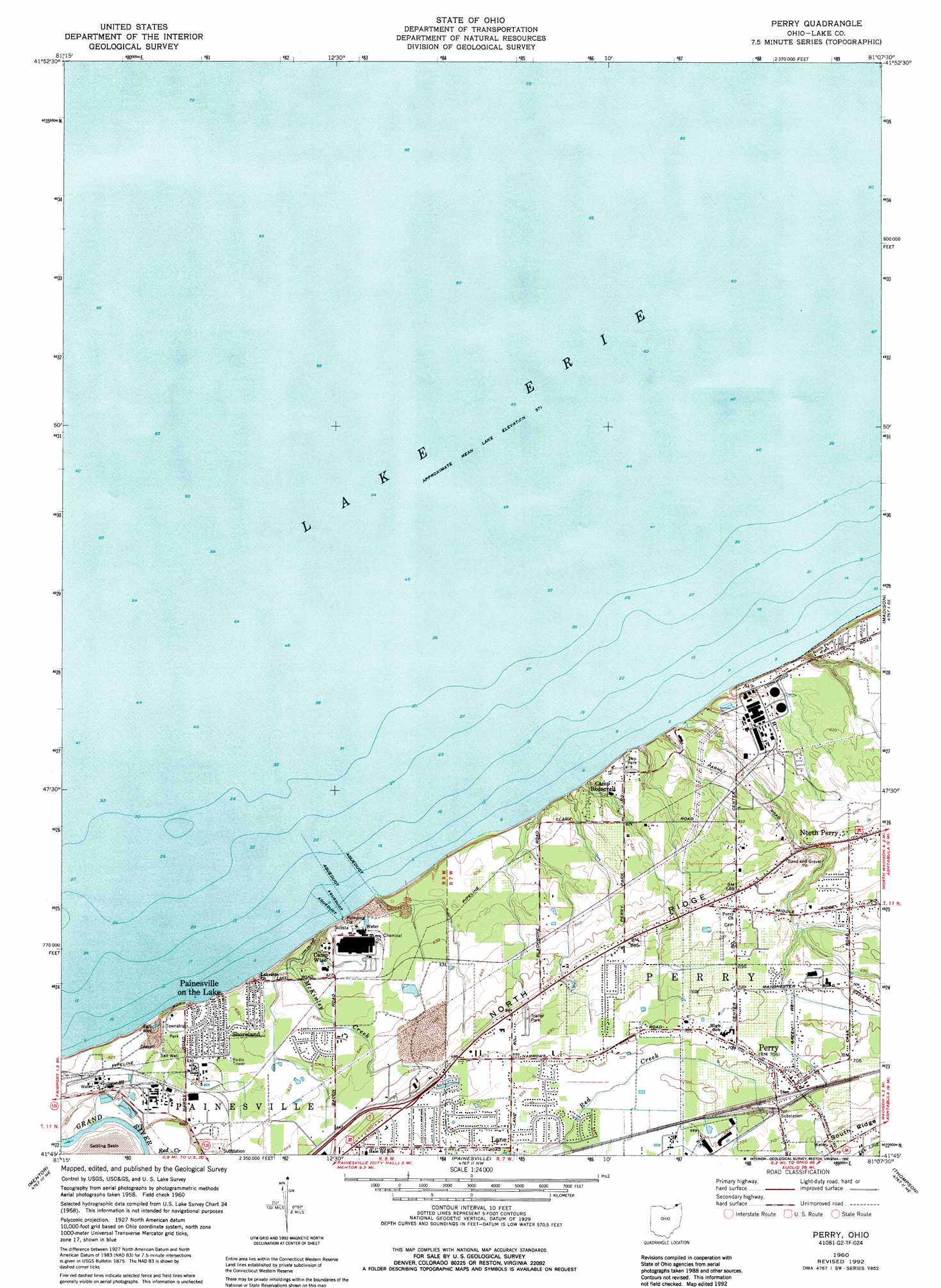
Perry Topo Map Ohio
To zoom in, hover over the map of Perry
USGS Topo Quad 41081g2 - 1:24,000 scale
| Topo Map Name: | Perry |
| USGS Topo Quad ID: | 41081g2 |
| Print Size: | ca. 21 1/4" wide x 27" high |
| Southeast Coordinates: | 41.75° N latitude / 81.125° W longitude |
| Map Center Coordinates: | 41.8125° N latitude / 81.1875° W longitude |
| U.S. State: | OH |
| Filename: | o41081g2.jpg |
| Download Map JPG Image: | Perry topo map 1:24,000 scale |
| Map Type: | Topographic |
| Topo Series: | 7.5´ |
| Map Scale: | 1:24,000 |
| Source of Map Images: | United States Geological Survey (USGS) |
| Alternate Map Versions: |
Perry OH 1960, updated 1961 Download PDF Buy paper map Perry OH 1960, updated 1971 Download PDF Buy paper map Perry OH 1960, updated 1979 Download PDF Buy paper map Perry OH 1960, updated 1992 Download PDF Buy paper map Perry OH 1994, updated 1997 Download PDF Buy paper map Perry OH 2010 Download PDF Buy paper map Perry OH 2013 Download PDF Buy paper map Perry OH 2016 Download PDF Buy paper map |
1:24,000 Topo Quads surrounding Perry
Perry |
Madison |
Geneva |
||
Eastlake |
Mentor |
Painesville |
Thompson |
East Trumbull |
Mayfield Heights |
Chesterland |
Chardon |
East Claridon |
Windsor |
> Back to 41081e1 at 1:100,000 scale
> Back to 41080a1 at 1:250,000 scale
> Back to U.S. Topo Maps home
Perry topo map: Gazetteer
Perry: Airports
Blackacre Farm Airport elevation 195m 639′Perry Nuclear Power Plant Heliport elevation 186m 610′
Perry: Parks
North Perry Park elevation 191m 626′Painesville Township Park elevation 192m 629′
Parmly Park elevation 187m 613′
Perry Township Park elevation 188m 616′
Township Park elevation 193m 633′
Township Park elevation 189m 620′
Perry: Populated Places
Buena Vista Beach elevation 191m 626′Camp Roosevelt elevation 184m 603′
Golfway Pines elevation 196m 643′
Lane elevation 209m 685′
North Perry elevation 208m 682′
Painesville on-the-Lake elevation 192m 629′
Perry elevation 213m 698′
Perry Mobile Homes elevation 210m 688′
Shoreland elevation 192m 629′
Perry: Post Offices
Lane Post Office (historical) elevation 210m 688′North Perry Post Office (historical) elevation 208m 682′
Perry Post Office elevation 213m 698′
Perry: Streams
McKinley Creek elevation 174m 570′Perry digital topo map on disk
Buy this Perry topo map showing relief, roads, GPS coordinates and other geographical features, as a high-resolution digital map file on DVD:
 map DVD")