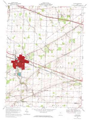
Clyde Topo Map Ohio
To zoom in, hover over the map of Clyde
USGS Topo Quad 41082c8 - 1:24,000 scale
| Topo Map Name: | Clyde |
| USGS Topo Quad ID: | 41082c8 |
| Print Size: | ca. 21 1/4" wide x 27" high |
| Southeast Coordinates: | 41.25° N latitude / 82.875° W longitude |
| Map Center Coordinates: | 41.3125° N latitude / 82.9375° W longitude |
| U.S. State: | OH |
| Filename: | o41082c8.jpg |
| Download Map JPG Image: | Clyde topo map 1:24,000 scale |
| Map Type: | Topographic |
| Topo Series: | 7.5´ |
| Map Scale: | 1:24,000 |
| Source of Map Images: | United States Geological Survey (USGS) |
| Alternate Map Versions: |
Clyde OH 1959, updated 1960 Download PDF Buy paper map Clyde OH 1969, updated 1971 Download PDF Buy paper map Clyde OH 1969, updated 1971 Download PDF Buy paper map Clyde OH 2010 Download PDF Buy paper map Clyde OH 2013 Download PDF Buy paper map Clyde OH 2016 Download PDF Buy paper map |
1:24,000 Topo Quads surrounding Clyde
> Back to 41082a1 at 1:100,000 scale
> Back to 41082a1 at 1:250,000 scale
> Back to U.S. Topo Maps home
Clyde topo map: Gazetteer
Clyde: Dams
Raccoon Creek Upground Reservoir Dam elevation 216m 708′Clyde: Parks
Cherry Street Park elevation 212m 695′Limerick Park elevation 215m 705′
Clyde: Populated Places
Clyde elevation 212m 695′Colby elevation 238m 780′
Galetown elevation 223m 731′
Mount Carmel elevation 238m 780′
Wales Corners elevation 223m 731′
York elevation 197m 646′
Clyde: Post Offices
Clyde Post Office elevation 212m 695′Colby Post Office (historical) elevation 238m 780′
York Post Office (historical) elevation 197m 646′
Clyde: Reservoirs
Raccoon Creek Reservoir elevation 219m 718′Raccoon Creek Upground Reservoir elevation 216m 708′
Clyde: Streams
Buck Creek elevation 191m 626′Sucker Run Creek elevation 205m 672′
Clyde digital topo map on disk
Buy this Clyde topo map showing relief, roads, GPS coordinates and other geographical features, as a high-resolution digital map file on DVD:


