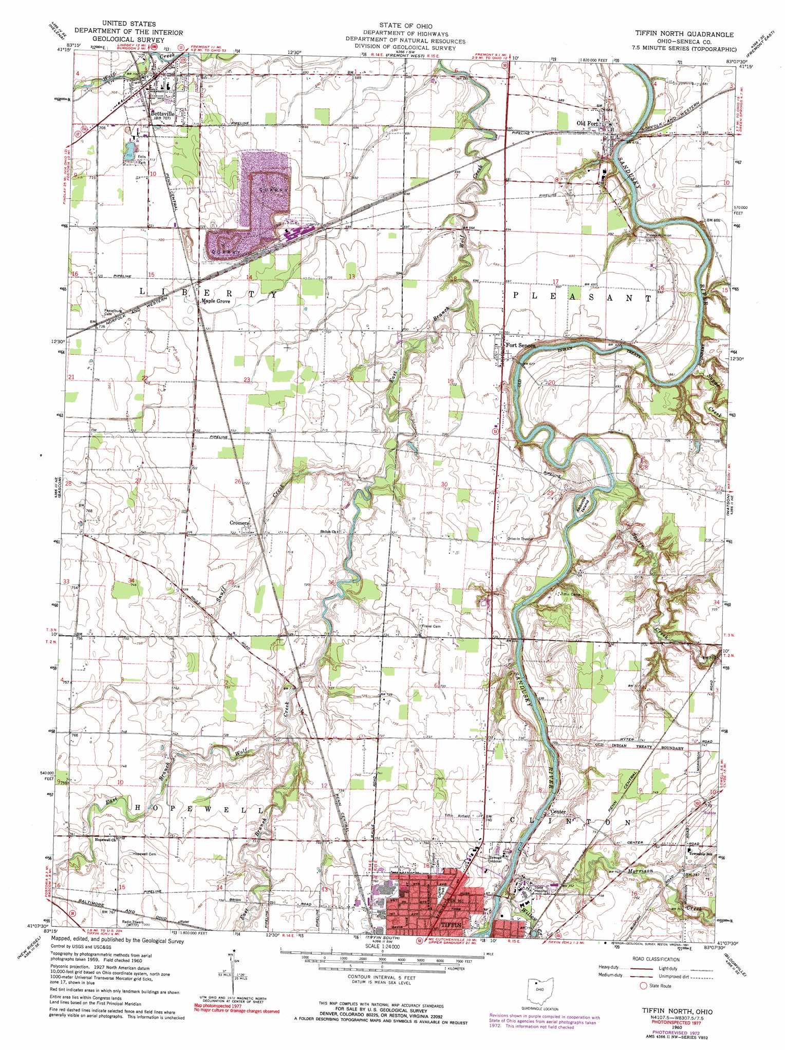
Tiffin North Topo Map Ohio
To zoom in, hover over the map of Tiffin North
USGS Topo Quad 41083b2 - 1:24,000 scale
| Topo Map Name: | Tiffin North |
| USGS Topo Quad ID: | 41083b2 |
| Print Size: | ca. 21 1/4" wide x 27" high |
| Southeast Coordinates: | 41.125° N latitude / 83.125° W longitude |
| Map Center Coordinates: | 41.1875° N latitude / 83.1875° W longitude |
| U.S. State: | OH |
| Filename: | o41083b2.jpg |
| Download Map JPG Image: | Tiffin North topo map 1:24,000 scale |
| Map Type: | Topographic |
| Topo Series: | 7.5´ |
| Map Scale: | 1:24,000 |
| Source of Map Images: | United States Geological Survey (USGS) |
| Alternate Map Versions: |
Tiffin North OH 1960, updated 1962 Download PDF Buy paper map Tiffin North OH 1960, updated 1973 Download PDF Buy paper map Tiffin North OH 1960, updated 1991 Download PDF Buy paper map Tiffin North OH 2010 Download PDF Buy paper map Tiffin North OH 2013 Download PDF Buy paper map Tiffin North OH 2016 Download PDF Buy paper map |
1:24,000 Topo Quads surrounding Tiffin North
Pemberville |
Elmore |
Lindsey |
Wightmans Grove |
Vickery |
Bradner |
Helena |
Fremont West |
Fremont East |
Clyde |
Fostoria |
Bascom |
Tiffin North |
Watson |
Fireside |
Alvada |
New Riegel |
Tiffin South |
Bloomville |
Attica |
Carey |
Mccutchenville |
Sycamore |
Lykens |
Chatfield |
> Back to 41083a1 at 1:100,000 scale
> Back to 41082a1 at 1:250,000 scale
> Back to U.S. Topo Maps home
Tiffin North topo map: Gazetteer
Tiffin North: Airports
Tiffin Airport elevation 225m 738′Tiffin North: Bridges
Abbots Bridge elevation 197m 646′Fort Seneca Bridge elevation 198m 649′
Tiffin North: Canals
Crum Ditch elevation 224m 734′Tiffin North: Islands
Abbotts Island elevation 204m 669′Tiffin North: Parks
Eells Park elevation 215m 705′Nature Trails Park elevation 220m 721′
Oakley Park elevation 233m 764′
Tiffin North: Populated Places
Bettsville elevation 213m 698′Center elevation 218m 715′
Cromers elevation 219m 718′
Fort Seneca elevation 213m 698′
Linden (historical) elevation 219m 718′
Maple Grove elevation 219m 718′
Mount Gilead elevation 226m 741′
Old Fort elevation 209m 685′
Tiffin North: Post Offices
Bettsville Post Office elevation 212m 695′Fort Seneca Post Office elevation 213m 698′
Maple Grove Post Office elevation 219m 718′
Old Fort Post Office elevation 209m 685′
Tiffin North: Streams
East Branch East Branch Wolf Creek elevation 217m 711′Morrison Creek elevation 215m 705′
Snuff Creek elevation 211m 692′
Spicer Creek elevation 201m 659′
Sugar Creek elevation 197m 646′
Willow Creek elevation 216m 708′
Tiffin North digital topo map on disk
Buy this Tiffin North topo map showing relief, roads, GPS coordinates and other geographical features, as a high-resolution digital map file on DVD:
 map DVD")