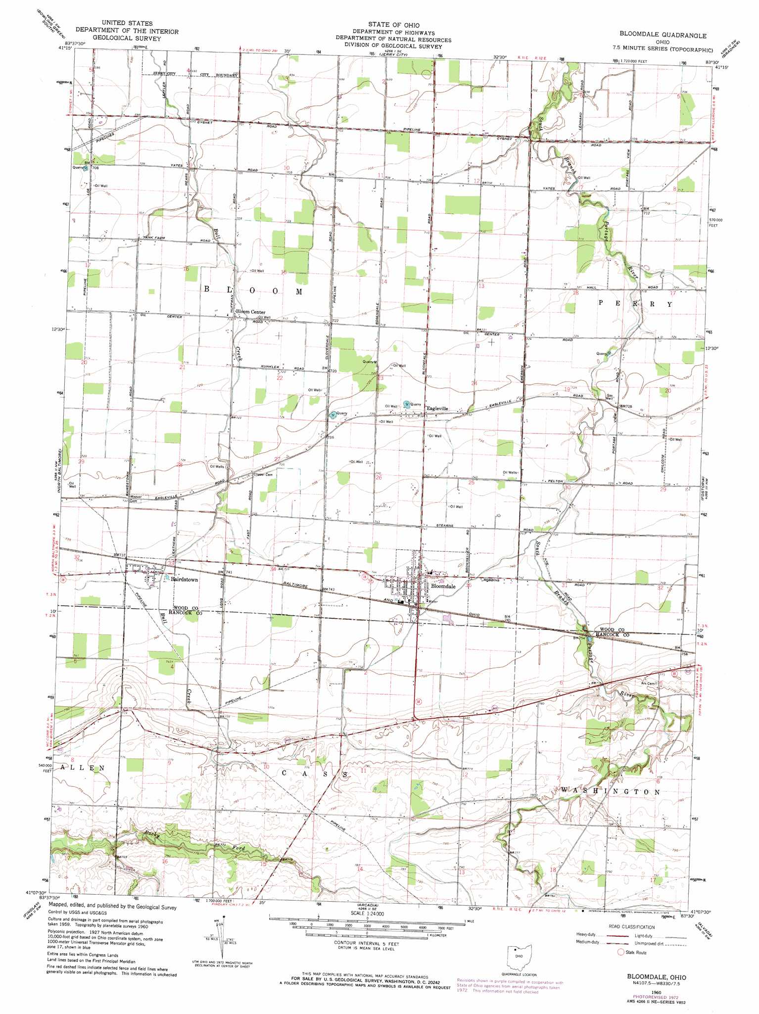
Bloomdale Topo Map Ohio
To zoom in, hover over the map of Bloomdale
USGS Topo Quad 41083b5 - 1:24,000 scale
| Topo Map Name: | Bloomdale |
| USGS Topo Quad ID: | 41083b5 |
| Print Size: | ca. 21 1/4" wide x 27" high |
| Southeast Coordinates: | 41.125° N latitude / 83.5° W longitude |
| Map Center Coordinates: | 41.1875° N latitude / 83.5625° W longitude |
| U.S. State: | OH |
| Filename: | o41083b5.jpg |
| Download Map JPG Image: | Bloomdale topo map 1:24,000 scale |
| Map Type: | Topographic |
| Topo Series: | 7.5´ |
| Map Scale: | 1:24,000 |
| Source of Map Images: | United States Geological Survey (USGS) |
| Alternate Map Versions: |
Bloomdale OH 1960, updated 1961 Download PDF Buy paper map Bloomdale OH 1960, updated 1973 Download PDF Buy paper map Bloomdale OH 2010 Download PDF Buy paper map Bloomdale OH 2013 Download PDF Buy paper map Bloomdale OH 2016 Download PDF Buy paper map |
1:24,000 Topo Quads surrounding Bloomdale
Grand Rapids |
Bowling Green North |
Dunbridge |
Pemberville |
Elmore |
Weston |
Bowling Green South |
Jerry City |
Bradner |
Helena |
Hoytville |
North Baltimore |
Bloomdale |
Fostoria |
Bascom |
Mccomb |
Findlay |
Arcadia |
Alvada |
New Riegel |
Rawson |
Arlington |
Mount Blanchard |
Carey |
Mccutchenville |
> Back to 41083a1 at 1:100,000 scale
> Back to 41082a1 at 1:250,000 scale
> Back to U.S. Topo Maps home
Bloomdale topo map: Gazetteer
Bloomdale: Airports
McArdle Airport elevation 217m 711′Bloomdale: Populated Places
Bairdstown elevation 224m 734′Bloom Center elevation 218m 715′
Bloomdale elevation 228m 748′
Eagleville elevation 224m 734′
Bloomdale: Post Offices
Bloomdale Post Office elevation 228m 748′Bloomdale digital topo map on disk
Buy this Bloomdale topo map showing relief, roads, GPS coordinates and other geographical features, as a high-resolution digital map file on DVD:
 map DVD")