Pemberville Topo Map Ohio
To zoom in, hover over the map of Pemberville
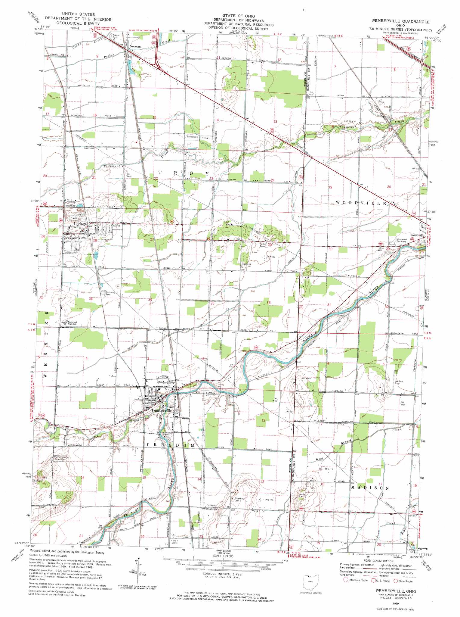
USGS Topo Quad 41083d4 - 1:24,000 scale
| Topo Map Name: | Pemberville |
| USGS Topo Quad ID: | 41083d4 |
| Print Size: | ca. 21 1/4" wide x 27" high |
| Southeast Coordinates: | 41.375° N latitude / 83.375° W longitude |
| Map Center Coordinates: | 41.4375° N latitude / 83.4375° W longitude |
| U.S. State: | OH |
| Filename: | o41083d4.jpg |
| Download Map JPG Image: | Pemberville topo map 1:24,000 scale |
| Map Type: | Topographic |
| Topo Series: | 7.5´ |
| Map Scale: | 1:24,000 |
| Source of Map Images: | United States Geological Survey (USGS) |
| Alternate Map Versions: |
Pemberville OH 1959, updated 1960 Download PDF Buy paper map Pemberville OH 1969, updated 1971 Download PDF Buy paper map Pemberville OH 1994, updated 1998 Download PDF Buy paper map Pemberville OH 2010 Download PDF Buy paper map Pemberville OH 2013 Download PDF Buy paper map Pemberville OH 2016 Download PDF Buy paper map |
1:24,000 Topo Quads surrounding Pemberville
Sylvania |
Toledo |
Oregon |
Reno Beach |
Metzger Marsh |
Maumee |
Rossford |
Walbridge |
Genoa |
Oak Harbor |
Bowling Green North |
Dunbridge |
Pemberville |
Elmore |
Lindsey |
Bowling Green South |
Jerry City |
Bradner |
Helena |
Fremont West |
North Baltimore |
Bloomdale |
Fostoria |
Bascom |
Tiffin North |
> Back to 41083a1 at 1:100,000 scale
> Back to 41082a1 at 1:250,000 scale
> Back to U.S. Topo Maps home
Pemberville topo map: Gazetteer
Pemberville: Airports
Hiview Airport elevation 198m 649′Pemberville: Canals
Foos Ditch elevation 201m 659′Martin Ditch elevation 196m 643′
Pemberville: Mines
Luckey Quarry elevation 195m 639′Pemberville: Parks
William Henry Harrison Park elevation 198m 649′Pemberville: Populated Places
Laffertys Trailer Court elevation 194m 636′Lemoyne elevation 196m 643′
Luckey elevation 203m 666′
Pemberville elevation 198m 649′
Tousaint (historical) elevation 188m 616′
Pemberville: Post Offices
Lemoyne Post Office elevation 195m 639′Luckey Post Office elevation 204m 669′
Pemberville Post Office elevation 198m 649′
Pemberville: Ridges
Calers Ridge elevation 207m 679′Trimmers Ridge elevation 203m 666′
Pemberville: Streams
North Branch Portage River elevation 194m 636′Schwan Creek elevation 199m 652′
South Branch Coon Creek elevation 198m 649′
Yankey Creek elevation 196m 643′
Pemberville digital topo map on disk
Buy this Pemberville topo map showing relief, roads, GPS coordinates and other geographical features, as a high-resolution digital map file on DVD:
 map DVD")