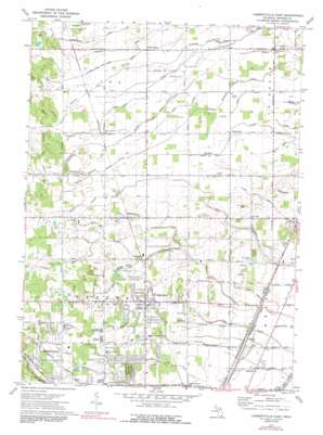
Lambertville East Topo Map Michigan
To zoom in, hover over the map of Lambertville East
USGS Topo Quad 41083g5 - 1:24,000 scale
| Topo Map Name: | Lambertville East |
| USGS Topo Quad ID: | 41083g5 |
| Print Size: | ca. 21 1/4" wide x 27" high |
| Southeast Coordinates: | 41.75° N latitude / 83.5° W longitude |
| Map Center Coordinates: | 41.8125° N latitude / 83.5625° W longitude |
| U.S. State: | MI |
| Filename: | o41083g5.jpg |
| Download Map JPG Image: | Lambertville East topo map 1:24,000 scale |
| Map Type: | Topographic |
| Topo Series: | 7.5´ |
| Map Scale: | 1:24,000 |
| Source of Map Images: | United States Geological Survey (USGS) |
| Alternate Map Versions: |
Samaria MI 1939, updated 1959 Download PDF Buy paper map Samaria MI 1941 Download PDF Buy paper map Lambertville East MI 1972, updated 1975 Download PDF Buy paper map Lambertville East MI 1972, updated 1991 Download PDF Buy paper map Lambertville East MI 2011 Download PDF Buy paper map Lambertville East MI 2014 Download PDF Buy paper map Lambertville East MI 2016 Download PDF Buy paper map |
1:24,000 Topo Quads surrounding Lambertville East
> Back to 41083e1 at 1:100,000 scale
> Back to 41082a1 at 1:250,000 scale
> Back to U.S. Topo Maps home
Lambertville East topo map: Gazetteer
Lambertville East: Airports
Erie Aerodrome elevation 181m 593′Lambertville East: Canals
Albain Drain elevation 189m 620′Bullock Drain elevation 201m 659′
Duck Pond Drain elevation 195m 639′
Gilday Drain elevation 191m 626′
Henry Drain elevation 193m 633′
Johnson Drain elevation 193m 633′
Kelly Doty Drain elevation 185m 606′
Kinney Drain elevation 181m 593′
Little Lake Drain elevation 191m 626′
Lyons Drain elevation 189m 620′
Salter Drain elevation 192m 629′
Yarger Drain elevation 192m 629′
Lambertville East: Lakes
Klinck Lakes elevation 191m 626′Lambertville East: Parks
Carr Park elevation 191m 626′Indian Creek Park elevation 195m 639′
Miller Park elevation 187m 613′
Samaria Park elevation 197m 646′
Vienna Park elevation 188m 616′
White Park elevation 199m 652′
Lambertville East: Populated Places
Ida Center elevation 194m 636′Ottawa elevation 183m 600′
Samaria elevation 196m 643′
Temperance elevation 190m 623′
Vienna Junction elevation 177m 580′
Yargerville elevation 193m 633′
Lambertville East: Post Offices
Little Lake Post Office (historical) elevation 191m 626′Morocco Post Office (historical) elevation 198m 649′
Samaria Post Office elevation 196m 643′
Temperance Post Office elevation 189m 620′
Willits Post Office (historical) elevation 195m 639′
Yargerville Post Office (historical) elevation 193m 633′
Lambertville East: Streams
Cone Creek elevation 191m 626′Fitzgerald Drain elevation 192m 629′
Middle Branch Otter Creek elevation 191m 626′
North Branch Cone Creek elevation 196m 643′
North River elevation 189m 620′
Salter Creek elevation 187m 613′
Tracey Run elevation 191m 626′
Lambertville East digital topo map on disk
Buy this Lambertville East topo map showing relief, roads, GPS coordinates and other geographical features, as a high-resolution digital map file on DVD:


