Miller City Topo Map Ohio
To zoom in, hover over the map of Miller City
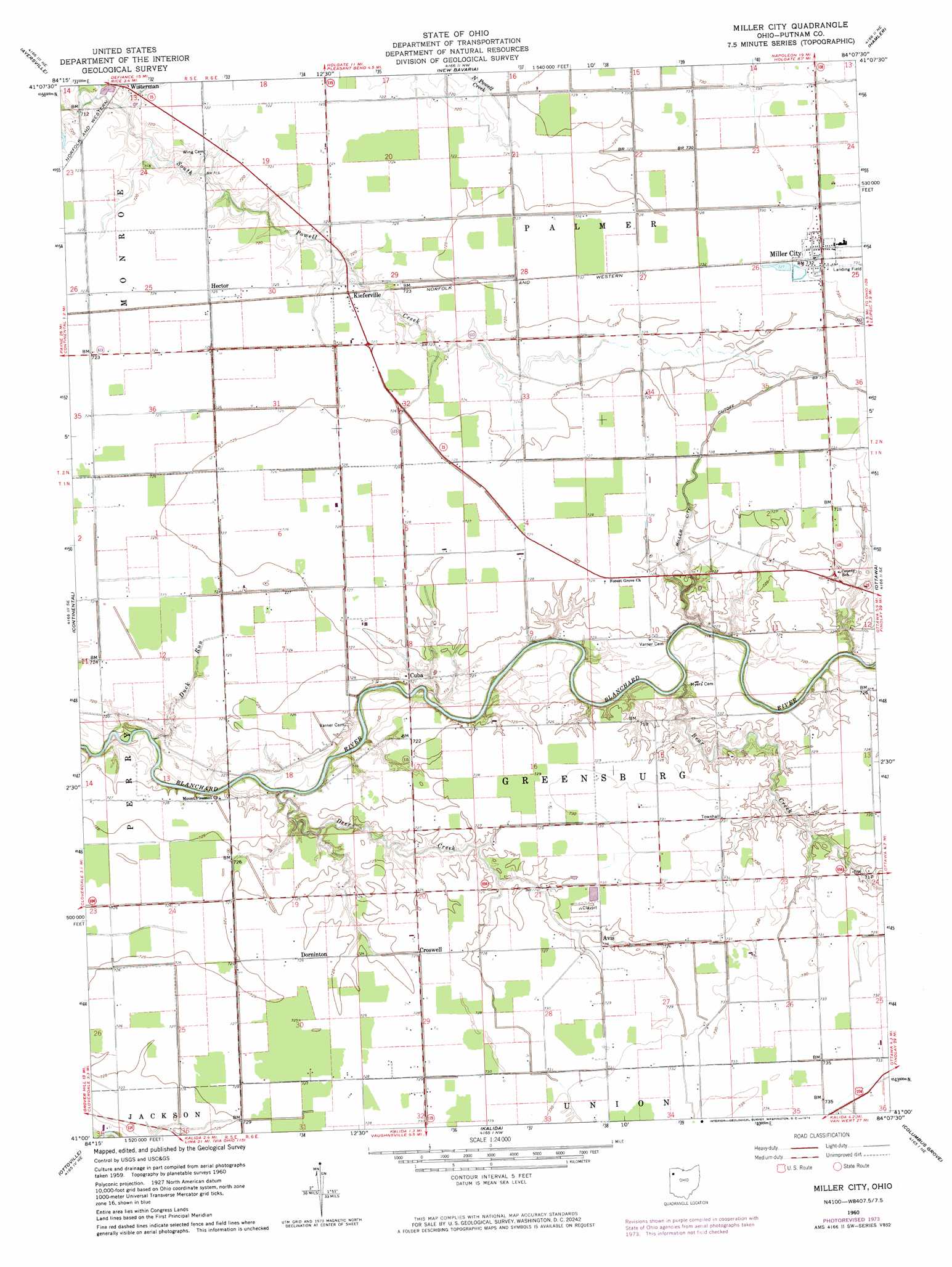
USGS Topo Quad 41084a2 - 1:24,000 scale
| Topo Map Name: | Miller City |
| USGS Topo Quad ID: | 41084a2 |
| Print Size: | ca. 21 1/4" wide x 27" high |
| Southeast Coordinates: | 41° N latitude / 84.125° W longitude |
| Map Center Coordinates: | 41.0625° N latitude / 84.1875° W longitude |
| U.S. State: | OH |
| Filename: | o41084a2.jpg |
| Download Map JPG Image: | Miller City topo map 1:24,000 scale |
| Map Type: | Topographic |
| Topo Series: | 7.5´ |
| Map Scale: | 1:24,000 |
| Source of Map Images: | United States Geological Survey (USGS) |
| Alternate Map Versions: |
Miller City OH 1960, updated 1961 Download PDF Buy paper map Miller City OH 1960, updated 1974 Download PDF Buy paper map Miller City OH 2010 Download PDF Buy paper map Miller City OH 2013 Download PDF Buy paper map Miller City OH 2016 Download PDF Buy paper map |
1:24,000 Topo Quads surrounding Miller City
Defiance West |
Defiance East |
Florida |
Malinta |
Mcclure |
Junction |
Ayersville |
New Bavaria |
Hamler |
Deshler |
Oakwood |
Continental |
Miller City |
Ottawa |
Leipsic |
Wetsel |
Ottoville |
Kalida |
Columbus Grove |
Bluffton |
Middle Point |
Delphos |
Elida |
Cairo |
Beaverdam |
> Back to 41084a1 at 1:100,000 scale
> Back to 41084a1 at 1:250,000 scale
> Back to U.S. Topo Maps home
Miller City topo map: Gazetteer
Miller City: Airports
Verhoff Airport elevation 221m 725′Miller City: Canals
Miller City Cutoff elevation 217m 711′Miller City: Populated Places
Avis elevation 221m 725′Croswell elevation 220m 721′
Cuba elevation 220m 721′
Dorninton elevation 220m 721′
Hector elevation 219m 718′
Kieferville elevation 220m 721′
Miller City elevation 221m 725′
Wisterman elevation 217m 711′
Miller City: Post Offices
Dornington Post Office (historical) elevation 220m 721′Hector Post Office (historical) elevation 219m 718′
Kieferville Post Office (historical) elevation 220m 721′
Wisterman Post Office (historical) elevation 218m 715′
Miller City: Streams
Bear Creek elevation 215m 705′Deer Creek elevation 212m 695′
Duck Run elevation 211m 692′
Miller City digital topo map on disk
Buy this Miller City topo map showing relief, roads, GPS coordinates and other geographical features, as a high-resolution digital map file on DVD:
Northern Illinois, Northern Indiana & Southwestern Michigan
Buy digital topo maps: Northern Illinois, Northern Indiana & Southwestern Michigan