Ayersville Topo Map Ohio
To zoom in, hover over the map of Ayersville
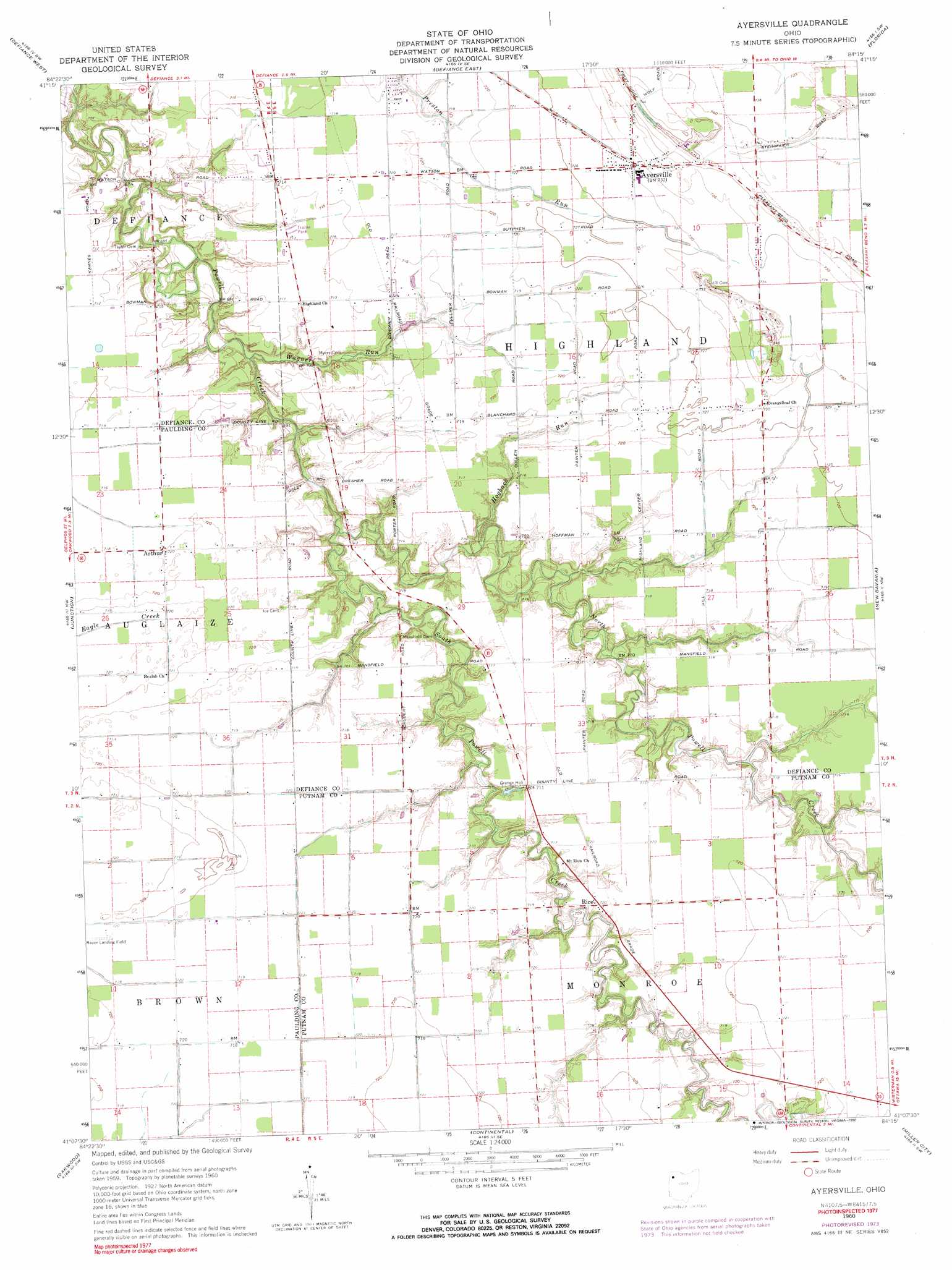
USGS Topo Quad 41084b3 - 1:24,000 scale
| Topo Map Name: | Ayersville |
| USGS Topo Quad ID: | 41084b3 |
| Print Size: | ca. 21 1/4" wide x 27" high |
| Southeast Coordinates: | 41.125° N latitude / 84.25° W longitude |
| Map Center Coordinates: | 41.1875° N latitude / 84.3125° W longitude |
| U.S. State: | OH |
| Filename: | o41084b3.jpg |
| Download Map JPG Image: | Ayersville topo map 1:24,000 scale |
| Map Type: | Topographic |
| Topo Series: | 7.5´ |
| Map Scale: | 1:24,000 |
| Source of Map Images: | United States Geological Survey (USGS) |
| Alternate Map Versions: |
Ayersville OH 1960, updated 1961 Download PDF Buy paper map Ayersville OH 1960, updated 1974 Download PDF Buy paper map Ayersville OH 1960, updated 1990 Download PDF Buy paper map Ayersville OH 2010 Download PDF Buy paper map Ayersville OH 2013 Download PDF Buy paper map Ayersville OH 2016 Download PDF Buy paper map |
1:24,000 Topo Quads surrounding Ayersville
Bryan |
Evansport |
Ridgeville Corners |
Napoleon West |
Napoleon East |
Sherwood |
Defiance West |
Defiance East |
Florida |
Malinta |
Paulding |
Junction |
Ayersville |
New Bavaria |
Hamler |
Latty |
Oakwood |
Continental |
Miller City |
Ottawa |
Scott |
Wetsel |
Ottoville |
Kalida |
Columbus Grove |
> Back to 41084a1 at 1:100,000 scale
> Back to 41084a1 at 1:250,000 scale
> Back to U.S. Topo Maps home
Ayersville topo map: Gazetteer
Ayersville: Airports
Bauer Landing Strip elevation 219m 718′Blevins Airport elevation 221m 725′
Ayersville: Canals
Steffel Ditch elevation 218m 715′Ayersville: Populated Places
Arthur elevation 219m 718′Ayersville elevation 223m 731′
Rice elevation 218m 715′
Southerton elevation 218m 715′
Ayersville: Post Offices
Arthur Post Office (historical) elevation 219m 718′Ayersville Post Office (historical) elevation 223m 731′
Rice Post Office (historical) elevation 218m 715′
Ayersville: Streams
Hogback Run elevation 213m 698′North Powell Creek elevation 208m 682′
South Powell Creek elevation 209m 685′
Wagner Run elevation 209m 685′
Ayersville digital topo map on disk
Buy this Ayersville topo map showing relief, roads, GPS coordinates and other geographical features, as a high-resolution digital map file on DVD:
Northern Illinois, Northern Indiana & Southwestern Michigan
Buy digital topo maps: Northern Illinois, Northern Indiana & Southwestern Michigan