Delta Topo Map Ohio
To zoom in, hover over the map of Delta
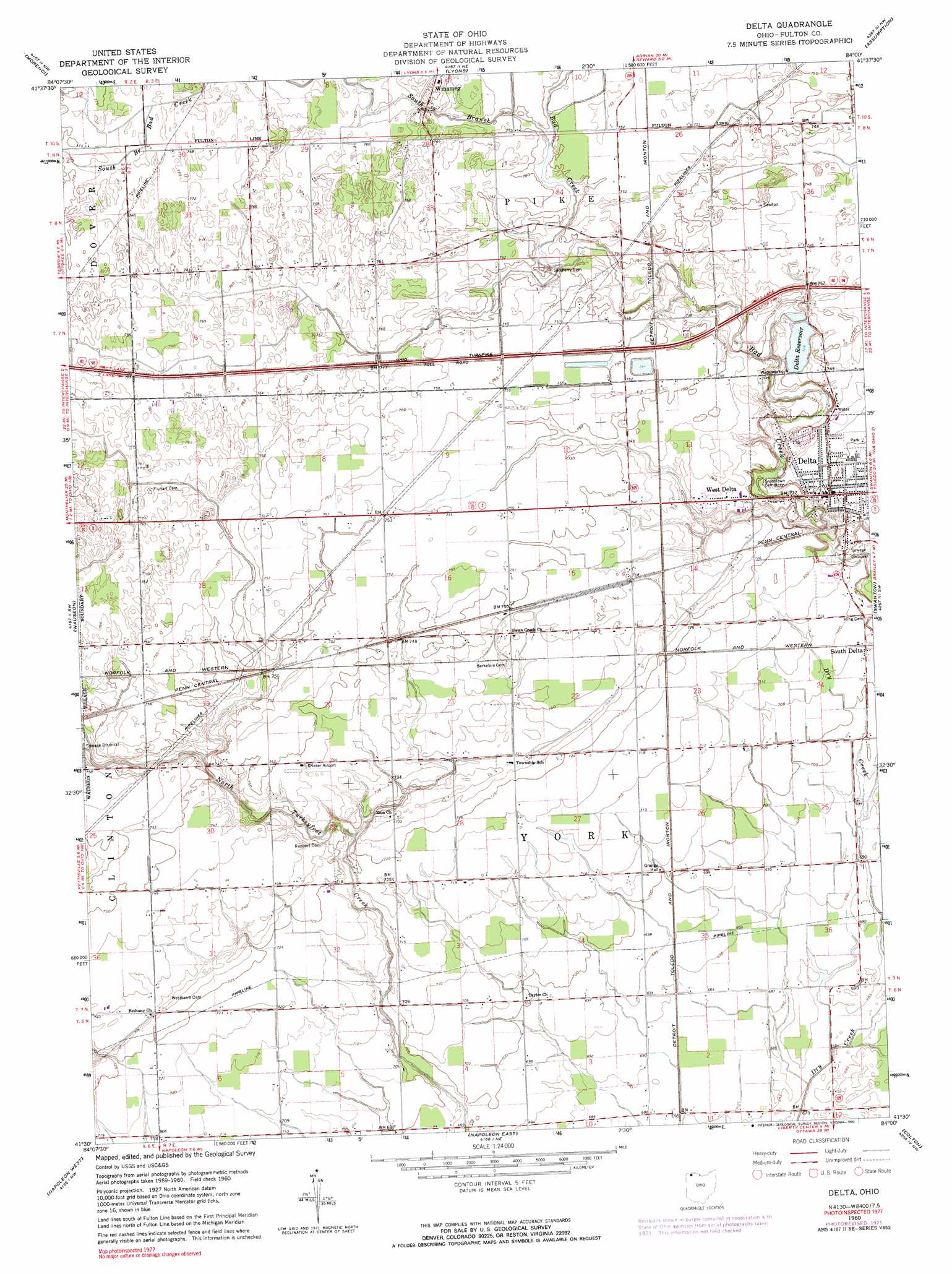
USGS Topo Quad 41084e1 - 1:24,000 scale
| Topo Map Name: | Delta |
| USGS Topo Quad ID: | 41084e1 |
| Print Size: | ca. 21 1/4" wide x 27" high |
| Southeast Coordinates: | 41.5° N latitude / 84° W longitude |
| Map Center Coordinates: | 41.5625° N latitude / 84.0625° W longitude |
| U.S. State: | OH |
| Filename: | o41084e1.jpg |
| Download Map JPG Image: | Delta topo map 1:24,000 scale |
| Map Type: | Topographic |
| Topo Series: | 7.5´ |
| Map Scale: | 1:24,000 |
| Source of Map Images: | United States Geological Survey (USGS) |
| Alternate Map Versions: |
Delta OH 1960, updated 1962 Download PDF Buy paper map Delta OH 1960, updated 1972 Download PDF Buy paper map Delta OH 1960, updated 1990 Download PDF Buy paper map Delta OH 2010 Download PDF Buy paper map Delta OH 2013 Download PDF Buy paper map Delta OH 2016 Download PDF Buy paper map |
1:24,000 Topo Quads surrounding Delta
Hudson |
Clayton |
Jasper |
Palmyra |
Blissfield |
Fayette |
Morenci |
Lyons |
Assumption |
Berkey |
Archbold |
Wauseon |
Delta |
Swanton |
Whitehouse |
Ridgeville Corners |
Napoleon West |
Napoleon East |
Colton |
Grand Rapids |
Defiance East |
Florida |
Malinta |
Mcclure |
Weston |
> Back to 41084e1 at 1:100,000 scale
> Back to 41084a1 at 1:250,000 scale
> Back to U.S. Topo Maps home
Delta topo map: Gazetteer
Delta: Airports
Grieser Airport elevation 227m 744′Delta: Dams
Delta Reservoir Dam elevation 223m 731′Delta: Parks
Delta Municipal Park elevation 221m 725′Wildwood Park (historical) elevation 214m 702′
Delta: Populated Places
Delta elevation 220m 721′Delta Heights elevation 225m 738′
Haller (historical) elevation 228m 748′
Plattston (historical) elevation 214m 702′
West Delta elevation 224m 734′
Delta: Post Offices
Delta Post Office elevation 220m 721′Plattston Post Office (historical) elevation 214m 702′
Delta: Reservoirs
Delta Reservoir elevation 223m 731′Delta: Streams
South Branch Bad Creek elevation 228m 748′Delta: Woods
Longnecker Grove elevation 214m 702′Delta digital topo map on disk
Buy this Delta topo map showing relief, roads, GPS coordinates and other geographical features, as a high-resolution digital map file on DVD:
Northern Illinois, Northern Indiana & Southwestern Michigan
Buy digital topo maps: Northern Illinois, Northern Indiana & Southwestern Michigan