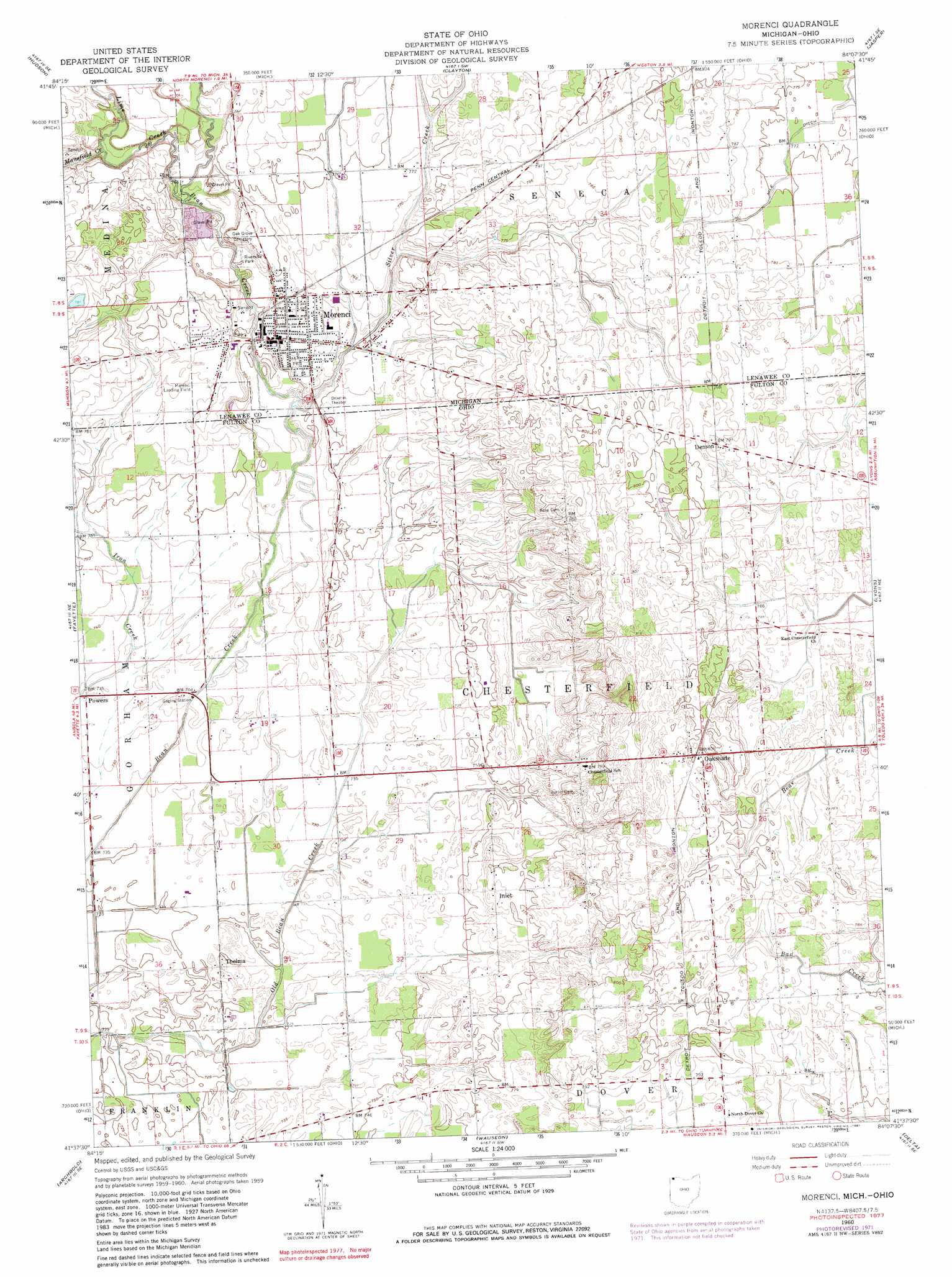
Morenci Topo Map Ohio
To zoom in, hover over the map of Morenci
USGS Topo Quad 41084f2 - 1:24,000 scale
| Topo Map Name: | Morenci |
| USGS Topo Quad ID: | 41084f2 |
| Print Size: | ca. 21 1/4" wide x 27" high |
| Southeast Coordinates: | 41.625° N latitude / 84.125° W longitude |
| Map Center Coordinates: | 41.6875° N latitude / 84.1875° W longitude |
| U.S. States: | OH, MI |
| Filename: | o41084f2.jpg |
| Download Map JPG Image: | Morenci topo map 1:24,000 scale |
| Map Type: | Topographic |
| Topo Series: | 7.5´ |
| Map Scale: | 1:24,000 |
| Source of Map Images: | United States Geological Survey (USGS) |
| Alternate Map Versions: |
Morenci MI 1960, updated 1961 Download PDF Buy paper map Morenci MI 1960, updated 1972 Download PDF Buy paper map Morenci MI 1960, updated 1981 Download PDF Buy paper map Morenci MI 2011 Download PDF Buy paper map Morenci MI 2014 Download PDF Buy paper map Morenci MI 2016 Download PDF Buy paper map |
1:24,000 Topo Quads surrounding Morenci
Wheatland |
Addison |
Rome Center |
Adrian |
Tecumseh South |
Pittsford |
Hudson |
Clayton |
Jasper |
Palmyra |
Alvordton |
Fayette |
Morenci |
Lyons |
Assumption |
West Unity |
Archbold |
Wauseon |
Delta |
Swanton |
Evansport |
Ridgeville Corners |
Napoleon West |
Napoleon East |
Colton |
> Back to 41084e1 at 1:100,000 scale
> Back to 41084a1 at 1:250,000 scale
> Back to U.S. Topo Maps home
Morenci topo map: Gazetteer
Morenci: Airports
Hochstetler Airport elevation 232m 761′Morenci: Parks
Murray D Van Wagoner Memorial Bridge Historical Marker elevation 228m 748′Riverside Park elevation 228m 748′
Stephenson Park elevation 233m 764′
Taft Memorial Highway Historical Marker elevation 228m 748′
Wakefield Park elevation 228m 748′
Morenci: Populated Places
Denson elevation 242m 793′Inlet elevation 234m 767′
Morenci elevation 233m 764′
Oakshade elevation 245m 803′
Powers elevation 224m 734′
Thelma elevation 222m 728′
Morenci: Post Offices
Bimo Post Office (historical) elevation 245m 803′Denson Post Office (historical) elevation 242m 793′
Inlet Post Office (historical) elevation 235m 770′
Morenci Post Office elevation 233m 764′
Oakshade Post Office (historical) elevation 244m 800′
Thelma Post Office (historical) elevation 222m 728′
Morenci: Streams
Carter Drain elevation 229m 751′Lime Creek elevation 228m 748′
Mansfield Creek elevation 230m 754′
Silver Creek elevation 225m 738′
Morenci digital topo map on disk
Buy this Morenci topo map showing relief, roads, GPS coordinates and other geographical features, as a high-resolution digital map file on DVD:
Northern Illinois, Northern Indiana & Southwestern Michigan
Buy digital topo maps: Northern Illinois, Northern Indiana & Southwestern Michigan