Pioneer Topo Map Ohio
To zoom in, hover over the map of Pioneer
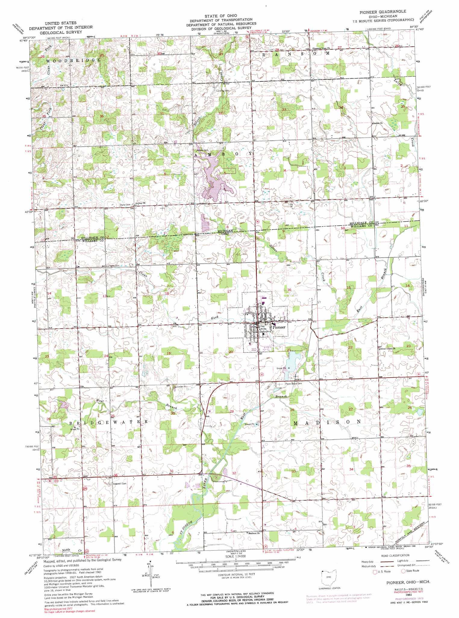
USGS Topo Quad 41084f5 - 1:24,000 scale
| Topo Map Name: | Pioneer |
| USGS Topo Quad ID: | 41084f5 |
| Print Size: | ca. 21 1/4" wide x 27" high |
| Southeast Coordinates: | 41.625° N latitude / 84.5° W longitude |
| Map Center Coordinates: | 41.6875° N latitude / 84.5625° W longitude |
| U.S. States: | OH, MI |
| Filename: | o41084f5.jpg |
| Download Map JPG Image: | Pioneer topo map 1:24,000 scale |
| Map Type: | Topographic |
| Topo Series: | 7.5´ |
| Map Scale: | 1:24,000 |
| Source of Map Images: | United States Geological Survey (USGS) |
| Alternate Map Versions: |
Pioneer OH 1961, updated 1962 Download PDF Buy paper map Pioneer OH 1961, updated 1974 Download PDF Buy paper map Pioneer OH 1961, updated 1990 Download PDF Buy paper map Pioneer OH 2011 Download PDF Buy paper map Pioneer OH 2013 Download PDF Buy paper map Pioneer OH 2016 Download PDF Buy paper map |
1:24,000 Topo Quads surrounding Pioneer
Allen |
Hillsdale |
North Adams |
Wheatland |
Addison |
Camden |
Reading |
Frontier |
Pittsford |
Hudson |
Clear Lake |
Nettle Lake |
Pioneer |
Alvordton |
Fayette |
Edon |
Blakeslee |
Montpelier |
West Unity |
Archbold |
Butler East |
Edgerton |
Bryan |
Evansport |
Ridgeville Corners |
> Back to 41084e1 at 1:100,000 scale
> Back to 41084a1 at 1:250,000 scale
> Back to U.S. Topo Maps home
Pioneer topo map: Gazetteer
Pioneer: Airports
A C Miller Airport elevation 287m 941′Pioneer: Populated Places
Greyhound elevation 274m 898′Grimms Subdivision elevation 279m 915′
Jim Town elevation 272m 892′
Pioneer elevation 268m 879′
Pioneer: Post Offices
Amboy Post Office (historical) elevation 284m 931′Buckeye Post Office (historical) elevation 274m 898′
Pioneer: Streams
Clear Fork elevation 262m 859′East Branch Saint Joseph River elevation 262m 859′
Silver Creek elevation 264m 866′
West Branch Saint Joseph River elevation 262m 859′
Pioneer digital topo map on disk
Buy this Pioneer topo map showing relief, roads, GPS coordinates and other geographical features, as a high-resolution digital map file on DVD:
Northern Illinois, Northern Indiana & Southwestern Michigan
Buy digital topo maps: Northern Illinois, Northern Indiana & Southwestern Michigan