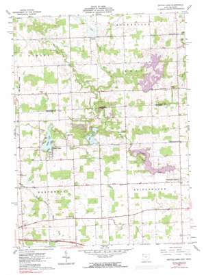
Nettle Lake Topo Map Ohio
To zoom in, hover over the map of Nettle Lake
USGS Topo Quad 41084f6 - 1:24,000 scale
| Topo Map Name: | Nettle Lake |
| USGS Topo Quad ID: | 41084f6 |
| Print Size: | ca. 21 1/4" wide x 27" high |
| Southeast Coordinates: | 41.625° N latitude / 84.625° W longitude |
| Map Center Coordinates: | 41.6875° N latitude / 84.6875° W longitude |
| U.S. States: | OH, MI |
| Filename: | o41084f6.jpg |
| Download Map JPG Image: | Nettle Lake topo map 1:24,000 scale |
| Map Type: | Topographic |
| Topo Series: | 7.5´ |
| Map Scale: | 1:24,000 |
| Source of Map Images: | United States Geological Survey (USGS) |
| Alternate Map Versions: |
Nettle Lake OH 1961, updated 1963 Download PDF Buy paper map Nettle Lake OH 1961, updated 1973 Download PDF Buy paper map Nettle Lake OH 1961, updated 1991 Download PDF Buy paper map Nettle Lake OH 2011 Download PDF Buy paper map Nettle Lake OH 2013 Download PDF Buy paper map Nettle Lake OH 2016 Download PDF Buy paper map |
1:24,000 Topo Quads surrounding Nettle Lake
> Back to 41084e1 at 1:100,000 scale
> Back to 41084a1 at 1:250,000 scale
> Back to U.S. Topo Maps home
Nettle Lake topo map: Gazetteer
Nettle Lake: Dams
Hays Lake Dam elevation 303m 994′Kohl Lake Dam elevation 303m 994′
Lake A Dam elevation 296m 971′
Lake C Dam elevation 291m 954′
Lake La Su An Dam elevation 283m 928′
Lake Seneca Dam elevation 271m 889′
Nettle Lake: Lakes
Lake La Su An elevation 283m 928′Nettle Lake elevation 288m 944′
Spring Pond elevation 279m 915′
Nettle Lake: Parks
Lake La Su An Wildlife Area elevation 295m 967′Nettle Lake: Populated Places
Ainger elevation 277m 908′Austin elevation 305m 1000′
Bridgewater Center elevation 278m 912′
Cooney elevation 298m 977′
Nettle Lake elevation 290m 951′
Northwest elevation 294m 964′
Nettle Lake: Post Offices
Hageman Post Office (historical) elevation 292m 958′Morganville Post Office (historical) elevation 286m 938′
White Post Office (historical) elevation 306m 1003′
Nettle Lake: Reservoirs
Clems Pond elevation 289m 948′Eds Pond elevation 288m 944′
Hays Lake elevation 303m 994′
Hogback Pond elevation 288m 944′
Jerrys Pond elevation 298m 977′
Kohl Lake elevation 303m 994′
Lake A elevation 296m 971′
Lake Ann elevation 295m 967′
Lake C elevation 291m 954′
Lake La Vere elevation 296m 971′
Lake Seneca elevation 271m 889′
Lake Sue elevation 290m 951′
Lous Pond elevation 284m 931′
Nettle Lake: Streams
East Fork West Branch Saint Joseph River elevation 283m 928′West Fork West Branch Saint Joseph River elevation 283m 928′
Nettle Lake digital topo map on disk
Buy this Nettle Lake topo map showing relief, roads, GPS coordinates and other geographical features, as a high-resolution digital map file on DVD:
Northern Illinois, Northern Indiana & Southwestern Michigan
Buy digital topo maps: Northern Illinois, Northern Indiana & Southwestern Michigan


