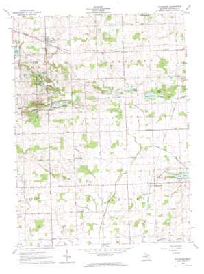
Pittsford Topo Map Michigan
To zoom in, hover over the map of Pittsford
USGS Topo Quad 41084g4 - 1:24,000 scale
| Topo Map Name: | Pittsford |
| USGS Topo Quad ID: | 41084g4 |
| Print Size: | ca. 21 1/4" wide x 27" high |
| Southeast Coordinates: | 41.75° N latitude / 84.375° W longitude |
| Map Center Coordinates: | 41.8125° N latitude / 84.4375° W longitude |
| U.S. State: | MI |
| Filename: | o41084g4.jpg |
| Download Map JPG Image: | Pittsford topo map 1:24,000 scale |
| Map Type: | Topographic |
| Topo Series: | 7.5´ |
| Map Scale: | 1:24,000 |
| Source of Map Images: | United States Geological Survey (USGS) |
| Alternate Map Versions: |
Pittsford MI 1962, updated 1963 Download PDF Buy paper map Pittsford MI 2011 Download PDF Buy paper map Pittsford MI 2014 Download PDF Buy paper map Pittsford MI 2016 Download PDF Buy paper map |
1:24,000 Topo Quads surrounding Pittsford
> Back to 41084e1 at 1:100,000 scale
> Back to 41084a1 at 1:250,000 scale
> Back to U.S. Topo Maps home
Pittsford topo map: Gazetteer
Pittsford: Lakes
Bell Lake elevation 311m 1020′Devoe Lake elevation 283m 928′
Lake Number Eight elevation 309m 1013′
Lake Number Five elevation 313m 1026′
Lake Number One elevation 291m 954′
Lake Number Two elevation 292m 958′
Mallory Lake elevation 278m 912′
Moon Lake elevation 282m 925′
Mud Lake elevation 281m 921′
Reece Lake elevation 285m 935′
Pittsford: Parks
Pittsford State Game Area elevation 314m 1030′Pittsford: Populated Places
Betzer elevation 275m 902′Lickly Corners elevation 289m 948′
Pittsford elevation 332m 1089′
Prattville elevation 285m 935′
Pittsford: Post Offices
Betzer Post Office (historical) elevation 275m 902′Lickleys Corners Post Office (historical) elevation 289m 948′
Mallory Post Office (historical) elevation 284m 931′
Pittsford Post Office elevation 332m 1089′
Prattville Post Office elevation 285m 935′
Pittsford: Reservoirs
Lime Lake elevation 268m 879′Pittsford Millpond elevation 300m 984′
Pittsford: Streams
Anderson Drain elevation 271m 889′Dillon Drain elevation 271m 889′
Goose Creek elevation 274m 898′
Lime Lake Inlet elevation 267m 875′
Moon Lake Drain elevation 278m 912′
Prattville Drain elevation 267m 875′
Timma Drain elevation 268m 879′
Pittsford digital topo map on disk
Buy this Pittsford topo map showing relief, roads, GPS coordinates and other geographical features, as a high-resolution digital map file on DVD:
Northern Illinois, Northern Indiana & Southwestern Michigan
Buy digital topo maps: Northern Illinois, Northern Indiana & Southwestern Michigan


