Frontier Topo Map Michigan
To zoom in, hover over the map of Frontier
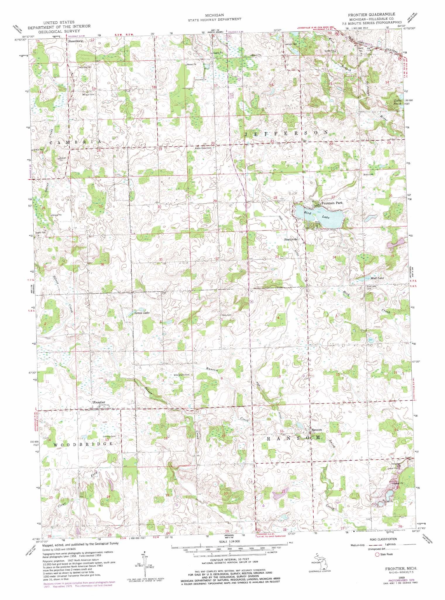
USGS Topo Quad 41084g5 - 1:24,000 scale
| Topo Map Name: | Frontier |
| USGS Topo Quad ID: | 41084g5 |
| Print Size: | ca. 21 1/4" wide x 27" high |
| Southeast Coordinates: | 41.75° N latitude / 84.5° W longitude |
| Map Center Coordinates: | 41.8125° N latitude / 84.5625° W longitude |
| U.S. State: | MI |
| Filename: | o41084g5.jpg |
| Download Map JPG Image: | Frontier topo map 1:24,000 scale |
| Map Type: | Topographic |
| Topo Series: | 7.5´ |
| Map Scale: | 1:24,000 |
| Source of Map Images: | United States Geological Survey (USGS) |
| Alternate Map Versions: |
Frontier MI 1959, updated 1960 Download PDF Buy paper map Frontier MI 1959, updated 1979 Download PDF Buy paper map Frontier MI 2011 Download PDF Buy paper map Frontier MI 2014 Download PDF Buy paper map Frontier MI 2016 Download PDF Buy paper map |
1:24,000 Topo Quads surrounding Frontier
Litchfield |
Mosherville |
Hanover |
Somerset Center |
Cement City |
Allen |
Hillsdale |
North Adams |
Wheatland |
Addison |
Camden |
Reading |
Frontier |
Pittsford |
Hudson |
Clear Lake |
Nettle Lake |
Pioneer |
Alvordton |
Fayette |
Edon |
Blakeslee |
Montpelier |
West Unity |
Archbold |
> Back to 41084e1 at 1:100,000 scale
> Back to 41084a1 at 1:250,000 scale
> Back to U.S. Topo Maps home
Frontier topo map: Gazetteer
Frontier: Canals
Nile Ditch elevation 314m 1030′Ransom Ditch elevation 307m 1007′
Frontier: Lakes
Bird Lake elevation 315m 1033′Grass Lake elevation 310m 1017′
Mud Lake elevation 310m 1017′
Frontier: Populated Places
Fountain Park elevation 317m 1040′Frontier elevation 314m 1030′
Ransom elevation 305m 1000′
Shadyside elevation 319m 1046′
Frontier: Post Offices
Frontier Post Office elevation 314m 1030′Jefferson Post Office (historical) elevation 321m 1053′
Ransom Post Office (historical) elevation 305m 1000′
Shadyside Post Office (historical) elevation 319m 1046′
Frontier: Streams
Otto Drain elevation 319m 1046′Frontier digital topo map on disk
Buy this Frontier topo map showing relief, roads, GPS coordinates and other geographical features, as a high-resolution digital map file on DVD:
Northern Illinois, Northern Indiana & Southwestern Michigan
Buy digital topo maps: Northern Illinois, Northern Indiana & Southwestern Michigan