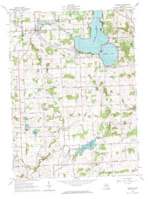
Addison Topo Map Michigan
To zoom in, hover over the map of Addison
USGS Topo Quad 41084h3 - 1:24,000 scale
| Topo Map Name: | Addison |
| USGS Topo Quad ID: | 41084h3 |
| Print Size: | ca. 21 1/4" wide x 27" high |
| Southeast Coordinates: | 41.875° N latitude / 84.25° W longitude |
| Map Center Coordinates: | 41.9375° N latitude / 84.3125° W longitude |
| U.S. State: | MI |
| Filename: | o41084h3.jpg |
| Download Map JPG Image: | Addison topo map 1:24,000 scale |
| Map Type: | Topographic |
| Topo Series: | 7.5´ |
| Map Scale: | 1:24,000 |
| Source of Map Images: | United States Geological Survey (USGS) |
| Alternate Map Versions: |
Addison MI 1962, updated 1984 Download PDF Buy paper map Addison MI 2011 Download PDF Buy paper map Addison MI 2014 Download PDF Buy paper map Addison MI 2016 Download PDF Buy paper map |
1:24,000 Topo Quads surrounding Addison
> Back to 41084e1 at 1:100,000 scale
> Back to 41084a1 at 1:250,000 scale
> Back to U.S. Topo Maps home
Addison topo map: Gazetteer
Addison: Lakes
Addison Millpond elevation 317m 1040′Binnes Lake elevation 315m 1033′
Horseshoe Lake elevation 295m 967′
Little Posey Lake elevation 289m 948′
Mud Lake elevation 319m 1046′
Round Lake elevation 294m 964′
Round Lake elevation 318m 1043′
Tanners Lake elevation 298m 977′
Tripp Lake elevation 297m 974′
Addison: Parks
Jack Tibbs Park elevation 326m 1069′Addison: Populated Places
Addison elevation 320m 1049′Addison Junction elevation 320m 1049′
Devil's Lake Estates elevation 323m 1059′
Geneva elevation 323m 1059′
Manitou Beach elevation 325m 1066′
Rollin elevation 299m 980′
Round Lake Estates elevation 323m 1059′
Addison: Post Offices
Addison Post Office elevation 320m 1049′Geneva Post Office (historical) elevation 324m 1062′
Manitou Beach Post Office elevation 324m 1062′
Quaker Post Office (historical) elevation 293m 961′
Rollin Post Office elevation 299m 980′
Townley Post Office (historical) elevation 323m 1059′
Addison: Reservoirs
Devils Lake elevation 318m 1043′Posey Lake elevation 289m 948′
Addison: Streams
Bowen Drain elevation 311m 1020′Branch Creek elevation 307m 1007′
Fisk Drain elevation 307m 1007′
Kempton Drain elevation 308m 1010′
Ketcham Drain elevation 286m 938′
O'Harrow Drain elevation 299m 980′
Patrick Drain elevation 292m 958′
Posey Creek elevation 307m 1007′
Posey Lake Drain elevation 284m 931′
Saint Joseph Creek elevation 279m 915′
Seeley Drain elevation 289m 948′
Tucker Drain elevation 286m 938′
Addison digital topo map on disk
Buy this Addison topo map showing relief, roads, GPS coordinates and other geographical features, as a high-resolution digital map file on DVD:
Northern Illinois, Northern Indiana & Southwestern Michigan
Buy digital topo maps: Northern Illinois, Northern Indiana & Southwestern Michigan


