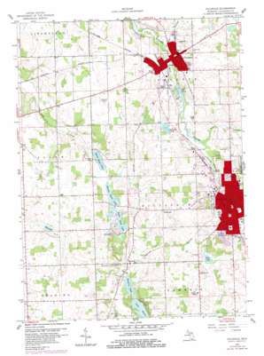
Hillsdale Topo Map Michigan
To zoom in, hover over the map of Hillsdale
USGS Topo Quad 41084h6 - 1:24,000 scale
| Topo Map Name: | Hillsdale |
| USGS Topo Quad ID: | 41084h6 |
| Print Size: | ca. 21 1/4" wide x 27" high |
| Southeast Coordinates: | 41.875° N latitude / 84.625° W longitude |
| Map Center Coordinates: | 41.9375° N latitude / 84.6875° W longitude |
| U.S. State: | MI |
| Filename: | o41084h6.jpg |
| Download Map JPG Image: | Hillsdale topo map 1:24,000 scale |
| Map Type: | Topographic |
| Topo Series: | 7.5´ |
| Map Scale: | 1:24,000 |
| Source of Map Images: | United States Geological Survey (USGS) |
| Alternate Map Versions: |
Hillsdale MI 1959, updated 1960 Download PDF Buy paper map Hillsdale MI 1959, updated 1984 Download PDF Buy paper map Hillsdale MI 2011 Download PDF Buy paper map Hillsdale MI 2014 Download PDF Buy paper map Hillsdale MI 2016 Download PDF Buy paper map |
1:24,000 Topo Quads surrounding Hillsdale
> Back to 41084e1 at 1:100,000 scale
> Back to 41084a1 at 1:250,000 scale
> Back to U.S. Topo Maps home
Hillsdale topo map: Gazetteer
Hillsdale: Airports
Hillsdale Hospital Heliport elevation 351m 1151′Hillsdale: Channels
Seventh Day Adventist Church elevation 333m 1092′Hillsdale: Lakes
Bankers Lake elevation 320m 1049′Bullhead Lake elevation 333m 1092′
Hog Lake elevation 333m 1092′
King Lake elevation 342m 1122′
Lake Wilson elevation 320m 1049′
Middle Sand Lake elevation 320m 1049′
North Sand Lake elevation 320m 1049′
South Sand Lake elevation 320m 1049′
Hillsdale: Parks
Cold Springs Park elevation 334m 1095′College Baptist Church Historical Marker elevation 340m 1115′
Grace Episcopal Church Historical Marker elevation 328m 1076′
Grosvenor House Historical Marker elevation 329m 1079′
Hillsdale College Historical Marker elevation 349m 1145′
Hillsdale Historical Marker elevation 341m 1118′
Johnny Williams Field elevation 328m 1076′
Muddy Waters Field elevation 332m 1089′
Saint Anthony's Catholic Church Historical Marker elevation 340m 1115′
Saint Peter's Episcopal Church Historical Marker elevation 341m 1118′
Simpson Field elevation 326m 1069′
Stock's Park elevation 332m 1089′
Hillsdale: Populated Places
Bankers elevation 329m 1079′Evergreen Estates Mobile Home Park elevation 347m 1138′
Hillsdale elevation 341m 1118′
Hillsdale Mobile Village elevation 335m 1099′
Hillside Acres Mobile Home Park elevation 362m 1187′
Jonesville elevation 328m 1076′
Hillsdale: Post Offices
Bankers Post Office (historical) elevation 329m 1079′Hillsdale Post Office elevation 330m 1082′
Jonesville Post Office elevation 328m 1076′
Hillsdale: Reservoirs
Mill Pond elevation 323m 1059′Hillsdale: Streams
Beebe Creek elevation 322m 1056′Hillsdale digital topo map on disk
Buy this Hillsdale topo map showing relief, roads, GPS coordinates and other geographical features, as a high-resolution digital map file on DVD:
Northern Illinois, Northern Indiana & Southwestern Michigan
Buy digital topo maps: Northern Illinois, Northern Indiana & Southwestern Michigan


