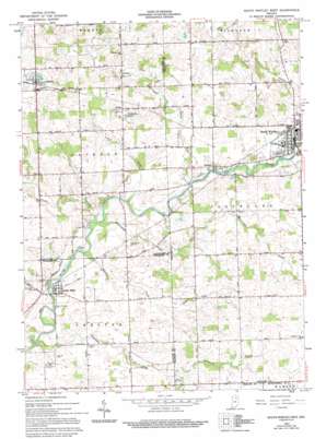
South Whitley West Topo Map Indiana
To zoom in, hover over the map of South Whitley West
USGS Topo Quad 41085a6 - 1:24,000 scale
| Topo Map Name: | South Whitley West |
| USGS Topo Quad ID: | 41085a6 |
| Print Size: | ca. 21 1/4" wide x 27" high |
| Southeast Coordinates: | 41° N latitude / 85.625° W longitude |
| Map Center Coordinates: | 41.0625° N latitude / 85.6875° W longitude |
| U.S. State: | IN |
| Filename: | o41085a6.jpg |
| Download Map JPG Image: | South Whitley West topo map 1:24,000 scale |
| Map Type: | Topographic |
| Topo Series: | 7.5´ |
| Map Scale: | 1:24,000 |
| Source of Map Images: | United States Geological Survey (USGS) |
| Alternate Map Versions: |
South Whitley West IN 1962, updated 1963 Download PDF Buy paper map South Whitley West IN 1962, updated 1994 Download PDF Buy paper map South Whitley West IN 2010 Download PDF Buy paper map South Whitley West IN 2013 Download PDF Buy paper map South Whitley West IN 2016 Download PDF Buy paper map |
1:24,000 Topo Quads surrounding South Whitley West
> Back to 41085a1 at 1:100,000 scale
> Back to 41084a1 at 1:250,000 scale
> Back to U.S. Topo Maps home
South Whitley West topo map: Gazetteer
South Whitley West: Airports
Mishler Landing Strip elevation 252m 826′South Whitley West: Canals
Cook Ditch elevation 253m 830′Koontz Ditch elevation 258m 846′
Mishler Ditch elevation 244m 800′
South Whitley West: Lakes
Heckman Lake elevation 253m 830′T Lake elevation 239m 784′
South Whitley West: Populated Places
Collamer elevation 243m 797′Kinsey elevation 263m 862′
Liberty Mills elevation 237m 777′
Sidney elevation 279m 915′
South Whitley elevation 245m 803′
South Whitley West: Streams
Crazy Creek elevation 234m 767′Hurricane Creek elevation 232m 761′
Plunge Creek elevation 232m 761′
Simonton Creek elevation 227m 744′
Sycamore Creek elevation 246m 807′
Wheeler Creek elevation 232m 761′
South Whitley West digital topo map on disk
Buy this South Whitley West topo map showing relief, roads, GPS coordinates and other geographical features, as a high-resolution digital map file on DVD:
Northern Illinois, Northern Indiana & Southwestern Michigan
Buy digital topo maps: Northern Illinois, Northern Indiana & Southwestern Michigan


