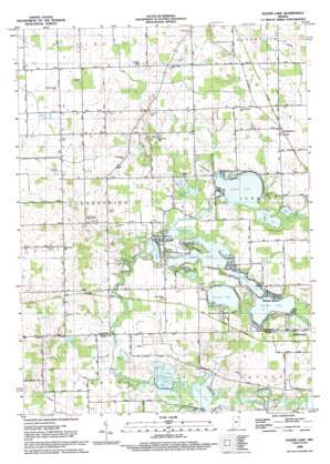
Oliver Lake Topo Map Indiana
To zoom in, hover over the map of Oliver Lake
USGS Topo Quad 41085e4 - 1:24,000 scale
| Topo Map Name: | Oliver Lake |
| USGS Topo Quad ID: | 41085e4 |
| Print Size: | ca. 21 1/4" wide x 27" high |
| Southeast Coordinates: | 41.5° N latitude / 85.375° W longitude |
| Map Center Coordinates: | 41.5625° N latitude / 85.4375° W longitude |
| U.S. State: | IN |
| Filename: | o41085e4.jpg |
| Download Map JPG Image: | Oliver Lake topo map 1:24,000 scale |
| Map Type: | Topographic |
| Topo Series: | 7.5´ |
| Map Scale: | 1:24,000 |
| Source of Map Images: | United States Geological Survey (USGS) |
| Alternate Map Versions: |
Oliver Lake IN 1947 Download PDF Buy paper map Oliver Lake IN 1959, updated 1961 Download PDF Buy paper map Oliver Lake IN 1992, updated 1993 Download PDF Buy paper map Oliver Lake IN 2010 Download PDF Buy paper map Oliver Lake IN 2013 Download PDF Buy paper map Oliver Lake IN 2016 Download PDF Buy paper map |
1:24,000 Topo Quads surrounding Oliver Lake
> Back to 41085e1 at 1:100,000 scale
> Back to 41084a1 at 1:250,000 scale
> Back to U.S. Topo Maps home
Oliver Lake topo map: Gazetteer
Oliver Lake: Airports
Oliver Lake Airport elevation 276m 905′Oliver Lake: Lakes
Atwood Lake elevation 273m 895′Basin Lake elevation 273m 895′
Bass Hole elevation 274m 898′
Dallas Lake elevation 272m 892′
Dollar Lake elevation 276m 905′
Goose Pond elevation 274m 898′
Hackenburg Lake elevation 273m 895′
Holsinger Hole elevation 273m 895′
Indian Lake elevation 275m 902′
Indian Lakes elevation 275m 902′
Jones Lake elevation 270m 885′
Martin Lake elevation 274m 898′
Messick Lake elevation 273m 895′
Mirror Lake elevation 272m 892′
Moore Lake elevation 270m 885′
Olin Lake elevation 273m 895′
Oliver Lake elevation 272m 892′
Pond Lil elevation 275m 902′
Quog Lake elevation 274m 898′
Smith Hole elevation 274m 898′
The Spreads elevation 274m 898′
Westler Lake elevation 273m 895′
Witmer Lake elevation 273m 895′
Oliver Lake: Parks
Limberlost Camp elevation 280m 918′Oliver Lake: Populated Places
Eddy elevation 279m 915′Valentine elevation 291m 954′
Webers Landing elevation 274m 898′
Witmer Manor elevation 277m 908′
Oliver Lake: Streams
Dove Creek elevation 273m 895′Little Elkhart Creek elevation 274m 898′
Middle Branch Elkhart River elevation 270m 885′
Oliver Lake: Swamps
Oliver Lake Outlet elevation 273m 895′Oliver Lake digital topo map on disk
Buy this Oliver Lake topo map showing relief, roads, GPS coordinates and other geographical features, as a high-resolution digital map file on DVD:
Northern Illinois, Northern Indiana & Southwestern Michigan
Buy digital topo maps: Northern Illinois, Northern Indiana & Southwestern Michigan


