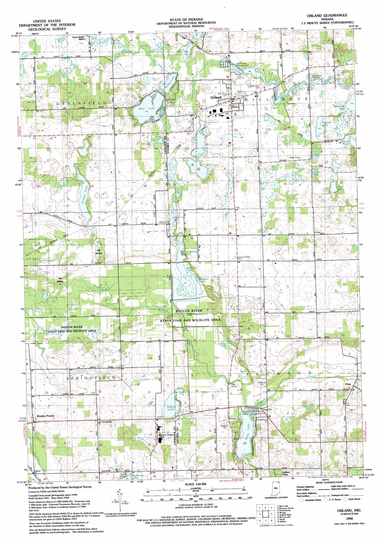
Orland Topo Map Indiana
To zoom in, hover over the map of Orland
USGS Topo Quad 41085f2 - 1:24,000 scale
| Topo Map Name: | Orland |
| USGS Topo Quad ID: | 41085f2 |
| Print Size: | ca. 21 1/4" wide x 27" high |
| Southeast Coordinates: | 41.625° N latitude / 85.125° W longitude |
| Map Center Coordinates: | 41.6875° N latitude / 85.1875° W longitude |
| U.S. State: | IN |
| Filename: | o41085f2.jpg |
| Download Map JPG Image: | Orland topo map 1:24,000 scale |
| Map Type: | Topographic |
| Topo Series: | 7.5´ |
| Map Scale: | 1:24,000 |
| Source of Map Images: | United States Geological Survey (USGS) |
| Alternate Map Versions: |
Orland IN 1940 Download PDF Buy paper map Orland IN 1940 Download PDF Buy paper map Orland IN 1941 Download PDF Buy paper map Orland IN 1960, updated 1962 Download PDF Buy paper map Orland IN 1960, updated 1962 Download PDF Buy paper map Orland IN 1992, updated 1993 Download PDF Buy paper map Orland IN 2010 Download PDF Buy paper map Orland IN 2013 Download PDF Buy paper map Orland IN 2016 Download PDF Buy paper map |
1:24,000 Topo Quads surrounding Orland
Nottawa |
Colon |
Bronson North |
Coldwater West |
Coldwater East |
Sturgis |
Burr Oak |
Bronson South |
Kinderhook |
California |
Lagrange |
Mongo |
Orland |
Angola West |
Angola East |
Oliver Lake |
Wolcottville |
Stroh |
Ashley |
Hamilton |
Albion |
Kendallville |
Corunna |
Waterloo |
Butler West |
> Back to 41085e1 at 1:100,000 scale
> Back to 41084a1 at 1:250,000 scale
> Back to U.S. Topo Maps home
Orland topo map: Gazetteer
Orland: Lakes
Beaverdam Lake elevation 287m 941′Brown Lake elevation 286m 938′
Deep Lake elevation 284m 931′
Grassy Lake elevation 290m 951′
Green Lake elevation 289m 948′
Lime Lake elevation 284m 931′
Otter Lake elevation 284m 931′
Perch Lake elevation 292m 958′
Shallow Lake elevation 283m 928′
Stayner Lake elevation 286m 938′
Wall Lake elevation 286m 938′
Warner Lake elevation 289m 948′
Orland: Populated Places
Brushy Prairie elevation 288m 944′Flint elevation 293m 961′
Orland elevation 293m 961′
Orland: Streams
Crooked Creek elevation 289m 948′Orland digital topo map on disk
Buy this Orland topo map showing relief, roads, GPS coordinates and other geographical features, as a high-resolution digital map file on DVD:
Northern Illinois, Northern Indiana & Southwestern Michigan
Buy digital topo maps: Northern Illinois, Northern Indiana & Southwestern Michigan