Mongo Topo Map Indiana
To zoom in, hover over the map of Mongo
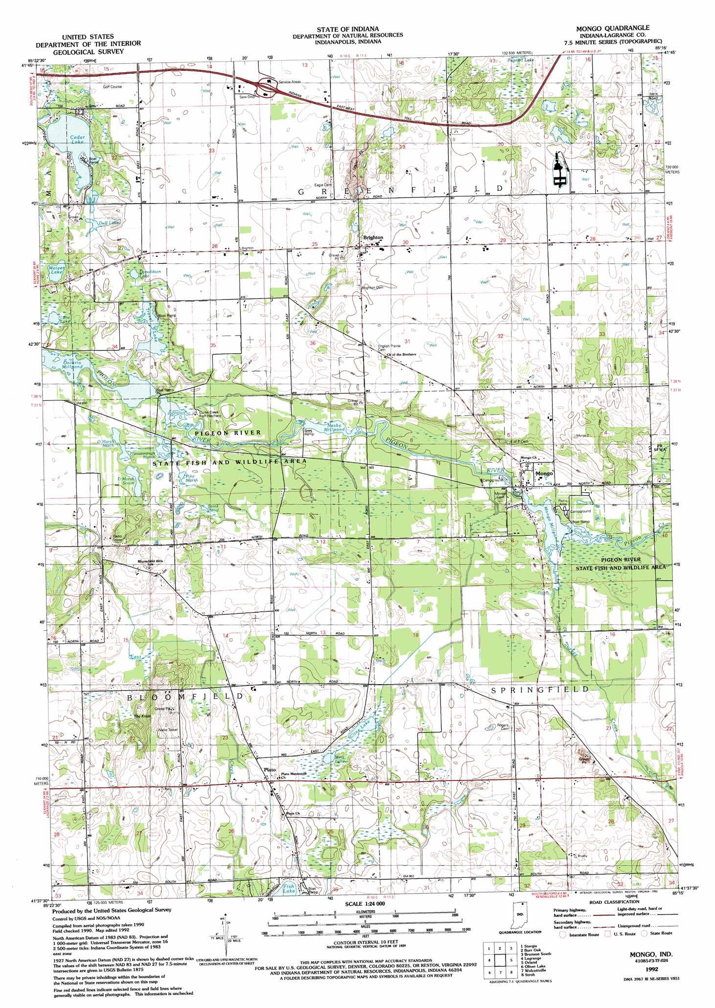
USGS Topo Quad 41085f3 - 1:24,000 scale
| Topo Map Name: | Mongo |
| USGS Topo Quad ID: | 41085f3 |
| Print Size: | ca. 21 1/4" wide x 27" high |
| Southeast Coordinates: | 41.625° N latitude / 85.25° W longitude |
| Map Center Coordinates: | 41.6875° N latitude / 85.3125° W longitude |
| U.S. State: | IN |
| Filename: | o41085f3.jpg |
| Download Map JPG Image: | Mongo topo map 1:24,000 scale |
| Map Type: | Topographic |
| Topo Series: | 7.5´ |
| Map Scale: | 1:24,000 |
| Source of Map Images: | United States Geological Survey (USGS) |
| Alternate Map Versions: |
Mongo IN 1947 Download PDF Buy paper map Mongo IN 1960, updated 1962 Download PDF Buy paper map Mongo IN 1960, updated 1973 Download PDF Buy paper map Mongo IN 1992, updated 1993 Download PDF Buy paper map Mongo IN 2010 Download PDF Buy paper map Mongo IN 2013 Download PDF Buy paper map Mongo IN 2016 Download PDF Buy paper map |
1:24,000 Topo Quads surrounding Mongo
Three Rivers East |
Nottawa |
Colon |
Bronson North |
Coldwater West |
Klinger Lake |
Sturgis |
Burr Oak |
Bronson South |
Kinderhook |
Shipshewana |
Lagrange |
Mongo |
Orland |
Angola West |
Topeka |
Oliver Lake |
Wolcottville |
Stroh |
Ashley |
Ligonier |
Albion |
Kendallville |
Corunna |
Waterloo |
> Back to 41085e1 at 1:100,000 scale
> Back to 41084a1 at 1:250,000 scale
> Back to U.S. Topo Maps home
Mongo topo map: Gazetteer
Mongo: Dams
Mongo Reservoir Dam elevation 276m 905′Ontario Millpond Dam elevation 267m 875′
Mongo: Lakes
Cedar Lake elevation 264m 866′Cline Lake elevation 279m 915′
D Marsh North elevation 268m 879′
D Marsh South elevation 271m 889′
Donaldson Lake elevation 269m 882′
Duff Lake elevation 266m 872′
Lane Lake elevation 267m 875′
Massassauga Marsh elevation 268m 879′
Meteer Lake elevation 266m 872′
Pike Marsh elevation 271m 889′
Stink Pond elevation 274m 898′
Troxel Lake elevation 268m 879′
Weir Lake elevation 279m 915′
Mongo: Populated Places
Brighton elevation 286m 938′Mongo elevation 277m 908′
Plato elevation 285m 935′
Mongo: Reservoirs
Mongo Millpond elevation 276m 905′Nasby Dam elevation 270m 885′
Nasby Millpond elevation 302m 990′
Ontario Millpond elevation 267m 875′
Mongo: Streams
Pigeon Creek elevation 278m 912′Turkey Creek elevation 275m 902′
Mongo: Summits
The Knob elevation 313m 1026′Mongo digital topo map on disk
Buy this Mongo topo map showing relief, roads, GPS coordinates and other geographical features, as a high-resolution digital map file on DVD:
Northern Illinois, Northern Indiana & Southwestern Michigan
Buy digital topo maps: Northern Illinois, Northern Indiana & Southwestern Michigan