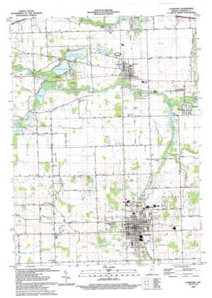
Lagrange Topo Map Indiana
To zoom in, hover over the map of Lagrange
USGS Topo Quad 41085f4 - 1:24,000 scale
| Topo Map Name: | Lagrange |
| USGS Topo Quad ID: | 41085f4 |
| Print Size: | ca. 21 1/4" wide x 27" high |
| Southeast Coordinates: | 41.625° N latitude / 85.375° W longitude |
| Map Center Coordinates: | 41.6875° N latitude / 85.4375° W longitude |
| U.S. State: | IN |
| Filename: | o41085f4.jpg |
| Download Map JPG Image: | Lagrange topo map 1:24,000 scale |
| Map Type: | Topographic |
| Topo Series: | 7.5´ |
| Map Scale: | 1:24,000 |
| Source of Map Images: | United States Geological Survey (USGS) |
| Alternate Map Versions: |
Lagrange IN 1947 Download PDF Buy paper map Lagrange IN 1960, updated 1961 Download PDF Buy paper map Lagrange IN 1960, updated 1976 Download PDF Buy paper map Lagrange IN 1960, updated 1982 Download PDF Buy paper map Lagrange IN 1993, updated 1993 Download PDF Buy paper map Lagrange IN 2010 Download PDF Buy paper map Lagrange IN 2013 Download PDF Buy paper map Lagrange IN 2016 Download PDF Buy paper map |
1:24,000 Topo Quads surrounding Lagrange
> Back to 41085e1 at 1:100,000 scale
> Back to 41084a1 at 1:250,000 scale
> Back to U.S. Topo Maps home
Lagrange topo map: Gazetteer
Lagrange: Airports
Reid-Eash Airport elevation 267m 875′Lagrange: Canals
East Buck Creek Ditch elevation 257m 843′Rowe Ditch elevation 264m 866′
Stoner Ditch elevation 270m 885′
Lagrange: Lakes
Buck Lake elevation 258m 846′North Twin Lake elevation 256m 839′
Pigeon Lake elevation 256m 839′
South Twin Lake elevation 256m 839′
Still Lake elevation 261m 856′
Twin Lakes elevation 261m 856′
Lagrange: Parks
Ontario Park elevation 269m 882′Lagrange: Populated Places
Howe elevation 269m 882′Lagrange elevation 284m 931′
Northwood elevation 280m 918′
Ontario elevation 269m 882′
River Oaks elevation 263m 862′
Star Mill elevation 260m 853′
Twin Lakes elevation 261m 856′
Woodland Hills elevation 284m 931′
Lagrange: Streams
Buck Creek elevation 257m 843′East Fly Creek elevation 264m 866′
Fly Creek elevation 263m 862′
McManus Ditch elevation 257m 843′
Lagrange digital topo map on disk
Buy this Lagrange topo map showing relief, roads, GPS coordinates and other geographical features, as a high-resolution digital map file on DVD:
Northern Illinois, Northern Indiana & Southwestern Michigan
Buy digital topo maps: Northern Illinois, Northern Indiana & Southwestern Michigan


