North Judson Se Topo Map Indiana
To zoom in, hover over the map of North Judson Se
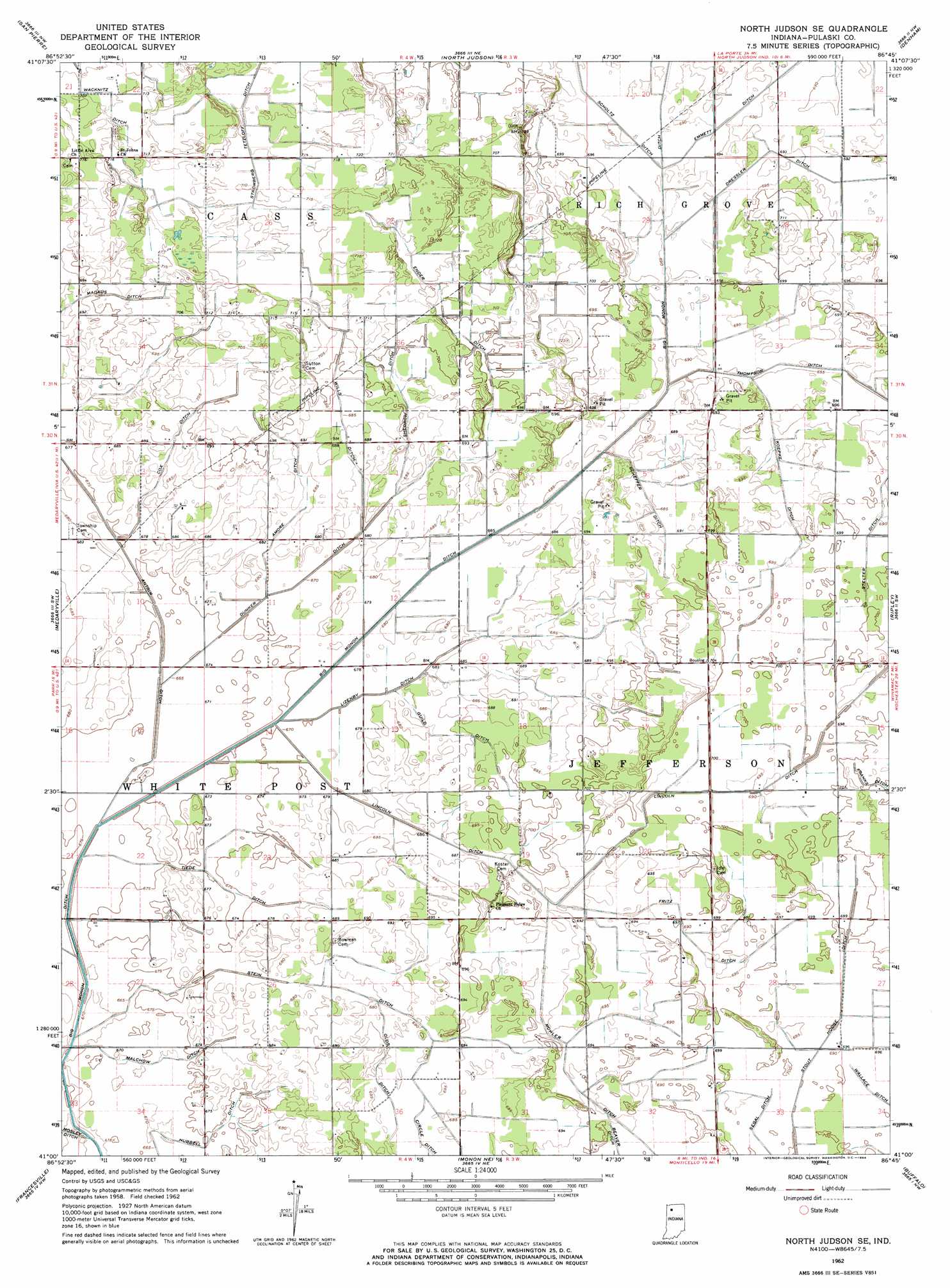
USGS Topo Quad 41086a7 - 1:24,000 scale
| Topo Map Name: | North Judson Se |
| USGS Topo Quad ID: | 41086a7 |
| Print Size: | ca. 21 1/4" wide x 27" high |
| Southeast Coordinates: | 41° N latitude / 86.75° W longitude |
| Map Center Coordinates: | 41.0625° N latitude / 86.8125° W longitude |
| U.S. State: | IN |
| Filename: | o41086a7.jpg |
| Download Map JPG Image: | North Judson Se topo map 1:24,000 scale |
| Map Type: | Topographic |
| Topo Series: | 7.5´ |
| Map Scale: | 1:24,000 |
| Source of Map Images: | United States Geological Survey (USGS) |
| Alternate Map Versions: |
North Judson SE IN 1962, updated 1964 Download PDF Buy paper map North Judson SE IN 2010 Download PDF Buy paper map North Judson SE IN 2013 Download PDF Buy paper map North Judson SE IN 2016 Download PDF Buy paper map |
1:24,000 Topo Quads surrounding North Judson Se
Kouts |
La Crosse |
English Lake |
Knox West |
Knox East |
Wheatfield |
San Pierre |
North Judson |
Denham |
Bass Lake |
Gifford |
Medaryville |
North Judson Se |
Ripley |
Winamac |
Mccoysburg |
Francesville |
Monon Ne |
Buffalo |
Star City |
Wolcott |
Monon |
Monticello North |
Idaville |
Burnettsville |
> Back to 41086a1 at 1:100,000 scale
> Back to 41086a1 at 1:250,000 scale
> Back to U.S. Topo Maps home
North Judson Se topo map: Gazetteer
North Judson Se: Canals
Amore Ditch elevation 208m 682′Antrim Ditch elevation 205m 672′
Circle Ditch elevation 211m 692′
Dunker Ditch elevation 207m 679′
Ender Ditch elevation 214m 702′
Fritz Ditch elevation 212m 695′
Guild Ditch elevation 209m 685′
Hubbell Ditch elevation 205m 672′
Koepke Ditch elevation 211m 692′
Lincoln Ditch elevation 213m 698′
Lizenby Ditch elevation 208m 682′
Malchow Ditch elevation 205m 672′
Mohler Ditch elevation 211m 692′
Olds Ditch elevation 211m 692′
Scheffer Ditch elevation 210m 688′
Segal Ditch elevation 212m 695′
Shedrow Ditch elevation 212m 695′
Stein Ditch elevation 207m 679′
Stelter Ditch elevation 212m 695′
Stout Hodge Ditch elevation 212m 695′
Tiede Ditch elevation 205m 672′
Wacknitz Ditch elevation 216m 708′
Wills Ditch elevation 212m 695′
North Judson Se digital topo map on disk
Buy this North Judson Se topo map showing relief, roads, GPS coordinates and other geographical features, as a high-resolution digital map file on DVD:
Northern Illinois, Northern Indiana & Southwestern Michigan
Buy digital topo maps: Northern Illinois, Northern Indiana & Southwestern Michigan