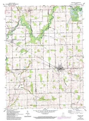
Mentone Topo Map Indiana
To zoom in, hover over the map of Mentone
USGS Topo Quad 41086b1 - 1:24,000 scale
| Topo Map Name: | Mentone |
| USGS Topo Quad ID: | 41086b1 |
| Print Size: | ca. 21 1/4" wide x 27" high |
| Southeast Coordinates: | 41.125° N latitude / 86° W longitude |
| Map Center Coordinates: | 41.1875° N latitude / 86.0625° W longitude |
| U.S. State: | IN |
| Filename: | o41086b1.jpg |
| Download Map JPG Image: | Mentone topo map 1:24,000 scale |
| Map Type: | Topographic |
| Topo Series: | 7.5´ |
| Map Scale: | 1:24,000 |
| Source of Map Images: | United States Geological Survey (USGS) |
| Alternate Map Versions: |
Mentone IN 1959, updated 1961 Download PDF Buy paper map Mentone IN 1959, updated 1980 Download PDF Buy paper map Mentone IN 1959, updated 1994 Download PDF Buy paper map Mentone IN 2010 Download PDF Buy paper map Mentone IN 2013 Download PDF Buy paper map Mentone IN 2016 Download PDF Buy paper map |
1:24,000 Topo Quads surrounding Mentone
> Back to 41086a1 at 1:100,000 scale
> Back to 41086a1 at 1:250,000 scale
> Back to U.S. Topo Maps home
Mentone topo map: Gazetteer
Mentone: Airports
Mentone Airport elevation 263m 862′Mentone: Canals
Blue Ditch elevation 241m 790′Busenburg Ditch elevation 240m 787′
Clarence Baker Ditch elevation 237m 777′
Crauder Ditch elevation 239m 784′
Dorsey Ditch elevation 243m 797′
Harsh Ditch elevation 241m 790′
Meredith Ditch elevation 254m 833′
Miskell Mahoney Ditch elevation 235m 770′
Moore Ditch elevation 241m 790′
Shatto Ditch elevation 241m 790′
Smith Ditch elevation 257m 843′
Tucker Ditch elevation 254m 833′
Washam Ditch elevation 243m 797′
Welch Ditch elevation 241m 790′
White Ditch elevation 256m 839′
William Baker Ditch elevation 253m 830′
Yantiss Ditch elevation 236m 774′
Mentone: Populated Places
Mentone elevation 256m 839′Old Tip Town elevation 239m 784′
Sevastopol elevation 268m 879′
Summit Chapel elevation 267m 875′
Tippecanoe elevation 238m 780′
Mentone: Streams
Little Yellow Creek elevation 238m 780′Mentone digital topo map on disk
Buy this Mentone topo map showing relief, roads, GPS coordinates and other geographical features, as a high-resolution digital map file on DVD:
Northern Illinois, Northern Indiana & Southwestern Michigan
Buy digital topo maps: Northern Illinois, Northern Indiana & Southwestern Michigan


