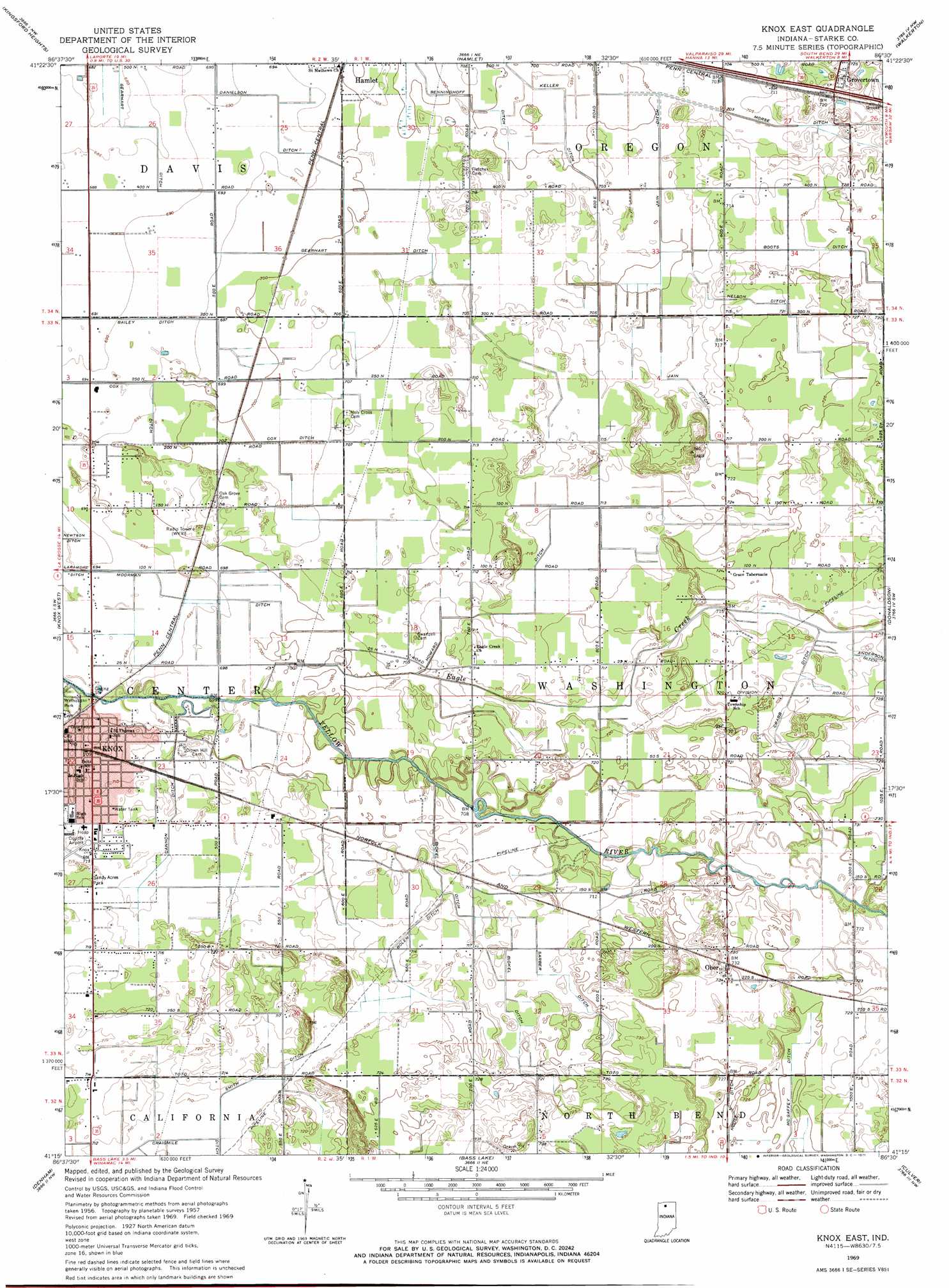
Knox East Topo Map Indiana
To zoom in, hover over the map of Knox East
USGS Topo Quad 41086c5 - 1:24,000 scale
| Topo Map Name: | Knox East |
| USGS Topo Quad ID: | 41086c5 |
| Print Size: | ca. 21 1/4" wide x 27" high |
| Southeast Coordinates: | 41.25° N latitude / 86.5° W longitude |
| Map Center Coordinates: | 41.3125° N latitude / 86.5625° W longitude |
| U.S. State: | IN |
| Filename: | o41086c5.jpg |
| Download Map JPG Image: | Knox East topo map 1:24,000 scale |
| Map Type: | Topographic |
| Topo Series: | 7.5´ |
| Map Scale: | 1:24,000 |
| Source of Map Images: | United States Geological Survey (USGS) |
| Alternate Map Versions: |
Knox East IN 1957, updated 1958 Download PDF Buy paper map Knox East IN 1969, updated 1971 Download PDF Buy paper map Knox East IN 1969, updated 1971 Download PDF Buy paper map Knox East IN 2010 Download PDF Buy paper map Knox East IN 2013 Download PDF Buy paper map Knox East IN 2016 Download PDF Buy paper map |
1:24,000 Topo Quads surrounding Knox East
Laporte West |
Laporte East |
Stillwell |
North Liberty |
Lakeville |
Hanna |
Kingsford Heights |
Hamlet |
Walkerton |
La Paz |
English Lake |
Knox West |
Knox East |
Donaldson |
Plymouth |
North Judson |
Denham |
Bass Lake |
Culver |
Rutland |
North Judson Se |
Ripley |
Winamac |
Kewanna |
Pershing |
> Back to 41086a1 at 1:100,000 scale
> Back to 41086a1 at 1:250,000 scale
> Back to U.S. Topo Maps home
Knox East topo map: Gazetteer
Knox East: Canals
Bickel Ditch elevation 216m 708′Bolen Ditch elevation 217m 711′
Boots Ditch elevation 220m 721′
Cannon Ditch elevation 217m 711′
Crabb Ditch elevation 218m 715′
Danielson Ditch elevation 211m 692′
Gearhart Ditch elevation 210m 688′
Howard Ditch elevation 217m 711′
Mooreman Ditch elevation 214m 702′
Morse Ditch elevation 216m 708′
Nelson Ditch elevation 219m 718′
Sarber Ditch elevation 217m 711′
Smith Ditch elevation 218m 715′
Knox East: Parks
Sandy Acres Park elevation 218m 715′Wythougan Park elevation 211m 692′
Knox East: Populated Places
Ober elevation 223m 731′Knox East: Streams
Eagle Creek elevation 210m 688′Knox East digital topo map on disk
Buy this Knox East topo map showing relief, roads, GPS coordinates and other geographical features, as a high-resolution digital map file on DVD:
Northern Illinois, Northern Indiana & Southwestern Michigan
Buy digital topo maps: Northern Illinois, Northern Indiana & Southwestern Michigan