Kingsford Heights Topo Map Indiana
To zoom in, hover over the map of Kingsford Heights
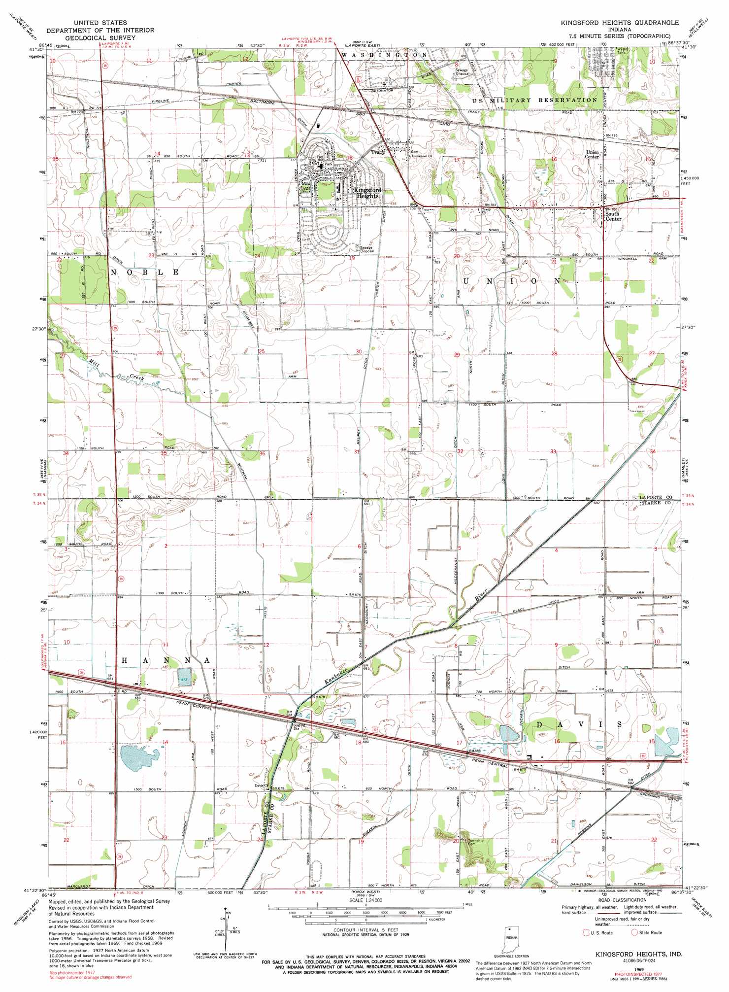
USGS Topo Quad 41086d6 - 1:24,000 scale
| Topo Map Name: | Kingsford Heights |
| USGS Topo Quad ID: | 41086d6 |
| Print Size: | ca. 21 1/4" wide x 27" high |
| Southeast Coordinates: | 41.375° N latitude / 86.625° W longitude |
| Map Center Coordinates: | 41.4375° N latitude / 86.6875° W longitude |
| U.S. State: | IN |
| Filename: | o41086d6.jpg |
| Download Map JPG Image: | Kingsford Heights topo map 1:24,000 scale |
| Map Type: | Topographic |
| Topo Series: | 7.5´ |
| Map Scale: | 1:24,000 |
| Source of Map Images: | United States Geological Survey (USGS) |
| Alternate Map Versions: |
Kingsford Heights IN 1958, updated 1960 Download PDF Buy paper map Kingsford Heights IN 1969, updated 1971 Download PDF Buy paper map Kingsford Heights IN 1969, updated 1992 Download PDF Buy paper map Kingsford Heights IN 2010 Download PDF Buy paper map Kingsford Heights IN 2013 Download PDF Buy paper map Kingsford Heights IN 2016 Download PDF Buy paper map |
1:24,000 Topo Quads surrounding Kingsford Heights
Michigan City West |
Michigan City East |
Springville |
New Carlisle |
Lydick |
Westville |
Laporte West |
Laporte East |
Stillwell |
North Liberty |
Wanatah |
Hanna |
Kingsford Heights |
Hamlet |
Walkerton |
La Crosse |
English Lake |
Knox West |
Knox East |
Donaldson |
San Pierre |
North Judson |
Denham |
Bass Lake |
Culver |
> Back to 41086a1 at 1:100,000 scale
> Back to 41086a1 at 1:250,000 scale
> Back to U.S. Topo Maps home
Kingsford Heights topo map: Gazetteer
Kingsford Heights: Airports
Shamrock Airport elevation 207m 679′Kingsford Heights: Bays
Cusher Arm elevation 206m 675′Kingsford Heights: Canals
Conboy Arm elevation 207m 679′Hickleson Ditch elevation 218m 715′
Hildebrandt Ditch elevation 207m 679′
Long Ditch elevation 209m 685′
Marquardt Ditch elevation 206m 675′
Maurey Ditch elevation 208m 682′
North Arm elevation 209m 685′
Place Ditch Arm elevation 207m 679′
Porter Ditch elevation 215m 705′
Ridgeway Arm elevation 207m 679′
Salisbury Ditch elevation 207m 679′
Shearin Ditch elevation 206m 675′
Whitham Ditch elevation 208m 682′
Winchell Arm elevation 210m 688′
Kingsford Heights: Populated Places
Kingsford Heights elevation 221m 725′South Center elevation 215m 705′
Tracy elevation 218m 715′
Union Center elevation 217m 711′
Kingsford Heights: Streams
Mill Creek elevation 210m 688′Kingsford Heights digital topo map on disk
Buy this Kingsford Heights topo map showing relief, roads, GPS coordinates and other geographical features, as a high-resolution digital map file on DVD:
Northern Illinois, Northern Indiana & Southwestern Michigan
Buy digital topo maps: Northern Illinois, Northern Indiana & Southwestern Michigan