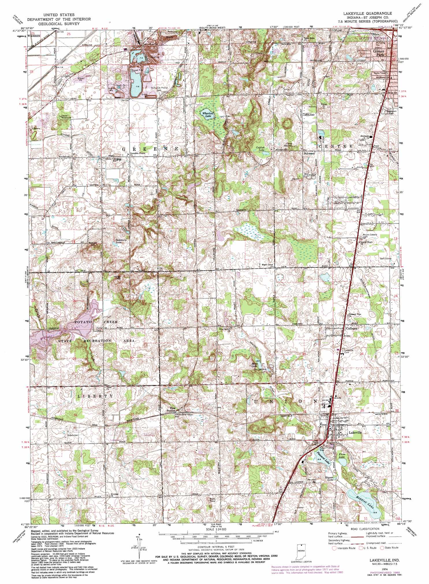
Lakeville Topo Map Indiana
To zoom in, hover over the map of Lakeville
USGS Topo Quad 41086e3 - 1:24,000 scale
| Topo Map Name: | Lakeville |
| USGS Topo Quad ID: | 41086e3 |
| Print Size: | ca. 21 1/4" wide x 27" high |
| Southeast Coordinates: | 41.5° N latitude / 86.25° W longitude |
| Map Center Coordinates: | 41.5625° N latitude / 86.3125° W longitude |
| U.S. State: | IN |
| Filename: | o41086e3.jpg |
| Download Map JPG Image: | Lakeville topo map 1:24,000 scale |
| Map Type: | Topographic |
| Topo Series: | 7.5´ |
| Map Scale: | 1:24,000 |
| Source of Map Images: | United States Geological Survey (USGS) |
| Alternate Map Versions: |
Lakeville IN 1958, updated 1964 Download PDF Buy paper map Lakeville IN 1974, updated 1975 Download PDF Buy paper map Lakeville IN 1974, updated 1981 Download PDF Buy paper map Lakeville IN 2010 Download PDF Buy paper map Lakeville IN 2013 Download PDF Buy paper map Lakeville IN 2016 Download PDF Buy paper map |
1:24,000 Topo Quads surrounding Lakeville
Three Oaks |
Galien |
Niles West |
Niles East |
Edwardsburg |
New Carlisle |
Lydick |
South Bend West |
South Bend East |
Osceola |
Stillwell |
North Liberty |
Lakeville |
Wyatt |
Wakarusa |
Hamlet |
Walkerton |
La Paz |
Bremen |
Nappanee West |
Knox East |
Donaldson |
Plymouth |
Inwood |
Bourbon |
> Back to 41086e1 at 1:100,000 scale
> Back to 41086a1 at 1:250,000 scale
> Back to U.S. Topo Maps home
Lakeville topo map: Gazetteer
Lakeville: Canals
Authen Ditch elevation 254m 833′Dixon West Place Ditch elevation 214m 702′
Eberly Ditch elevation 245m 803′
Heston Ditch elevation 251m 823′
Schang Ditch elevation 223m 731′
Shidler - Hoffman Ditch elevation 256m 839′
Lakeville: Dams
Potato Creek Reservoir Dam elevation 228m 748′Lakeville: Lakes
Catfish Lake elevation 250m 820′Dipper Lake elevation 250m 820′
Moon Lake elevation 252m 826′
Pleasant Lake elevation 250m 820′
Riddles Lake elevation 250m 820′
Sommers Lake elevation 245m 803′
Wharton Lake elevation 237m 777′
Lakeville: Parks
Camp Millhouse elevation 226m 741′Camp Wakinda elevation 257m 843′
Potato Creek State Park elevation 235m 770′
Lakeville: Populated Places
Colburn elevation 262m 859′Gilmer Park elevation 251m 823′
Lakeville elevation 257m 843′
Nutwood elevation 256m 839′
Pine Station elevation 252m 826′
Lakeville: Reservoirs
Worster Lake elevation 232m 761′Lakeville: Summits
Reeves Hill elevation 263m 862′Vargo Hill elevation 269m 882′
Lakeville digital topo map on disk
Buy this Lakeville topo map showing relief, roads, GPS coordinates and other geographical features, as a high-resolution digital map file on DVD:
Northern Illinois, Northern Indiana & Southwestern Michigan
Buy digital topo maps: Northern Illinois, Northern Indiana & Southwestern Michigan